 www.geodatenkatalog.de (S1L)
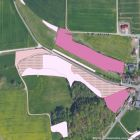
Biotopkartierung (Alpen)
Das Thema Biotopkartierung (Alpen) beinhaltet die im Rahmen der Biotopkartierung Bayern erfassten Biotope in den Alpen.
|
|
Citation proposal
. Biotopkartierung (Alpen). https://gdk.gdi-de.org/geonetwork/srv/api/records/40986241-934a-46e8-a24a-2c0383c5963e |
INSPIRE
Identification
- File identifier
- 40986241-934a-46e8-a24a-2c0383c5963e XML
- Hierarchy level
- dataset Dataset
Online resource
Resource identifier
- Metadata language
- ger German
- Spatial representation type
- vector Vector
Encoding
- Format
- Shapefile (*.shp)
- Version
- keine Angabe
- Format
- Microsoft Access Database (*.mdb)
- Version
- Office 2003
- Format
- Oracle Spatial Tabelle
- Version
- 11.x
Projection
Classification of data and services
- Topic category
-
- Biota
- Environment
Classification of data and services
Coupled resource
Coupled resource
Classification of data and services
Coupled resource
Coupled resource
Keywords
- GEMET - INSPIRE themes, version 1.0 ( Theme )
-
- Lebensräume und Biotope
- Spatial scope
-
- Regional
Other keywords
- Keywords
-
- opendata
- gdiby
- inspireidentifiziert
Geographic coverage
N
S
E
W
))
Temporal reference
Temporal extent
Temporal extent
- Date ( Revision )
- 2022-12-19
Quality and validity
- Lineage
- Die Biotope werden in verschiedene Biotoptypen unterteilt, die sich aufgrund ihrer Gelände- und Standorteigenschaften, dem Vorkommen von Pflanzenarten und ihren Lebensgemeinschaften sowie ihrer Entstehung voneinander unterscheiden. Bei diesen Biotoptypen handelt es sich zum einen um natürlich entstandene Flächen wie Hochmoore und Felsvegetation sowie zum anderen um Gebiete, die aufgrund menschlicher Nutzung entstanden sind (z.B. Streuwiesen, Magerrasen, Hecken, Abbaustellen).
- Denominator
- 5000
Conformity
Conformity
Conformity
Conformity
Conformity
Conformity
- Explanation
- Es besteht keine Konformität zur Datenspezifikation.
Restrictions on access and use
- Use limitation
- keine Einschränkungen
- Access constraints
- Der Datensatz/Dienst steht unter der Lizenz: Creative Commons Namensnennung 4.0 International (CC BY 4.0). Die Namensnennung des Bayerischen Landesamtes für Umwelt als Rechteinhaber hat in folgender Weise zu erfolgen: "Datenquelle: Bayerisches Landesamt für Umwelt, www.lfu.bayern.de". Die Nutzung von Daten über Dienste ist geldleistungsfrei. Bei Bezug von Daten über die Datenstelle des LfU (nur Daten, die nicht über Dienste verfügbar sind) wird eine Bereitstellungsgebühr erhoben, die sich an der Umweltgebührenordnung orientiert.
- Access constraints
- { "id": "cc-by", "name": "Creative Commons Namensnennung (CC BY)", "quelle": "Datenquelle: Bayerisches Landesamt für Umwelt, www.lfu.bayern.de", "url": "http://creativecommons.org/licenses/by/3.0/deed.de" }
Restrictions on access and use
Responsible organization (s)
Contact for the resource
- Organisation name
- Bayerisches Landesamt für Umwelt
Responsible organization (s)
Contact for the resource
- Organisation name
- Bayerisches Landesamt für Umwelt
Metadata information
Contact for the metadata
- Organisation name
- Bayerisches Landesamt für Umwelt
- Date stamp
- 2023-01-25T11:03:24+01:00
- Metadata language
- ger German
- Character set
- utf8 UTF8
SDS
Conformance class 1: invocable
Access Point URL
Endpoint URL
Technical specification
Conformance class 2: interoperable
Coordinate reference system
Quality of Service
Access constraints
Limitation
Use constraints
Limitation
Responsible custodian
Contact for the resource
Conformance class 3: harmonized
Overviews
Provided by

Views
40986241-934a-46e8-a24a-2c0383c5963e
Access to the portal
Read here the full details and access to the data.
Associated resources
Not available