 www.geodatenkatalog.de (S2F)
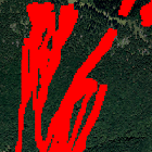
Gefahrenhinweisbereich Steinschlag/Blockschlag mit Walddämpfung
Der hier dargestellte Gefahrenhinweisbereich der Prozesse Steinschlag/Blockschlag ist das Ergebnis einer Modellierung unter der Berücksichtigung der dämpfenden Wirkung des Waldbestandes.
Weiterführende Informationen zur Interpretation sowie zur Vorgehensweise bei der Erstellung der Gefahrenhinweiskarte sind in den Berichten zu den Gefahrenhinweiskarten zu finden: https://www.lfu.bayern.de/geologie/massenbewegungen_karten_daten/gefahrenhinweiskarten/index.htm
|
|
Citation proposal
(2014) . Gefahrenhinweisbereich Steinschlag/Blockschlag mit Walddämpfung. https://gdk.gdi-de.org/geonetwork/srv/api/records/41a7493c-dd03-456e-94e5-b60de14b49c1 |
INSPIRE
Identification
- File identifier
- 41a7493c-dd03-456e-94e5-b60de14b49c1 XML
- Hierarchy level
- dataset Dataset
Online resource
Resource identifier
- Metadata language
- German
- Spatial representation type
- Vector
Encoding
- Format
- Shapefile
- Format
- Datenbank
Projection
Classification of data and services
- Topic category
-
- Geoscientific information
Classification of data and services
Coupled resource
Coupled resource
Classification of data and services
Coupled resource
Coupled resource
Keywords
- GEMET - INSPIRE themes, version 1.0 ( Theme )
-
- Gebiete mit naturbedingten Risiken
- Spatial scope
Other keywords
- Keywords
-
- UmweltAtlas
- gdiby
- Hangbewegung
- Georisiken
- Gefahrenhinweiskarte
- Steinschlag
- Blockschlag
- opendata
- Keywords ( Theme )
-
- ENVI
- Keywords
-
- inspireidentifiziert
Geographic coverage
N
S
E
W
))
Temporal reference
Temporal extent
Temporal extent
- Date ( Publication )
- 2014-01-14T00:00:00.000+01:00
Quality and validity
- Lineage
- Im Gelände wurde anhand der Geologie die zu erwartende mittlere Blockgröße (Bemessungsereignis) für ein Sturzereignis ermittelt. Bei der Modellierung entstanden je nach geologischen Gegebenheiten und Geländeoberfläche unterschiedliche Sturzbahnen. Übersicht über die Gefährdungssituation durch Massenbewegungen. Zielmaßstab ist 1: 25 000 d.h. es ist keine parzellenscharfe Einteilung. Die Abgrenzung der Gefahrenhinweisflächen ist als Saum und nicht als scharfe Grenze zu sehen.
- Denominator
- 10000
Conformity
Conformity
Conformity
Conformity
Conformity
Conformity
- Explanation
- see the referenced specification
- Explanation
- see the referenced specification
Restrictions on access and use
- Access constraints
- Creative Commons Namensnennung 4.0 International (CC BY 4.0); Datenquelle: Bayerisches Landesamt für Umwelt, www.lfu.bayern.de; Die Nutzung von Daten über Dienste ist geldleistungsfrei. Bei Bezug von Daten über die Datenstelle des LfU (nur Daten, die nicht über Dienste verfügbar sind) wird eine Bereitstellungsgebühr erhoben, die sich an der Umweltgebührenordnung orientiert.
- Access constraints
- {"id":"cc-by/4.0","name":"Creative Commons Namensnennung 4.0 International (CC BY 4.0)","url":"https://creativecommons.org/licenses/by/4.0/deed.de","quelle":"Bayerisches Landesamt für Umwelt, www.lfu.bayern.de"}
Restrictions on access and use
Responsible organization (s)
Contact for the resource
- Organisation name
- Bayerisches Landesamt für Umwelt
- Organisation name
- Bayerisches Landesamt für Umwelt
Responsible organization (s)
Contact for the resource
- Organisation name
- Bayerisches Landesamt für Umwelt
- Organisation name
- Bayerisches Landesamt für Umwelt
Metadata information
Contact for the metadata
- Organisation name
- Bayerisches Landesamt für Umwelt
- Date stamp
- 2024-06-28
- Metadata language
- German
- Character set
- UTF8
SDS
Conformance class 1: invocable
Access Point URL
Endpoint URL
Technical specification
Conformance class 2: interoperable
Coordinate reference system
Quality of Service
Access constraints
Limitation
Use constraints
Limitation
Responsible custodian
Contact for the resource
Conformance class 3: harmonized
Overviews
Provided by

Views
41a7493c-dd03-456e-94e5-b60de14b49c1
Access to the portal
Read here the full details and access to the data.
Associated resources
Not available