 www.geodatenkatalog.de (S1L)
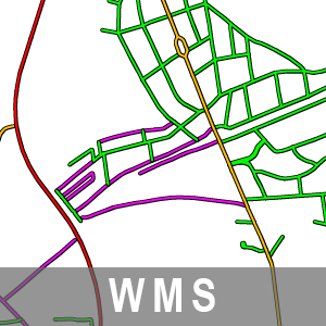
WMS ATKIS Basis-DLM Straßenklassifizierung Brandenburg
Der Web Map Service stellt die Geometrien der Straßen aus dem Basis-DLM bereit, gruppiert nach den jeweiligen Zuständigkeiten (Bund, Land, Kreis und Gemeinde). Die Grundlage dafür bildet die 'Widmung' aus AX_Strasse mit der Zuordnung bzw. Klassifizierung der Straßen nach ihrer Verkehrsbedeutung.
|
|
Citation proposal
. WMS ATKIS Basis-DLM Straßenklassifizierung Brandenburg. https://gdk.gdi-de.org/geonetwork/srv/api/records/43b2b158-1489-4164-81a5-a4c63e390fc4 |
INSPIRE
Identification
- File identifier
- 43b2b158-1489-4164-81a5-a4c63e390fc4 XML
- Hierarchy level
- service Service
Online resource
Resource identifier
Encoding
Projection
Classification of data and services
Classification of data and services
- Service Type
- view
- Coupling Type
- mixed Mixed
Coupled resource
Coupled resource
Classification of data and services
- Service Type
- view
- Coupling Type
- mixed Mixed
Coupled resource
Coupled resource
Keywords
- BE/BB Schlagwortliste, Version 1.0 ( Theme )
-
- Vermessung
- Verkehr
- Planung
Other keywords
- Keywords ( Theme )
-
- AdV
- ATKIS Basis-DLM
- LGB
- WMS
- Geobasisdaten
- GDI
- AdVMIS
- infoMapAccessService
- Amtliches Topographisch-Kartographisches Informationssystem Digitales Basis-Landschaftsmodell
- Verkehrsnetz
- AAA
- WMS_BB_ATKIS_Basis-DLM_Straßenklassifizierung
- Keywords ( Place )
-
- Brandenburg
- BB
Geographic coverage
N
S
E
W
))
Temporal reference
Temporal extent
Temporal extent
- Date ( Creation )
- 2019-09-02T00:00:00
Quality and validity
Conformity
Conformity
Conformity
Conformity
Conformity
Conformity
Restrictions on access and use
Restrictions on access and use
- Access constraints
- Die Daten können gemäß der „Datenlizenz Deutschland - Namensnennung - Version 2.0“ (https://www.govdata.de/dl-de/by-2-0) genutzt werden. Namensnennung: "GeoBasis-DE/LGB", Beispiel: „© GeoBasis-DE/LGB, dl-de/by-2-0, (Daten geändert)“, (Klammer = optional)
Responsible organization (s)
Contact for the resource
- Organisation name
- Landesvermessung und Geobasisinformation Brandenburg (LGB)
Responsible organization (s)
Contact for the resource
- Organisation name
- Landesvermessung und Geobasisinformation Brandenburg (LGB)
Metadata information
Contact for the metadata
- Organisation name
- Landesvermessung und Geobasisinformation Brandenburg (LGB)
- Date stamp
- 2025-07-18T14:56:19
- Metadata language
- ger German
SDS
Conformance class 1: invocable
Access Point URL
Endpoint URL
Technical specification
Conformance class 2: interoperable
Coordinate reference system
Quality of Service
Access constraints
- Access constraints
- Other restrictions
Limitation
Use constraints
Limitation
- string
- Die Daten können gemäß der „Datenlizenz Deutschland - Namensnennung - Version 2.0“ (https://www.govdata.de/dl-de/by-2-0) genutzt werden. Namensnennung: "GeoBasis-DE/LGB", Beispiel: „© GeoBasis-DE/LGB, dl-de/by-2-0, (Daten geändert)“, (Klammer = optional)
Responsible custodian
Contact for the resource
Conformance class 3: harmonized
Contains Operations
- Operation Name
- GetCapabilities
- Distributed Computing Platforms
- Web services
Contains Operations
- Operation Name
- GetMap
- Distributed Computing Platforms
- Web services
Contains Operations
- Operation Name
- GetFeatureInfo
- Distributed Computing Platforms
- Web services
Contains Operations
- Operation Name
- DescribeLayer
- Distributed Computing Platforms
- Web services
Overviews
Provided by

Views
43b2b158-1489-4164-81a5-a4c63e390fc4
Access to the portal
Read here the full details and access to the data.
Associated resources
Not available