 www.geodatenkatalog.de (S1L)
Nicht (zumutbar) zäunbare naturräumliche Untereinheiten
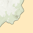
Die hier veröffentlichte Karte zeigt erste "nicht zumutbar zäunbare naturräumliche Untereinheiten".
|
|
Citation proposal
. Nicht (zumutbar) zäunbare naturräumliche Untereinheiten. https://gdk.gdi-de.org/geonetwork/srv/api/records/49053a8f-a52a-4fff-963a-c2e693b454a1 |
INSPIRE
Identification
- File identifier
- 49053a8f-a52a-4fff-963a-c2e693b454a1 XML
- Hierarchy level
- dataset Dataset
Online resource
Resource identifier
- Metadata language
- German
- Spatial representation type
- Vector
Encoding
- Format
- Shapefile
Projection
Classification of data and services
- Topic category
-
- Society
- Environment
- Farming
Classification of data and services
Coupled resource
Coupled resource
Classification of data and services
Coupled resource
Coupled resource
Keywords
Other keywords
- Keywords
-
- UmweltAtlas
- CC-BY-ND
- gdiby
- Herdenschutz
- Wolf
- Wolfsgebiete
- Nicht zumutbar zäunbare naturräumliche Untereinheiten
- nicht zumutbar zäunbar
- Förderrichtlinie Investition Herdenschutz Wolf
- FöRIHW
- Förderprogramm Wolf
- Förderung Wolf
- Förderkulisse Wolf
Geographic coverage
N
S
E
W
))
Temporal reference
Temporal extent
Temporal extent
- Date ( Creation )
- 2023-05-03T00:00:00.000+02:00
Quality and validity
- Lineage
- Die hier veröffentlichte Karte zeigt erste "nicht zumutbar zäunbare naturräumliche Untereinheiten".
Conformity
Conformity
Conformity
Conformity
Conformity
Conformity
Restrictions on access and use
- Access constraints
- Creative Commons Namensnennung - Keine Bearbeitung 4.0 International (CC BY-ND 4.0); Datenquelle: Bayerisches Landesamt für Umwelt, www.lfu.bayern.de; Die Nutzung von Daten über Dienste ist geldleistungsfrei. Bei Bezug von Daten über die Datenstelle des LfU (nur Daten, die nicht über Dienste verfügbar sind) wird eine Bereitstellungsgebühr erhoben, die sich an der Umweltgebührenordnung orientiert.
- Access constraints
- {"id":"cc-by-nd/4.0","name":"Creative Commons Namensnennung - Keine Bearbeitung 4.0 International (CC BY-ND 4.0)","url":"https://creativecommons.org/licenses/by-nd/4.0/deed.de","quelle":"Bayerisches Landesamt für Umwelt, www.lfu.bayern.de"}
Restrictions on access and use
Responsible organization (s)
Contact for the resource
- Organisation name
- Bayerisches Landesamt für Umwelt
Responsible organization (s)
Contact for the resource
- Organisation name
- Bayerisches Landesamt für Umwelt
Metadata information
Contact for the metadata
- Organisation name
- Bayerisches Landesamt für Umwelt
- Date stamp
- 2024-06-28
- Metadata language
- German
- Character set
- UTF8
SDS
Conformance class 1: invocable
Access Point URL
Endpoint URL
Technical specification
Conformance class 2: interoperable
Coordinate reference system
Quality of Service
Access constraints
Limitation
Use constraints
Limitation
Responsible custodian
Contact for the resource
Conformance class 3: harmonized
Overviews
Provided by

Views
49053a8f-a52a-4fff-963a-c2e693b454a1
Access to the portal
Read here the full details and access to the data.
Associated resources
Not available