 www.geodatenkatalog.de (S1F)
Plan von der Gegend um Potsdam, 1785 mehrfarbig
Die historischen Karten - Pläne von der Gegend um Potsdam - wurden von der Landesvermessung Brandenburg 2001 als Farb-Reproduktion herausgegeben. Die Originale liegen in der Staatsbibliothek Preußischer Kulturbesitz in Berlin. Im Querformat erhältlich zeigen die Karten in unterschiedlichen Maßstäben die Gegend von Potsdam und Ihre Enwicklung in den Jahren 1785 und 1786. Diese historischen Karten zeichnen sich durch einen hohen Anteil an Details aus, u.a. durch die Darstellung der unterschiedlichen Geländeformen mit Hilfe der Schraffen-Methode.
|
|
Citation proposal
. Plan von der Gegend um Potsdam, 1785 mehrfarbig. Landesvermessung und Geobasisinformation Brandenburg (LGB) https://gdk.gdi-de.org/geonetwork/srv/api/records/4a3f4e7a-87cd-4856-b1e8-2de832f0dd90 |
INSPIRE
Identification
- File identifier
- 4a3f4e7a-87cd-4856-b1e8-2de832f0dd90 XML
- Hierarchy level
- dataset Dataset
Online resource
Resource identifier
- Metadata language
- ger German
Encoding
Projection
Classification of data and services
- Topic category
-
- Imagery base maps earth cover
Classification of data and services
Coupled resource
Coupled resource
Classification of data and services
Coupled resource
Coupled resource
Keywords
- BE/BB Schlagwortliste, Version 1.0 ( Theme )
-
- Vermessung
Other keywords
- Keywords
-
- opendata
- Keywords ( Theme )
-
- Karte
- Historisch
- bodenbedeckung
Geographic coverage
N
S
E
W
))
Temporal reference
Temporal extent
Temporal extent
- Date ( Creation )
- 1785-12-31T00:00:00
Quality and validity
- Lineage
- Eine Auskunft über die Herkunft der Daten erhalten Sie per Anfrage an die E-Mail kundenservice@geobasis-bb.de.
- Denominator
- 18000
Conformity
Conformity
Conformity
Conformity
Conformity
Conformity
Restrictions on access and use
- Access constraints
- Die Daten können gemäß der „Datenlizenz Deutschland - Namensnennung - Version 2.0“ (https://www.govdata.de/dl-de/by-2-0) genutzt werden. Namensnennung: "GeoBasis-DE/LGB", Beispiel: „© GeoBasis-DE/LGB, dl-de/by-2-0, (Daten geändert)“, (Klammer = optional)
- Access constraints
- {"id":"dl-by-de/2.0","name":"Datenlizenz Deutschland - Namensnennung - Version 2.0","url":"https://www.govdata.de/dl-de/by-2-0","quelle":"Quelle: © GeoBasis-DE/LGB, dl-de/by-2-0"}
Restrictions on access and use
Responsible organization (s)
Contact for the resource
- Organisation name
- Landesvermessung und Geobasisinformation Brandenburg (LGB)
Responsible organization (s)
Contact for the resource
- Organisation name
- Landesvermessung und Geobasisinformation Brandenburg (LGB)
Metadata information
Contact for the metadata
- Organisation name
- Landesvermessung und Geobasisinformation Brandenburg (LGB)
- Date stamp
- 2025-03-05T16:05:01
- Metadata language
- ger German
- Character set
- utf8 UTF8
SDS
Conformance class 1: invocable
Access Point URL
Endpoint URL
Technical specification
Conformance class 2: interoperable
Coordinate reference system
Quality of Service
Access constraints
Limitation
Use constraints
Limitation
Responsible custodian
Contact for the resource
Conformance class 3: harmonized
Overviews
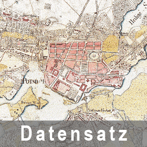
Beispielausschnitt aus dem Plan Gegend Potsdam
Provided by

Views
4a3f4e7a-87cd-4856-b1e8-2de832f0dd90
Access to the portal
Read here the full details and access to the data.
Associated resources
Not available