 www.geodatenkatalog.de (S1L)
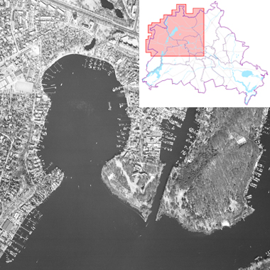
Luftbilder 1996, Maßstab 1:12 000
Senkrechtaufnahmen von Berlin, mit Überlappungen im Maßstab 1:12.000
|
|
Citation proposal
. Luftbilder 1996, Maßstab 1:12 000. https://gdk.gdi-de.org/geonetwork/srv/api/records/4caad423-5263-3dfd-ad72-faa3f2b37312 |
- Identification
- Distribution
- Quality
- Spatial rep.
- Ref. system
- Content
- Portrayal
- Metadata
- Md. constraints
- Md. maintenance
- Schema info
Identification
Data identification
Citation
- Date ( Creation )
- 1996-04-08
- Presentation form
- Digital map
Point of contact
- Keywords ( Theme )
-
- open data
- opendata
- AdVMIS
- Karten
- Geodaten
- Berlin
- Luftbilder
- Luftbildpläne
- Senkrechtaufnahmen
- Luftbildplan
- Luftbildmosaike
- Topographie
- Topografie
- topographisch
- topografisch
- Spatial scope
Legal constraints
- Access constraints
- Other restrictions
Legal constraints
- Use constraints
- Other restrictions
- Other constraints
- Für die Nutzung der Daten ist die Datenlizenz Deutschland - Zero - Version 2.0 anzuwenden. Die Lizenz ist über https://www.govdata.de/dl-de/zero-2-0 abrufbar.
- Other constraints
- { "id": "dl-zero-de/2.0" , "name": "Datenlizenz Deutschland - Zero - Version 2.0", "url": "https://www.govdata.de/dl-de/zero-2-0" }
- Spatial representation type
- Grid
- Denominator
- 12000
- Metadata language
- German
- Character set
- UTF8
- Topic category
-
- Imagery base maps earth cover
Extent
N
S
E
W
))
Geographic description
- Extent type code
- true
- Geographic identifier
- 110000000000
Distribution
Distribution
- Distribution format
-
-
text/html
(4.01 )
- Specification
- keine Angabe
-
text/html
(4.01 )
Digital transfer options
- OnLine resource
-
Darstellung der Daten im Geoportal Berlin
Darstellung der Daten im Geoportal Berlin
- OnLine resource
-
Darstellungsdienst - Luftbilder 1996, Maßstab 1:12 000 (WMS)
Darstellungsdienst - Luftbilder 1996, Maßstab 1:12 000 (WMS)
- OnLine resource
-
Downloaddienst - Luftbilder 1996, Maßstab 1:12 000 (WFS)
Downloaddienst - Luftbilder 1996, Maßstab 1:12 000 (WFS)
Quality
Data quality
- Hierarchy level
- Dataset
- Statement
- Daten aus der Berliner Verwaltung
Ref. system
- Reference system identifier
- http://www.opengis.net/def/crs/EPSG/0/25833
Metadata
Metadata
- File identifier
- 4caad423-5263-3dfd-ad72-faa3f2b37312 XML
- Metadata language
- German
- Character set
- UTF8
- Hierarchy level
- Dataset
- Date stamp
- 2025-03-06T12:33:32
- Metadata standard name
- ISO 19115/19119 ? BE
- Metadata standard version
- 1.0.0
Overviews
Provided by

Views
4caad423-5263-3dfd-ad72-faa3f2b37312
Access to the portal
Read here the full details and access to the data.
Associated resources
Not available