 www.geodatenkatalog.de (S1L)
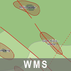
WMS Strukturgeologische Übersicht BB (WMS-SALINAR)
Der Darstellungsdienst (WMS) Strukturgeologische Übersicht Brandenburg stellt Daten zur Strukturgeologische Übersicht bereit. Dieser wird dominiert durch die NW-SE streichende intrakratonale Norddeutsche Senke, deren Basis sich im nördlichen und mittleren Teil des Landesterritoriums auf über 5 000 m Tiefe absenkt und nach Süden und Südosten heraushebt. Das Beckenzentrum setzt sich von Nordwest-Brandenburg in Richtung Unterelbe fort. Dagegen ist die jetzige südliche Begrenzung tektonisch bedingt. Die strukturgeologischen Verhältnisse werden durch die jetzige Tiefenlage der Zechsteinbasis und die strukturelle Modulierung der Zechsteinoberfläche wiedergegeben. Weitere Informationen unter: https://geo.brandenburg.de/karten/htdocs/salinar.pdf.
Die Strukturgeologische Übersicht Brandenburg gehört thematisch zu der Rohstoff- und Tiefengeologie. Diesem Thema sind zwei weitere Dienstethemen zugeorndet:
- WMS/WFS/WCS Reflexionsseismische Horizonte 2D BB,
- WMS/WFS Karte der oberflächennahen Rohstoffe 1: 50 000 BB.
Der WMS beinhaltet die folgenden Layer:
- Beschriftungen Störungen [bstoerungen],
- Beschriftungen Blöcke [bbloecke],
- Störungen [stoer],
- Diapir [diapir],
- Kissen [kissen],
- Zechstein [zechstein].
|
|
Citation proposal
. WMS Strukturgeologische Übersicht BB (WMS-SALINAR). Landesvermessung und Geobasisinformation Brandenburg (LGB) https://gdk.gdi-de.org/geonetwork/srv/api/records/5258688e-4df4-4986-a925-02c245f6c43a |
INSPIRE
Identification
- File identifier
- 5258688e-4df4-4986-a925-02c245f6c43a XML
- Hierarchy level
- service Service
Online resource
Resource identifier
Encoding
Projection
Classification of data and services
Classification of data and services
- Service Type
- view
- Coupling Type
- tight Tight
Coupled resource
Coupled resource
Classification of data and services
- Service Type
- view
- Coupling Type
- tight Tight
Coupled resource
Coupled resource
Keywords
Other keywords
- Keywords
-
- opendata
- Keywords ( Theme )
-
- Ökologie
- strukturgeologisch
- Geologie
- Diapir
- Zechstein
- Senken
- Tektonik
- Tiefengeologie
- sgd_Geologie
- organisch
- Salzstock
- Störung
- Salzkissen
- Salinar
- Brandenburg
- gravitativ
- WMS
- Tiefenstörung
Geographic coverage
))
Temporal reference
Temporal extent
Temporal extent
- Date ( Creation )
- 2024-03-22T00:00:00
Quality and validity
Conformity
Conformity
Conformity
Conformity
Conformity
Conformity
Restrictions on access and use
Restrictions on access and use
- Access constraints
- Die Daten können gemäß der „Datenlizenz Deutschland - Namensnennung - Version 2.0“ (https://www.govdata.de/dl-de/by-2-0) genutzt werden. Namensnennung: "Landesamt für Bergbau, Geologie und Rohstoffe Brandenburg (LBGR)", Beispiel: „© Landesamt für Bergbau, Geologie und Rohstoffe Brandenburg (LBGR), dl-de/by-2-0, (Daten geändert)“, (Klammer = optional)
- Access constraints
-
{
"id": "dl-by-de/2.0",
"name": "Datenlizenz Deutschland - Namensnennung - Version 2.0",
"url": "https://www.govdata.de/dl-de/by-2-0",
"quelle": "Quelle: © Landesamt für Bergbau, Geologie und Rohstoffe Brandenburg (LBGR), dl-de/by-2-0"
}
Responsible organization (s)
Contact for the resource
- Organisation name
- Landesamt für Bergbau, Geologie und Rohstoffe Brandenburg (LBGR)
- Organisation name
- Landesvermessung und Geobasisinformation Brandenburg (LGB)
Responsible organization (s)
Contact for the resource
- Organisation name
- Landesamt für Bergbau, Geologie und Rohstoffe Brandenburg (LBGR)
- Organisation name
- Landesvermessung und Geobasisinformation Brandenburg (LGB)
Metadata information
Contact for the metadata
- Organisation name
- Landesvermessung und Geobasisinformation Brandenburg (LGB)
- Date stamp
- 2025-09-02T10:10:24
- Metadata language
- ger German
SDS
Conformance class 1: invocable
Access Point URL
Endpoint URL
Technical specification
Conformance class 2: interoperable
Coordinate reference system
Quality of Service
Access constraints
- Access constraints
- Other restrictions
Limitation
Use constraints
Limitation
- string
- Die Daten können gemäß der „Datenlizenz Deutschland - Namensnennung - Version 2.0“ (https://www.govdata.de/dl-de/by-2-0) genutzt werden. Namensnennung: "Landesamt für Bergbau, Geologie und Rohstoffe Brandenburg (LBGR)", Beispiel: „© Landesamt für Bergbau, Geologie und Rohstoffe Brandenburg (LBGR), dl-de/by-2-0, (Daten geändert)“, (Klammer = optional)
- string
-
{
"id": "dl-by-de/2.0",
"name": "Datenlizenz Deutschland - Namensnennung - Version 2.0",
"url": "https://www.govdata.de/dl-de/by-2-0",
"quelle": "Quelle: © Landesamt für Bergbau, Geologie und Rohstoffe Brandenburg (LBGR), dl-de/by-2-0"
}
Responsible custodian
Contact for the resource
Conformance class 3: harmonized
Contains Operations
- Operation Name
- GetLegendGraphic
- Distributed Computing Platforms
- Web services
- Connect Point
- https://inspire.brandenburg.de/services/salinar_wms?
Contains Operations
- Operation Name
- GetFeatureInfo
- Distributed Computing Platforms
- Web services
- Connect Point
- https://inspire.brandenburg.de/services/salinar_wms?
Contains Operations
- Operation Name
- GetCapabilities
- Distributed Computing Platforms
- Web services
- Connect Point
- https://inspire.brandenburg.de/services/salinar_wms?
Contains Operations
- Operation Name
- GetMap
- Distributed Computing Platforms
- Web services
- Connect Point
- https://inspire.brandenburg.de/services/salinar_wms?
Overviews
Provided by
