 www.geodatenkatalog.de (S3L)
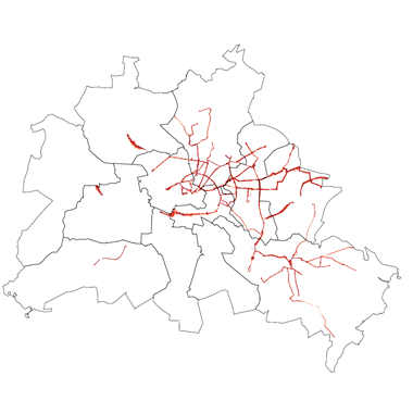
Strategische Lärmkarten 2017 (Umweltatlas)
Die Strategischen Lärmkarten 2017 geben Auskunft über die Lärmbelastung im Einwirkbereich von Hauptlärmquellen. Sie sind eine Fortführung der Strategischen Lärmkarten 2012.
|
|
Citation proposal
(2017) . Strategische Lärmkarten 2017 (Umweltatlas). https://gdk.gdi-de.org/geonetwork/srv/api/records/53ef42dd-4c9e-3e8b-993a-e264ece2b350 |
INSPIRE
Identification
- File identifier
- 53ef42dd-4c9e-3e8b-993a-e264ece2b350 XML
- Hierarchy level
- Dataset
Online resource
- Protocol
- INSPIRE ATOM
Resource identifier
- Metadata language
- German
- Spatial representation type
- Grid
Encoding
- Format
- Text/HTML
- Version
- 4.01
- Specification
- Keine Angabe
Projection
Classification of data and services
- Topic category
-
- Health
Classification of data and services
Coupled resource
Coupled resource
Classification of data and services
Coupled resource
Coupled resource
Keywords
- Räumlicher Anwendungsbereich ( Theme )
Other keywords
- Keywords ( Theme )
-
- open data
- opendata
- Sachdaten
- Karten
- Geodaten
- Berlin
- 34. BImSchV
- Umgebungslärm
- Lärmkartierung
- U-Bahn
- Tram
- Verkehr
- Straßenbahn
- BVG
- Strategische Lärmkarten
- Emissionen
- Lärmbelastung
Geographic coverage
N
S
E
W
))
Temporal reference
Temporal extent
Temporal extent
- Date ( Creation )
- 2017-08-08
- Date ( Publication )
- 2017-10-11
Quality and validity
- Lineage
- Darstellung der Lärmkartierungen nach Umgebungslärmrichtlinie Ballungsraum Berlin 2017, Lärmkartierung nach Umgebungslärmrichtlinie Ballungsraum Berlin 2017 durch Wölfel Engineering GmbH+Co. KG Berlin, Senatsverwaltung für Mobilität, Verkehr, Klimaschutz und Umwelt: I C Immissionsschutz in Zusammenarbeit mit Senatsverwaltung für Stadtentwicklung, Bauen und Wohnen, III D 1 Umweltatlas
- Denominator
- 1000
Conformity
Conformity
Conformity
Conformity
Conformity
Conformity
Restrictions on access and use
- Access constraints
- Für die Nutzung der Daten ist die Datenlizenz Deutschland - Zero - Version 2.0 anzuwenden. Die Lizenz ist über https://www.govdata.de/dl-de/zero-2-0 abrufbar.
- Access constraints
- {"id":"dl-zero-de/2.0","name":"Datenlizenz Deutschland - Zero - Version 2.0","url":"https://www.govdata.de/dl-de/zero-2-0"}
Restrictions on access and use
Responsible organization (s)
Contact for the resource
- Organisation name
- Senatsverwaltung für Mobilität, Verkehr, Klimaschutz und Umwelt Berlin
- Organisation name
- Senatsverwaltung für Stadtentwicklung, Bauen und Wohnen Berlin
Responsible organization (s)
Contact for the resource
- Organisation name
- Senatsverwaltung für Mobilität, Verkehr, Klimaschutz und Umwelt Berlin
- Organisation name
- Senatsverwaltung für Stadtentwicklung, Bauen und Wohnen Berlin
Metadata information
Contact for the metadata
- Organisation name
- Senatsverwaltung für Stadtentwicklung, Bauen und Wohnen Berlin
- Date stamp
- 2025-12-01T10:02:33.112991470Z
- Metadata language
- German
- Character set
- UTF8
SDS
Conformance class 1: invocable
Access Point URL
Endpoint URL
Technical specification
Conformance class 2: interoperable
Coordinate reference system
Quality of Service
Access constraints
Limitation
Use constraints
Limitation
Responsible custodian
Contact for the resource
Conformance class 3: harmonized
Overviews
Vorschaubild
Provided by

Views
53ef42dd-4c9e-3e8b-993a-e264ece2b350
Access to the portal
Read here the full details and access to the data.
Associated resources
Not available