 www.geodatenkatalog.de (S2L)
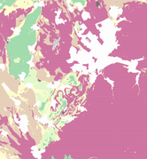
LGRB-BW Gesamtschutzfunktion der Grundwasserüberdeckung (wasserwirtschaftl. genutzter GWL, Variante 2)
In Variante 2 wird die Geschütztheit des Grundwasservorkommens nach Hölting et al. (1995) im wasserwirtschaftlich genutzten Grundwasserleiter bewertet (Fachbericht LGRB 2020/1). Er liegt gebietsweise unterhalb des in Variante 1 ausgewiesenen Grundwasserleiters und wird bspw. aufgrund höherer Ergiebigkeit oder besserer Geschütztheit genutzt. Die Gesamtschutzfunktion der Grundwasserüberdeckung beschreibt halbquantitativ die Verweilzeit des Sickerwassers von der Geländeoberkante bis zur Grundwasseroberfläche. Sie beinhaltet sowohl die Schutzfunktion des Bodens als auch die der ungesättigten Zone unterhalb des Bodens. Das Ergebnis (40 m Raster) wurde in die Schutzfunktionsklassen (Punkte und qualitative Bewertung) nach Hölting unterteilt.
|
|
Citation proposal
. LGRB-BW Gesamtschutzfunktion der Grundwasserüberdeckung (wasserwirtschaftl. genutzter GWL, Variante 2). https://gdk.gdi-de.org/geonetwork/srv/api/records/5402e117-72d3-4c6d-b140-46b5c40f3d10 |
INSPIRE
Identification
- File identifier
- 5402e117-72d3-4c6d-b140-46b5c40f3d10 XML
- Hierarchy level
- Dataset
Online resource
Resource identifier
- Metadata language
- German
Encoding
- Format
- ESRI Shapefile
- Version
- n/a (default)
- Specification
- https://www.esri.com/content/dam/esrisites/sitecore-archive/Files/Pdfs/library/whitepapers/pdfs/shapefile.pdf
Projection
Classification of data and services
Classification of data and services
Coupled resource
Coupled resource
Classification of data and services
Coupled resource
Coupled resource
Keywords
- GDI-BW-Schlüsselwortliste nach dem mehrsprachigen Umwelt-Thesaurus GEMET
-
- Hydrogeologie
Other keywords
- Keywords
-
- Hydrogeologie
- Keywords
-
- Schutzfunktion
- Keywords
-
- Grundwasserleiter
- Keywords
-
- Vulnerabilität
- Keywords
-
- Grundwasserüberdeckung
Geographic coverage
N
S
E
W
))
Temporal reference
Temporal extent
Temporal extent
- Date ( Revision )
- 2020-04-01
Quality and validity
- Lineage
- LGRB-Fachbericht 2020/1
Conformity
Conformity
Conformity
Conformity
Conformity
Conformity
Restrictions on access and use
Restrictions on access and use
Responsible organization (s)
Contact for the resource
- Organisation name
- Regierungspräsidium Freiburg - Abteilung 9 Landesamt für Geologie, Rohstoffe und Bergbau, Ref. 94 Landeshydrogeologie und -geothermie
- abteilung9@rpf.bwl.de
Responsible organization (s)
Contact for the resource
- Organisation name
- Regierungspräsidium Freiburg - Abteilung 9 Landesamt für Geologie, Rohstoffe und Bergbau, Ref. 94 Landeshydrogeologie und -geothermie
- abteilung9@rpf.bwl.de
Metadata information
Contact for the metadata
- Organisation name
- Regierungspräsidium Freiburg - Abteilung 9 Landesamt für Geologie, Rohstoffe und Bergbau, Referat 91 Geowissenschaftliches Landeservicezentrum
- abteilung9@rpf.bwl.de
- Date stamp
- 2023-10-31T15:34:07
- Metadata language
- German
- Character set
- UTF8
SDS
Conformance class 1: invocable
Access Point URL
Endpoint URL
Technical specification
Conformance class 2: interoperable
Coordinate reference system
Quality of Service
Access constraints
Limitation
Use constraints
Limitation
Responsible custodian
Contact for the resource
Conformance class 3: harmonized
Overviews
thumbnail
Provided by

Views
5402e117-72d3-4c6d-b140-46b5c40f3d10
Access to the portal
Read here the full details and access to the data.
Associated resources
Not available