 www.geodatenkatalog.de (S2L)
Ertragspotenzial_50000
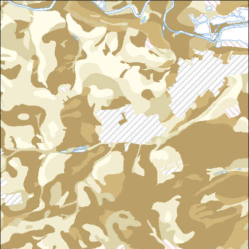
Ertragspotenzial des Bodens in Hessen (BFD50) - Die Bodenflächendaten 1:50 000 (BFD50, 2. Ausbaustufe) beschreiben flächenhaft die Böden, ihre Eigenschaften und Bodenfunktionen im regionalen Maßstab. In der Karte sind die edaphischen Faktoren des Ertragspotenzials zusammengetragen.
|
|
Citation proposal
. Ertragspotenzial_50000. https://gdk.gdi-de.org/geonetwork/srv/api/records/5450bd65-0b1f-1c52-2945-218e31ba6aff |
INSPIRE
Identification
- File identifier
- 5450bd65-0b1f-1c52-2945-218e31ba6aff XML
- Hierarchy level
- dataset Dataset
Online resource
Resource identifier
- Metadata language
- Deutsch German
- Spatial representation type
- Vector
Encoding
- Format
- Database
- Specification
- Specification unkown
Projection
- code
- urn:ogc:def:crs:EPSG:25832
Classification of data and services
- Topic category
-
- Farming
- Environment
- Geoscientific information
Classification of data and services
Coupled resource
Coupled resource
Classification of data and services
Coupled resource
Coupled resource
Keywords
- GEMET - INSPIRE themes, version 1.0
-
- Boden
- mapbender.2.registryId
-
- 1c349fea-924b-488f-b6a2-e896f40ac897
Other keywords
- Keywords
-
- BFD50
- Boden
- Bodenflächendaten
- Ertragspotenzial
- Hessen
- HLNUG
- Regional
- Soil
- inspireidentifiziert
Geographic coverage
N
S
E
W
))
Temporal reference
Temporal extent
Temporal extent
- Date ( Revision )
- 2024-04-30
Quality and validity
- Lineage
- Eingangsdaten: Basenhaushalt (42) potenzieller Grundwassereinfluss (43) nFK-DB PD klassifiziert (32)
- Denominator
- 50000
Conformity
Conformity
Conformity
Conformity
Conformity
Conformity
- Explanation
- No explanation available
- Explanation
- No explanation available
- Explanation
- No explanation available
- Explanation
- No explanation available
Restrictions on access and use
- Access constraints
- Dienst und Daten stellen keine rechtsverbindliche Auskunft dar. Die kostenfreie Nutzung der Geo- und Metadaten sowie der Geodatendienste ist für private und kommerzielle Zwecke erlaubt. Lizenz: Creative Commons BY 4.0. Quellenvermerk für Dienst: „Hessisches Landesamt für Naturschutz, Umwelt und Geologie“. Quellenvermerk für Daten: „Darstellung auf der Grundlage von Daten des Hessischen Landesamtes für Naturschutz, Umwelt und Geologie“. - Lizenz: cc-by - Creative Commons: Namensnennung 3.0 Deutschland - https://creativecommons.org/licenses/by/3.0/de/ - Quellenvermerk: Darstellung auf der Grundlage von Daten des Hessischen Landesamtes für Naturschutz, Umwelt und Geologie
- Access constraints
- {"id":"cc-by","name":"Creative Commons: Namensnennung 3.0 Deutschland","url":"https://creativecommons.org/licenses/by/3.0/de/","quelle":"Darstellung auf der Grundlage von Daten des Hessischen Landesamtes f\u00fcr Naturschutz, Umwelt und Geologie"}
Restrictions on access and use
Responsible organization (s)
Contact for the resource
- Organisation name
- Hessisches Landesamt für Naturschutz, Umwelt und Geologie (Mathias Schmanke)
Responsible organization (s)
Contact for the resource
- Organisation name
- Hessisches Landesamt für Naturschutz, Umwelt und Geologie (Mathias Schmanke)
Metadata information
Contact for the metadata
- Organisation name
- HLNUG
- arcgis@hlnug.hessen.de
- Date stamp
- 2024-04-30
- Metadata language
- Deutsch German
- Character set
- UTF8
SDS
Conformance class 1: invocable
Access Point URL
Endpoint URL
Technical specification
Conformance class 2: interoperable
Coordinate reference system
Quality of Service
Access constraints
Limitation
Use constraints
Limitation
Responsible custodian
Contact for the resource
Conformance class 3: harmonized
Overviews
Provided by

Views
5450bd65-0b1f-1c52-2945-218e31ba6aff
Access to the portal
Read here the full details and access to the data.
Associated resources
Not available