 www.geodatenkatalog.de (S3L)
Topographische Karte 1 : 10 000 - 3641-SO Grebs
Die Topographischen Karten (TK) werden aus Digitalen Landschafts- und Geländemodellen sowie dem Amtlichen Liegenschaftskatasterinformationssystem ALKIS erzeugt und nach dem bundeseinheitlichen Signaturenkatalog der Präsentationsausgaben „basemap.de P10“ Raster visualisiert. Die TK liegen flächendeckend und im einheitlichen geodätischen Bezugssystem und Kartenprojektion für das Land Brandenburg vor. Sie sind als analoge Kartendrucke (Plots), als Rasterdaten und als Webdienste, verfügbar. Bei Nutzung der Daten sind die Lizenzbedingungen zu beachten.
|
|
Citation proposal
(2025) . Topographische Karte 1 : 10 000 - 3641-SO Grebs. Landesvermessung und Geobasisinformation Brandenburg (LGB) https://gdk.gdi-de.org/geonetwork/srv/api/records/55429665-ea40-489b-9f65-7a019cf87fa8 |
INSPIRE
Identification
- File identifier
- 55429665-ea40-489b-9f65-7a019cf87fa8 XML
- Hierarchy level
- tile Tile
Online resource
Resource identifier
- Metadata language
- ger German
Encoding
Projection
Classification of data and services
- Topic category
-
- Imagery base maps earth cover
Classification of data and services
Coupled resource
Coupled resource
Classification of data and services
Coupled resource
Coupled resource
Keywords
- GEMET - INSPIRE themes, version 1.0 ( Theme )
-
- Bodenbedeckung
- BE/BB Schlagwortliste, Version 1.0 ( Theme )
-
- Vermessung
- Amtliche Karte
- Gebäude
Other keywords
- Keywords ( Theme )
-
- Karte
- Höhenlinien
- 3641-SO
- 1:10.000
- Verkehr
- Straßennamen
- Keywords
-
- opendata
Geographic coverage
N
S
E
W
))
Temporal reference
Temporal extent
Temporal extent
- Date ( Revision )
- 2024-04-19T00:00:00
- Date ( Creation )
- 2021-11-10T00:00:00
- Date ( Publication )
- 2025-02-20T09:19:57
Quality and validity
- Lineage
- Die Topographischen Karten werden aus Digitalen Landschafts-und Geländemodellen sowie dem Amtlichen Liegenschaftskatasterinformationssystem ALKIS erzeugt und nach dem bundeseinheitlichen ATKIS-Signaturenkatalog visualisiert.
- Denominator
- 10000
Conformity
Conformity
Conformity
Conformity
Conformity
Conformity
Restrictions on access and use
- Access constraints
- Die Daten können gemäß der „Datenlizenz Deutschland - Namensnennung - Version 2.0“ (https://www.govdata.de/dl-de/by-2-0) genutzt werden. Namensnennung: "GeoBasis-DE/LGB", Beispiel: „© GeoBasis-DE/LGB, dl-de/by-2-0, (Daten geändert)“, (Klammer = optional)
- Access constraints
- {"id":"dl-by-de/2.0","name":"Datenlizenz Deutschland - Namensnennung - Version 2.0","url":"https://www.govdata.de/dl-de/by-2-0","quelle":"Quelle: © GeoBasis-DE/LGB, dl-de/by-2-0"}
Restrictions on access and use
Responsible organization (s)
Contact for the resource
- Organisation name
- Landesvermessung und Geobasisinformation Brandenburg (LGB)
Responsible organization (s)
Contact for the resource
- Organisation name
- Landesvermessung und Geobasisinformation Brandenburg (LGB)
Metadata information
Contact for the metadata
- Organisation name
- Landesvermessung und Geobasisinformation Brandenburg (LGB)
- Date stamp
- 2025-02-20T09:19:57
- Metadata language
- ger German
- Character set
- utf8 UTF8
SDS
Conformance class 1: invocable
Access Point URL
Endpoint URL
Technical specification
Conformance class 2: interoperable
Coordinate reference system
Quality of Service
Access constraints
Limitation
Use constraints
Limitation
Responsible custodian
Contact for the resource
Conformance class 3: harmonized
Overviews
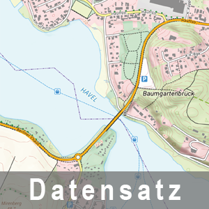
Ausschnitt aus der TK10
Provided by

Views
55429665-ea40-489b-9f65-7a019cf87fa8
Access to the portal
Read here the full details and access to the data.
Associated resources
Not available