 www.geodatenkatalog.de (S1L)
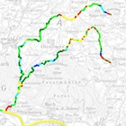
Gewässerstrukturkartierung der Fließgewässer Bayerns 2017 - WMS
Die Gewässerstrukturkartierung (GSK) aller nach EG-WRRL berichtspflichtiger, natürlicher Fließgewässer Bayerns – einschließlich der stark veränderten (HMWB) – ist Ende 2014 bis Anfang 2018 erfasst und bewertet worden,
gemäß „Gewässerstrukturkartierung von Fließgewässern in Bayern – Erläuterungen zur Erfassung und Bewertung“ (Bay. LfU 2018, siehe https://www.bestellen.bayern.de/shoplink/lfu_was_00152.htm ).
Zu jedem 100-m-Abschnitt sind die Geometrie, wichtige Stammdaten, die Bewertung der 2 Teilsysteme (Gewässerbett und Aue) sowie die Gesamtbewertung öffentlich bereitgestellt. Erläuterung zum Fachbezug: Liniengeometrien (Gewässernetz) verknüpft mit Ereignisthemen (Sachdaten).
Die 100-m-Abschnitte sind generiert aus den Routen des Fließgewässernetzes FGN25 (Stand 2013) als GISkm.
Die Erfassung der Sachdaten erfolgte mit dem Bay. Vor-Ort-Verfahren, Version 2017.
|
|
Citation proposal
(2019) . Gewässerstrukturkartierung der Fließgewässer Bayerns 2017 - WMS. https://gdk.gdi-de.org/geonetwork/srv/api/records/5b7e31b1-5aac-486e-958d-22e60d1bd76a |
INSPIRE
Identification
- File identifier
- 5b7e31b1-5aac-486e-958d-22e60d1bd76a XML
- Hierarchy level
- service Service
Online resource
Resource identifier
Encoding
- Format
- Sonstiges
Projection
Classification of data and services
Classification of data and services
- Service Type
- view
- Coupling Type
- Tight
Coupled resource
Coupled resource
Classification of data and services
- Service Type
- view
- Coupling Type
- Tight
Coupled resource
Coupled resource
Keywords
- Service Classification, version 1.0 ( Theme )
-
- infoMapAccessService
Other keywords
- Keywords
-
- gdiby
- Fließgewässerstruktur
- hydromorphologische Qualitätskomponenten
- Hydromorphologie
- Gewässerentwicklung
- Gewässerstruktur
- Vor-Ort-Verfahren
- UmweltAtlas
Geographic coverage
))
Temporal reference
Temporal extent
Temporal extent
- Date ( Publication )
- 2019-03-20T00:00:00.000+01:00
- Date ( Revision )
- 2020-11-09T00:00:00.000+01:00
Quality and validity
Conformity
Conformity
Conformity
Conformity
Conformity
Conformity
Restrictions on access and use
Restrictions on access and use
- Access constraints
- Creative Commons Namensnennung - Weitergabe unter gleichen Bedingungen 4.0 International (CC BY-SA 4.0); Datenquelle: Bayerisches Landesamt für Umwelt, www.lfu.bayern.de
- Access constraints
- {"id":"cc-by-sa/4.0","name":"Creative Commons Namensnennung - Weitergabe unter gleichen Bedingungen 4.0 International (CC BY-SA 4.0)","url":"https://creativecommons.org/licenses/by-sa/4.0/deed.de","quelle":"Bayerisches Landesamt für Umwelt, www.lfu.bayern.de"}
Responsible organization (s)
Contact for the resource
- Organisation name
- Bayerisches Landesamt für Umwelt
- Organisation name
- Bayerisches Landesamt für Umwelt
Responsible organization (s)
Contact for the resource
- Organisation name
- Bayerisches Landesamt für Umwelt
- Organisation name
- Bayerisches Landesamt für Umwelt
Metadata information
Contact for the metadata
- Organisation name
- Bayerisches Landesamt für Umwelt
- Date stamp
- 2024-06-28
- Metadata language
- German
SDS
Conformance class 1: invocable
Access Point URL
Endpoint URL
Technical specification
Conformance class 2: interoperable
Coordinate reference system
Quality of Service
Access constraints
- Access constraints
- otherRestrictions Other restrictions
Limitation
Use constraints
Limitation
- string
- Creative Commons Namensnennung - Weitergabe unter gleichen Bedingungen 4.0 International (CC BY-SA 4.0); Datenquelle: Bayerisches Landesamt für Umwelt, www.lfu.bayern.de
- string
- {"id":"cc-by-sa/4.0","name":"Creative Commons Namensnennung - Weitergabe unter gleichen Bedingungen 4.0 International (CC BY-SA 4.0)","url":"https://creativecommons.org/licenses/by-sa/4.0/deed.de","quelle":"Bayerisches Landesamt für Umwelt, www.lfu.bayern.de"}
Responsible custodian
Contact for the resource
Conformance class 3: harmonized
Contains Operations
- Operation Name
- GetCapabilities
- Distributed Computing Platforms
- Web services
- Operation Description
- application/vnd.ogc.wms_xml; text/xml;
Contains Operations
- Operation Name
- GetMap
- Distributed Computing Platforms
- Web services
- Operation Description
- image/bmp; image/jpeg; image/tiff; image/png; image/png8; image/png24; image/png32; image/gif; image/svg+xml;
Contains Operations
- Operation Name
- GetFeatureInfo
- Distributed Computing Platforms
- Web services
- Operation Description
- application/vnd.esri.wms_raw_xml; application/vnd.esri.wms_featureinfo_xml; application/vnd.ogc.wms_xml; text/xml; text/html; text/plain;
Contains Operations
- Operation Name
- esri_wms:GetStyles
- Distributed Computing Platforms
- Web services
- Operation Description
- application/vnd.ogc.sld+xml;
Overviews
Provided by
