 www.geodatenkatalog.de (S3L)
Helicopter-borne Electromagnetics (HEM)
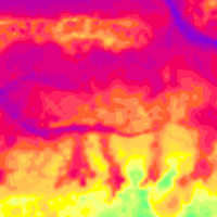
The BGR helicopter (Sikorsky S-76B) is used for airborne geophysical surveying of the Earth’s subsurface. The standard equipment comprises the methods electromagnetics, magnetics and radiometrics. The active multi-frequency, helicopter-borne electromagnetic (HEM) measuring system consists of circular (diameter about 0,5 m) transmitter and receiver coils (horizontal separation about 8 m) housed by a flying tube (bird) about 40 m beneath the helicopter. The ratio of received and transmitted signal yields to the electrical conductivity down to 50/150 m depth in case of conductive/resistive subsurface. The results are displayed as apparent resistivity (= half-space resistivity) and centroid depth at each of the six system frequencies ranging from 0.4 to 130 kHz. Furthermore, vertical and horizontal resistivity (= inverse of conductivity) sections are derived from multi-layer inversion results (1D resistivity-depth models).
|
|
Citation proposal
(2016) . Helicopter-borne Electromagnetics (HEM). https://gdk.gdi-de.org/geonetwork/srv/api/records/5d3c332a-bce3-498f-840f-3cbf19359aef |
Simple
- Alternate title
- HEM (Serie)
- Date ( Publication )
- 2016-09-06
- Identifier
- 1ddf4c22-0b63-425f-be21-b7530e1b831f
- Status
- onGoing On going
Point of contact
- GEMET - INSPIRE themes, version 1.0 ( Theme )
-
- Geologie
- Geology
- GEMET - Concepts, version 2.4 ( Theme )
-
- Geophysik
- Keywords ( Theme )
-
- Aerogeophysik
- Hubschrauber-Elektromagnetik
- elektrische Leitfähigkeit
- spezifischer Widerstand
- Halbraumwiderstand
- Schwerpunktstiefe
- airborne geophysics
- helicopter-borne electromagnetics
- electrical conductivity
- resistivity
- apparent resistivity
- centroid depth
- Keywords ( Place )
-
- Deutschland
- Access constraints
- Other restrictions
- Use constraints
- Other restrictions
- Other constraints
- Allgemeine Geschäftsbedingungen, siehe https://www.bgr.bund.de/AGB - General terms and conditions, see https://www.bgr.bund.de/AGB_en. Die bereitgestellten Informationen sind bei Weiterverwendung wie folgt zu zitieren: Datenquelle: HEM, (c) BGR, Hannover, 2016
- Spatial representation type
- Grid
- Metadata language
- German
- Character set
- UTF8
- Topic category
-
- Geoscientific information
N
S
E
W
))
- Distribution format
-
- WMS (OGC:WMS 1.3.0 )
- PDF (n/a )
- georef. TIFF (n/a )
- OnLine resource
-
BGR-Website: Aeroelektromagnetik
BGR-Website: Aeroelektromagnetik
- Hierarchy level
- Series
Conformance result
- Date ( Publication )
- 2010-12-08
- Explanation
- siehe dazu die angegebene Durchführungsbestimmung
- Statement
- Erarbeitung im Rahmen diverser Projekte, in denen das aerogeophysikalische Messsystem der BGR in Deutschland eingesetzt wurde.
gmd:MD_Metadata
- File identifier
- 5d3c332a-bce3-498f-840f-3cbf19359aef XML
- Metadata language
- German
- Character set
- UTF8
- Hierarchy level
- Series
- Hierarchy level name
- Geophysik
- Date stamp
- 2025-04-07
- Metadata standard name
- INSPIRE Metadata Implementing Rules: Technical Guidelines based on EN ISO 19115 and EN ISO 19119
- Metadata standard version
- n/a
Point of contact
Overviews
Provided by

Views
5d3c332a-bce3-498f-840f-3cbf19359aef
Access to the portal
Read here the full details and access to the data.
Associated resources
Not available