 www.geodatenkatalog.de (S3L)
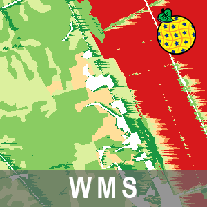
WMS Bodenerosionsgefährdung BB (WMS-BOEROSION)
Der Darstellungsdienst (WMS) Bodenerosionsgefährdung Brandenburgs stellt Daten zum Bodenabtrag (t/ha/a) durch Wassererosion (RxKxS), Bodenabtrag (t/ha/a) durch Wassererosion (RxKxSxL), Gefährdungsstufen der Wassererosion (RxKxS), Gefährdungsstufen der Wassererosion (RxKxSxL) sowie Gefährdungsstufen der Winderosion bereit. Der Dienst beinhaltet drei Layer. Im Layer „Gefährdungsstufen Winderosion“ sind die landwirtschaftlichen Flächen in einer räumlichen Auflösung von 2x2 Meter nach ihrer potenziellen Winderosionsgefährdung in Anlehnung an die Berechnungsvorschrift DIN19706 (https://dx.doi.org/10.31030/1934215) sowie Funk et al. 2023 (https://dx.doi.org/10.1016/j.aeolia.2023.100878) klassifiziert. Im Layer „Bodenabtrag (t/ha/a) Wassererosion (RxKxS)“ ist der potenzielle Bodenabtrag durch Wasser nach DIN19708 (https://dx.doi.org/10.31030/2676773) in einer räumlichen Auflösung von 5x5 Meter dargestellt. Im Layer „Gefährdungsstufen Wassererosion (RxKxS)“ ist eine Einstufung der potenziellen Wassererosionsgefährdung der landwirtschaftlichen Flächen nach DIN19708 in einer räumlichen Auflösung von 5x5 Meter dargestellt. Die potenzielle Erosionsgefährdung entspricht der Gefährdung der Flächen auf Grund naturräumlicher Bedingungen, d.h. ohne Berücksichtigung von landwirtschaftlichen Bewirtschaftungsmaßnahmen wie Bodenbearbeitung, Bodenbedeckung und Fruchtfolge.
Der WMS beinhaltet die folgenden Layer:
- Bodenabtrag (t/ha/a) Wassererosion (RxKxS) [wa_bodenabtrag_rks],
- Gefährdungsstufen Wassererosion (RxKxS) [wa_gefstufen_rks],
- Bodenabtrag (t/ha/a) Wassererosion (RxKxSxL) [wa_bodenabtrag_rksl],
- Gefährdungsstufen Wassererosion (RxKxSxL) [wa_gefstufen_rksl],
- Gefährdungsstufen Winderosion [wi_gefstufen].
|
|
Citation proposal
. WMS Bodenerosionsgefährdung BB (WMS-BOEROSION). Landesvermessung und Geobasisinformation Brandenburg (LGB) https://gdk.gdi-de.org/geonetwork/srv/api/records/5f3931b7-ac10-4482-9683-2c6fbe6af6f7 |
INSPIRE
Identification
- File identifier
- 5f3931b7-ac10-4482-9683-2c6fbe6af6f7 XML
- Hierarchy level
- service Service
Online resource
Resource identifier
Encoding
Projection
Classification of data and services
Classification of data and services
- Service Type
- view
- Coupling Type
- tight Tight
Coupled resource
Coupled resource
Classification of data and services
- Service Type
- view
- Coupling Type
- tight Tight
Coupled resource
Coupled resource
Keywords
- BE/BB Schlagwortliste, Version 1.0 ( Theme )
-
- Boden
- Bodenkunde
Other keywords
- Keywords
-
- opendata
- Keywords ( Theme )
-
- Erosion
- Erosionsgefährdung
- Wassererosion
- WMS
- Brandenburg
- Bodenabtrag
- Winderosion
- Bodenerosion
- sgd_Boden
- Geologie
Geographic coverage
))
Temporal reference
Temporal extent
Temporal extent
- Date ( Revision )
- 2023-10-11T00:00:00
- Date ( Creation )
- 2015-07-13T00:00:00
Quality and validity
Conformity
Conformity
Conformity
Conformity
Conformity
Conformity
Restrictions on access and use
Restrictions on access and use
- Access constraints
- Die Daten können gemäß der „Datenlizenz Deutschland - Namensnennung - Version 2.0“ (https://www.govdata.de/dl-de/by-2-0) genutzt werden. Namensnennung: "Landesamt für Bergbau, Geologie und Rohstoffe Brandenburg (LBGR)", Beispiel: „© Landesamt für Bergbau, Geologie und Rohstoffe Brandenburg (LBGR), dl-de/by-2-0, (Daten geändert)“, (Klammer = optional)
- Access constraints
-
{
"id": "dl-by-de/2.0",
"name": "Datenlizenz Deutschland - Namensnennung - Version 2.0",
"url": "https://www.govdata.de/dl-de/by-2-0",
"quelle": "Quelle: © Landesamt für Bergbau, Geologie und Rohstoffe Brandenburg (LBGR), dl-de/by-2-0"
}
Responsible organization (s)
Contact for the resource
- Organisation name
- Landesamt für Bergbau, Geologie und Rohstoffe Brandenburg (LBGR)
- Organisation name
- Landesvermessung und Geobasisinformation Brandenburg (LGB)
Responsible organization (s)
Contact for the resource
- Organisation name
- Landesamt für Bergbau, Geologie und Rohstoffe Brandenburg (LBGR)
- Organisation name
- Landesvermessung und Geobasisinformation Brandenburg (LGB)
Metadata information
Contact for the metadata
- Organisation name
- Landesvermessung und Geobasisinformation Brandenburg (LGB)
- Date stamp
- 2025-09-02T10:10:03
- Metadata language
- ger German
SDS
Conformance class 1: invocable
Access Point URL
Endpoint URL
Technical specification
Conformance class 2: interoperable
Coordinate reference system
Quality of Service
Access constraints
- Access constraints
- Other restrictions
Limitation
Use constraints
Limitation
- string
- Die Daten können gemäß der „Datenlizenz Deutschland - Namensnennung - Version 2.0“ (https://www.govdata.de/dl-de/by-2-0) genutzt werden. Namensnennung: "Landesamt für Bergbau, Geologie und Rohstoffe Brandenburg (LBGR)", Beispiel: „© Landesamt für Bergbau, Geologie und Rohstoffe Brandenburg (LBGR), dl-de/by-2-0, (Daten geändert)“, (Klammer = optional)
- string
-
{
"id": "dl-by-de/2.0",
"name": "Datenlizenz Deutschland - Namensnennung - Version 2.0",
"url": "https://www.govdata.de/dl-de/by-2-0",
"quelle": "Quelle: © Landesamt für Bergbau, Geologie und Rohstoffe Brandenburg (LBGR), dl-de/by-2-0"
}
Responsible custodian
Contact for the resource
Conformance class 3: harmonized
Contains Operations
- Operation Name
- GetLegendGraphic
- Distributed Computing Platforms
- Web services
- Connect Point
- https://inspire.brandenburg.de/services/boerosion_wms?
Contains Operations
- Operation Name
- GetFeatureInfo
- Distributed Computing Platforms
- Web services
- Connect Point
- https://inspire.brandenburg.de/services/boerosion_wms?
Contains Operations
- Operation Name
- GetCapabilities
- Distributed Computing Platforms
- Web services
- Connect Point
- https://inspire.brandenburg.de/services/boerosion_wms?
Contains Operations
- Operation Name
- GetMap
- Distributed Computing Platforms
- Web services
- Connect Point
- https://inspire.brandenburg.de/services/boerosion_wms?
Overviews
Provided by
