 www.geodatenkatalog.de (S3L)
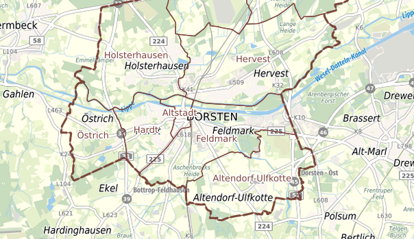
Gebietsgrenzen der Stadt Dorsten
|
|
Citation proposal
. Gebietsgrenzen der Stadt Dorsten. https://gdk.gdi-de.org/geonetwork/srv/api/records/6072b2ef2a58fb4319bdabdb7bf46386c33003b4 |
Simple
Identification info
- Date ( Revision )
- 2023-08-31T08:44:37
- Status
- Completed
Point of contact
- ISO ( Theme )
-
- infoMapAccessService
- Access constraints
- Other restrictions
- Other constraints
- no conditions apply
- Use limitation
- no conditions apply
- Service Type
- OGC:WMS
- Service Version
- 1.3.0
- Fees
- None
))
Coupled Resource
- Operation Name
- GetMap
- Identifier
- 6bd7ffeb468ee0820ca2f3a06698923c0e592bdb
Coupled Resource
- Operation Name
- GetMap
- Identifier
- 24f9653773aaf633a58c258eb46d18910b93b99a
- Coupling Type
- Tight
Contains Operations
- Operation Name
- GetCapabilities
- Distributed Computing Platforms
- HTTP-GET
- Connect Point
-
Format : text/xml
Format :
text/xml
Contains Operations
- Operation Name
- GetMap
- Distributed Computing Platforms
- HTTP-GET
- Connect Point
-
Format : image/jpeg
Format :
image/jpeg
- Connect Point
-
Format : image/png
Format :
image/png
- Connect Point
-
Format : image/png; mode=16bit
Format :
image/png; mode=16bit
- Connect Point
-
Format : image/png; mode=8bit
Format :
image/png; mode=8bit
- Connect Point
-
Format : image/png; mode=1bit
Format :
image/png; mode=1bit
- Connect Point
-
Format : application/dxf
Format :
application/dxf
Contains Operations
- Operation Name
- GetFeatureInfo
- Distributed Computing Platforms
- HTTP-GET
- Connect Point
-
Format : text/plain
Format :
text/plain
- Connect Point
-
Format : text/html
Format :
text/html
- Connect Point
-
Format : text/xml
Format :
text/xml
- Connect Point
-
Format : application/vnd.ogc.gml
Format :
application/vnd.ogc.gml
- Connect Point
-
Format : application/vnd.ogc.gml/3.1.1
Format :
application/vnd.ogc.gml/3.1.1
Contains Operations
- Operation Name
- sld:GetLegendGraphic
- Distributed Computing Platforms
- HTTP-GET
- Connect Point
-
Format : image/jpeg
Format :
image/jpeg
- Connect Point
-
Format : image/png
Format :
image/png
Contains Operations
- Operation Name
- sld:DescribeLayer
- Distributed Computing Platforms
- HTTP-GET
- Connect Point
-
Format : text/xml
Format :
text/xml
Contains Operations
- Operation Name
- qgs:GetStyles
- Distributed Computing Platforms
- HTTP-GET
- Connect Point
-
Format : text/xml
Format :
text/xml
- Distribution format
-
- ( )
- Hierarchy level
- Service
Attributes
- Statement
gmd:MD_Metadata
- File identifier
- 6072b2ef2a58fb4319bdabdb7bf46386c33003b4 XML
- Metadata language
- German
- Character set
- UTF8
- Hierarchy level
- Service
- Date stamp
- 2023-11-13T12:55:44.417Z
- Metadata standard name
- ISO 19119/2005
- Metadata standard version
- 1.0
Point of contact
Overviews
Provided by
