 www.geodatenkatalog.de (S1L)
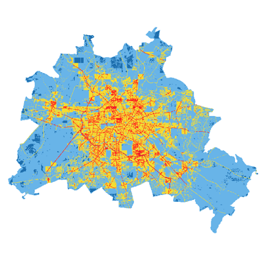
Durchschnittliche jährliche Luftschadstoffbelastung: Modelldaten (Umweltatlas)
Modellierte Luftschadstoffe NO2, PM10 und PM2.5 ausgegeben als Jahresmittelwert in µg/m3 auf einem 50 x 50 Quadratmeter Raster im Berliner Stadtgebiet.
|
|
Citation proposal
(2025) . Durchschnittliche jährliche Luftschadstoffbelastung: Modelldaten (Umweltatlas). https://gdk.gdi-de.org/geonetwork/srv/api/records/61b1e3bd-938d-4261-a770-1a60f4717292 |
- Identification
- Distribution
- Quality
- Spatial rep.
- Ref. system
- Content
- Portrayal
- Metadata
- Md. constraints
- Md. maintenance
- Schema info
Identification
Data identification
Citation
- Date ( Creation )
- 2024-12-31
- Date ( Publication )
- 2025-06-13
- Date ( Revision )
- 2025-06-13
Point of contact
Point of contact
- Maintenance and update frequency
- Not planned
- Keywords ( Theme )
-
- open data
- opendata
- Sachdaten
- Karten
- Geodaten
- Berlin
- Umweltatlas
- Luft
- Luftqualität
- Luftschadstoffe
- Luftbelastung
- Schadstoffe
- Luftreinhaltung
- Luftreinhalteplan
- Luftreinhalteplanung
- Luftverschmutzung
- Räumlicher Anwendungsbereich ( Theme )
Legal constraints
- Access constraints
- Other restrictions
Legal constraints
- Use constraints
- Other restrictions
- Other constraints
- Für die Nutzung der Daten ist die Datenlizenz Deutschland - Zero - Version 2.0 anzuwenden. Die Lizenz ist über https://www.govdata.de/dl-de/zero-2-0 abrufbar.
- Other constraints
- {"id":"dl-zero-de/2.0","name":"Datenlizenz Deutschland - Zero - Version 2.0","url":"https://www.govdata.de/dl-de/zero-2-0"}
- Spatial representation type
- Grid
- Denominator
- 50000
- Metadata language
- German
- Character set
- UTF8
- Topic category
-
- Environment
Extent
N
S
E
W
))
Geographic description
- Extent type code
- true
- Geographic identifier
- 110000000000
Distribution
Distribution
- Distribution format
-
-
Text/HTML
(4.01 )
- Specification
- Keine Angabe
-
Text/HTML
(4.01 )
- OnLine resource
-
Downloaddienst - Durchschnittliche jährliche Luftschadstoffbelastung: Modelldaten (Umweltatlas) (ATOM)
Downloaddienst - Durchschnittliche jährliche Luftschadstoffbelastung: Modelldaten (Umweltatlas) (ATOM)
- OnLine resource
-
Darstellungsdienst - Durchschnittliche jährliche Luftschadstoffbelastung: Modelldaten (Umweltatlas) (WMS)
Darstellungsdienst - Durchschnittliche jährliche Luftschadstoffbelastung: Modelldaten (Umweltatlas) (WMS)
- OnLine resource
-
Inhaltliche Beschreibung
Inhaltliche Beschreibung
- OnLine resource
-
Technische Beschreibung
Technische Beschreibung
Digital transfer options
- OnLine resource
-
Luftqualität
Luftqualität
- OnLine resource
-
Luftreinhaltung
Luftreinhaltung
- OnLine resource
-
Umweltatlas, Karte 03.12
Umweltatlas, Karte 03.12
Quality
Data quality
- Hierarchy level
- Dataset
Lineage
- Statement
- Verkehrsmengenkarte 2019 (URL) und Verkehrsqualität, Handbuch für Emissionsfaktoren, Meteorologie, Gebäudestruktur (URL), Emissionskataster (URL)
- Description
- Verkehrsmengenkarte 2019 (URL) und Verkehrsqualität, Handbuch für Emissionsfaktoren, Meteorologie, Gebäudestruktur (URL), Emissionskataster (URL)
Ref. system
- Reference system identifier
- http://www.opengis.net/def/crs/EPSG/0/25833
Metadata
Metadata
- File identifier
- 61b1e3bd-938d-4261-a770-1a60f4717292 XML
- Metadata language
- German
- Character set
- UTF8
- Hierarchy level
- Dataset
- Date stamp
- 2025-11-19T00:00:00Z
- Metadata standard name
- ISO 19115/19119 - BE
- Metadata standard version
- 1.0.0
Point of contact
Overviews
Vorschaubild
Provided by

Views
61b1e3bd-938d-4261-a770-1a60f4717292
Access to the portal
Read here the full details and access to the data.
Associated resources
Not available