 www.geodatenkatalog.de (S1F)
LGRB-BW INSPIRE LED: Permanente Erdbebenmessstationen (Geophysics: Geophysical Stations) - Datensatz
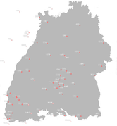
Das Netz der permanenten Messstationen zur Erdbebenregistrierung in Baden-Württemberg gliedert sich technisch und funktional in Gruppen unterschiedlicher Ausrichtung: 1. empfindliche Detektionsstationen, 2. Starkbebenmessstationen, 3. Hybridstationen, die Detektions- und Starkbeben-Eigenschaften verbinden. Dies gilt sowohl für die LED-eigenen Erdbebenmessstationen als auch für die anderer Betreiber. Sämtliche Messstationen übertragen heute ihre Daten echtzeitnah via Mobilfunk, DSL oder Internet in die Zentrale des LED in Freiburg. Die Daten der Stationen anderer Betreiber werden dem LED freundlicherweise zur Verfügung gestellt. Mit dem Landeserdbebendienst Rheinland-Pfalz (LER) besteht der Verbund "Erdbebendienst Südwest".
|
|
Citation proposal
. LGRB-BW INSPIRE LED: Permanente Erdbebenmessstationen (Geophysics: Geophysical Stations) - Datensatz. https://gdk.gdi-de.org/geonetwork/srv/api/records/625b0678-ca4e-4df9-8776-31848a4d9447 |
INSPIRE
Identification
- File identifier
- 625b0678-ca4e-4df9-8776-31848a4d9447 XML
- Hierarchy level
- Dataset
Online resource
Resource identifier
- Metadata language
- German
- Spatial representation type
- Vector
Encoding
- Format
- ESRI Shapefile
- Version
- n/a (default)
- Specification
- https://www.esri.com/content/dam/esrisites/sitecore-archive/Files/Pdfs/library/whitepapers/pdfs/shapefile.pdf
Projection
Classification of data and services
- Topic category
-
- Geoscientific information
- Environment
Classification of data and services
Coupled resource
Coupled resource
Classification of data and services
Coupled resource
Coupled resource
Keywords
- Liste der Datenkategorien in der GDI-BW für Geodaten
-
- inspireidentifiziert
- GDB GDI-BW
- GEMET - INSPIRE themes, version 1.0 ( Theme )
- Spatial scope
- GDI-BW-Schlüsselwortliste nach dem mehrsprachigen Umwelt-Thesaurus GEMET
-
- Geologie
- Monitoring
Other keywords
- Keywords
-
- Erdbeben
Geographic coverage
N
S
E
W
))
Temporal reference
Temporal extent
Temporal extent
- Date ( Revision )
- 2021-10-01
Quality and validity
- Lineage
- Erdbebenmessnetz von Baden-Württemberg
- Denominator
- 350000
Conformity
Conformity
Conformity
Conformity
Conformity
Conformity
Restrictions on access and use
Restrictions on access and use
Responsible organization (s)
Contact for the resource
- Organisation name
- Regierungspräsidium Freiburg - Abteilung 9 Landesamt für Geologie, Rohstoffe und Bergbau, Ref. 98 Landeserdbebendienst
- abteilung9@rpf.bwl.de
Responsible organization (s)
Contact for the resource
- Organisation name
- Regierungspräsidium Freiburg - Abteilung 9 Landesamt für Geologie, Rohstoffe und Bergbau, Ref. 98 Landeserdbebendienst
- abteilung9@rpf.bwl.de
Metadata information
Contact for the metadata
- Organisation name
- Regierungspräsidium Freiburg - Abteilung 9 Landesamt für Geologie, Rohstoffe und Bergbau, Referat 91 Geowissenschaftliches Landeservicezentrum
- abteilung9@rpf.bwl.de
- Organisation name
- Regierungspräsidium Freiburg - Abteilung 9 Landesamt für Geologie, Rohstoffe und Bergbau, Referat 91 Geowissenschaftliches Landeservicezentrum
- abteilung9@rpf.bwl.de
- Date stamp
- 2023-05-23T09:48:44
- Metadata language
- German
- Character set
- UTF8
SDS
Conformance class 1: invocable
Access Point URL
Endpoint URL
Technical specification
Conformance class 2: interoperable
Coordinate reference system
Quality of Service
Access constraints
Limitation
Use constraints
Limitation
Responsible custodian
Contact for the resource
Conformance class 3: harmonized
Overviews
thumbnail
Provided by

Views
625b0678-ca4e-4df9-8776-31848a4d9447
Access to the portal
Read here the full details and access to the data.
Associated resources
Not available