 www.geodatenkatalog.de (S1L)
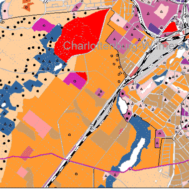
Bodengesellschaften und Bodenarten 2001 (Umweltatlas)
Bodengesellschaften und Bodenarten unversiegelter Böden, Konzeptkarte ermittelt aus Bodenuntersuchungen und Nutzungsarten auf Grundlage der Blockkarte 1 : 50.000 (ISU50, Raumbezug Umweltatlas 2001), Bearbeitungsstand Dezember 2003.
|
|
Citation proposal
(2003) . Bodengesellschaften und Bodenarten 2001 (Umweltatlas). https://gdk.gdi-de.org/geonetwork/srv/api/records/632fef78-5b78-32b1-a4e5-3fb6ef302c21 |
INSPIRE
Identification
- File identifier
- 632fef78-5b78-32b1-a4e5-3fb6ef302c21 XML
- Hierarchy level
- Dataset
Online resource
Resource identifier
- Metadata language
- German
- Spatial representation type
- Vector
Encoding
- Format
- text/html
- Version
- 4.01
- Specification
- keine Angabe
Projection
Classification of data and services
- Topic category
-
- Geoscientific information
Classification of data and services
Coupled resource
Coupled resource
Classification of data and services
Coupled resource
Coupled resource
Keywords
- Spatial scope
Other keywords
- Keywords ( Theme )
-
- Karten
- Geodaten
- Berlin
- Bodengesellschaften
- Bodentypen
- Bodenkarte
- Umweltatlas
- Bodenkartierung
- Konzeptbodenkarte
- Böden
Geographic coverage
N
S
E
W
))
Temporal reference
Temporal extent
Temporal extent
- Date ( Creation )
- 2003-12-01
- Date ( Publication )
- 2003-12-01
Quality and validity
- Lineage
- Grenzius, R. 1987: Die Böden Berlins (West). Diss. TU Berlin; Verschiedene bodenkundliche Gutachten und Einzelkartierungen des Instituts für Bodenkunde der TU Berlin; Flächennutzung Stand 2001; Karte der Kriegszerstörung; Versiegelung Stand 2001; Mittelmaßstäbliche landwirtschaftliche Kartierung; Geologische Übersichtskarte 1:50 000 und 1: 100 000; Forstliche Standortkartierung; Preußische Geologische Kartierung; Flurabstand des Grundwassers Stand Mai 2003
- Denominator
- 50000
Conformity
Conformity
Conformity
Conformity
Conformity
Conformity
Restrictions on access and use
- Access constraints
- Für die Nutzung der Daten ist die Datenlizenz Deutschland - Zero - Version 2.0 anzuwenden. Die Lizenz ist über https://www.govdata.de/dl-de/zero-2-0 abrufbar.
- Access constraints
- { "id": "dl-zero-de/2.0" , "name": "Datenlizenz Deutschland - Zero - Version 2.0", "url": "https://www.govdata.de/dl-de/zero-2-0" }
Restrictions on access and use
Responsible organization (s)
Contact for the resource
- Organisation name
- Senatsverwaltung für Mobilität, Verkehr, Klimaschutz und Umwelt Berlin
Responsible organization (s)
Contact for the resource
- Organisation name
- Senatsverwaltung für Mobilität, Verkehr, Klimaschutz und Umwelt Berlin
Metadata information
Contact for the metadata
- Organisation name
- Senatsverwaltung für Stadtentwicklung, Bauen und Wohnen Berlin
- Date stamp
- 2025-03-06T12:33:36
- Metadata language
- German
- Character set
- UTF8
SDS
Conformance class 1: invocable
Access Point URL
Endpoint URL
Technical specification
Conformance class 2: interoperable
Coordinate reference system
Quality of Service
Access constraints
Limitation
Use constraints
Limitation
Responsible custodian
Contact for the resource
Conformance class 3: harmonized
Overviews
Provided by

Views
632fef78-5b78-32b1-a4e5-3fb6ef302c21
Access to the portal
Read here the full details and access to the data.
Associated resources
Not available