 www.geodatenkatalog.de (S2L)
LEP/RP Ausschlussflächen Kleve
Der Layer „Ausschluss Flächen“ stellt für die Stadt Kleve die auszuschließenden Flächen für raumbedeutsame Freiflächenphotovoltaikanlagen entsprechend Landesentwicklungsplans dar.
Die Daten stammen vom Energieatlas des Landesamtes für Natur, Umwelt und Verbraucherschutz Nordrhein-Westfalen und sind pro Kommune ausgewertet.
|
|
Citation proposal
(2024) . LEP/RP Ausschlussflächen Kleve. Kreis Kleve - Der Landrat https://gdk.gdi-de.org/geonetwork/srv/api/records/6357a4cb-0b92-4ec3-8325-fdf2a05aa309 |
- Identification
- Distribution
- Quality
- Spatial rep.
- Ref. system
- Content
- Portrayal
- Metadata
- Md. constraints
- Md. maintenance
- Schema info
Identification
Data identification
Citation
- Date ( Publication )
- 2024-05-11T00:00:00.000+02:00
Publisher
Point of contact
Kreis Kleve - Abt. Kataster- und Vermessung - Produktbereich GeoInformation (GIS)
Nassauerallee 15-23
Kleve
Nordrhein-Westfalen
47533
DEU
Maintenance information
- Maintenance and update frequency
- Annually
- Update scope
- Dataset
- Keywords
-
- Kreis Kleve
- Kleve
- NW
- NRW
- Nordrhein-Westfalen
- Geoportal
- 051540004004
- PV
- Solar
- Modulfläche
- Energieatlas
- Leistung
- Energien
- Erneuerbare
- potenziell
- Photovoltaikanlage
- Freiflächen
- LEP/RP
- Landesentwicklungsplan
- Ausschlussflächen
- Stadt Kleve
- opendata
- Keywords ( Theme )
-
- ENER
- UMTHES Thesaurus ( Theme )
- GEMET - Concepts, version 3.1 ( Theme )
Legal constraints
- Use constraints
- Other restrictions
- Other constraints
- Datenlizenz Deutschland - Zero - Version 2.0 [https://www.govdata.de/dl-de/zero-2-0]
- Other constraints
- {"id":"dl-zero-de/2.0","name":"Datenlizenz Deutschland – Zero – Version 2.0","url":"https://www.govdata.de/dl-de/zero-2-0","quelle":""}
Legal constraints
- Access constraints
- otherRestrictions Other restrictions
- Metadata language
- German
- Topic category
-
- Planning cadastre
Extent
Bounding Polygon
- Extent type code
- true
Geographic description
- Extent type code
- true
- Geographic identifier
- Kleve, Gemeinde (051540036036)
N
S
E
W
))
Distribution
Distribution
- Distribution format
-
- ()
- OnLine resource
- Energieatlas/Solarkataster
Quality
Data quality
- Hierarchy level
- Dataset
- Statement
-
Bundesnetzagentur - Anlagenregister zu den Erneuerbaren Energien
Übertragungsnetzbetreiber Amprion GmbH und TenneT B V - Meldedaten nach EEG
Metadata
Metadata
- File identifier
- 6357a4cb-0b92-4ec3-8325-fdf2a05aa309 XML
- Metadata language
- German
- Character set
- UTF8
- Hierarchy level
- dataset Dataset
- Date stamp
- 2025-02-26
- Metadata standard name
- ISO19115
- Metadata standard version
- 2003/Cor.1:2006
Point of contact
Kreis Kleve - Abt. Kataster- und Vermessung - Produktbereich GeoInformation (GIS)
Nassauerallee 15-23
Kleve
Nordrhein-Westfalen
47533
DEU
Overviews
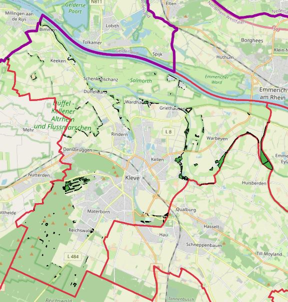
Ausschlussflächen Kleve
Provided by

Views
6357a4cb-0b92-4ec3-8325-fdf2a05aa309
Access to the portal
Read here the full details and access to the data.
Associated resources
Not available