 www.geodatenkatalog.de (S2L)
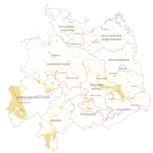
Map of the distribution of sand and gravel in the Northern German glacial area (WMS)
Geological distribution of aggregates (sand and gravel) in northern Germany, especially north of the southernmost maximum of the Scandinavian inland ice sheet (Saalian and Elsterian glaciation).
|
|
Citation proposal
Bundesanstalt für Geowissenschaften und Rohstoffe (BGR) (2023) . Map of the distribution of sand and gravel in the Northern German glacial area (WMS). https://gdk.gdi-de.org/geonetwork/srv/api/records/640cc74b-f2f6-483f-a792-8c39d42f04b2 |
Simple
Identification info
- Alternate title
- SuK-Nord (WMS)
- Date ( Publication )
- 2023-04-25
- Identifier
- e3e7c35c-aa0e-4014-a7aa-459c281b5753
- Status
- completed Completed
Point of contact
- Keywords ( Theme )
-
- Sand
- Kies
- Vorkommen
- Erkundung
- SGD
- Ablagerung
- Eiszeiten
- Inlandeis
- Norddeutschland
- Vereisungsgrenze
- GEMET - INSPIRE themes, version 1.0 ( Theme )
-
- Geologie
- geology
- Keywords
-
- infoMapAccessService
- Access constraints
- Other restrictions
- Use constraints
- Other restrictions
- Other constraints
- Allgemeine Geschäftsbedingungen, siehe https://www.bgr.bund.de/AGB - General terms and conditions, see https://www.bgr.bund.de/AGB_en. Die bereitgestellten Informationen sind bei Weiterverwendung wie folgt zu zitieren: Datenquelle: SuK Nord, BGR, Hannover, 2023
- Service Type
- view
- Service Version
- OGC:WMS 1.3.0
N
S
E
W
))
Coupled Resource
- Operation Name
- getCapabilities
- Identifier
- e4db4340-1db7-2e04-55e5-5778f3bfa44c
- Coupling Type
- Tight
Contains Operations
- Operation Name
- GetCapabilities
- Distributed Computing Platforms
- Web services
- Connect Point
- https://services.bgr.de/wms/rohstoffe/suk_nord/?
Contains Operations
- Operation Name
- GetMap
- Distributed Computing Platforms
- Web services
- Connect Point
- https://services.bgr.de/wms/rohstoffe/suk_nord/?
- Operates On
- Distribution format
-
- WMS (OGC:WMS 1.3.0 )
- OnLine resource
- https://services.bgr.de/wms/rohstoffe/suk_nord/?REQUEST=GetCapabilities&SERVICE=wms&VERSION=1.3.0
- OnLine resource
-
Karte im BGR-Geoviewer
Karte im BGR-Geoviewer
- Hierarchy level
- Service
- Other
- Service
Conformance result
- Date ( Publication )
- 2013-04-04
Conformance result
- Date ( Publication )
- 2009-10-20
- Statement
- Bereitstellung der Daten durch die Staatlichen Geologischen Dienste
gmd:MD_Metadata
- File identifier
- 640cc74b-f2f6-483f-a792-8c39d42f04b2 XML
- Metadata language
- German
- Character set
- UTF8
- Hierarchy level
- Service
- Hierarchy level name
- Rohstoffe
- Date stamp
- 2024-01-24
- Metadata standard name
- INSPIRE Metadata Implementing Rules: Technical Guidelines based on EN ISO 19115 and EN ISO 19119
- Metadata standard version
- V 2.0.1
Point of contact
Overviews
Provided by

Views
640cc74b-f2f6-483f-a792-8c39d42f04b2
Access to the portal
Read here the full details and access to the data.
Associated resources
Not available