 www.geodatenkatalog.de (S2L)
WMS der Stadt Waltershausen
Darstellungsdienst (WMS) der Geodaten der Stadt Waltershausen. Der Darstellungsdienst enthält die Geltungsbereiche der Bebauungspläne und Satzungen sowie die Standorte der Kindertagesstätten, Spielplätze und Friedhöfe. Es handelt sich um einen Sekundärdatenbestand.
|
|
Citation proposal
(2023) . WMS der Stadt Waltershausen. https://gdk.gdi-de.org/geonetwork/srv/api/records/67072a99-7dd1-452e-a8dc-8e1037ddfc81 |
INSPIRE
Identification
- File identifier
- 67072a99-7dd1-452e-a8dc-8e1037ddfc81 XML
- Hierarchy level
- Service
Online resource
- Protocol
- OGC:WMS-http-get-map
Resource identifier
Encoding
- Format
- shp
- Version
- QGIS
Projection
Classification of data and services
Classification of data and services
- Service Type
- view
- Coupling Type
- Tight
Coupled resource
Coupled resource
Classification of data and services
- Service Type
- view
- Coupling Type
- Tight
Coupled resource
Coupled resource
Keywords
- GEMET - INSPIRE themes, version 1.0 ( Theme )
-
- Bodennutzung
- Versorgungswirtschaft und staatliche Dienste
- VERORDNUNG (EG) Nr. 1205/2008 DER KOMMISSION zur Durchführung der Richtlinie 2007/2/EG des Europäischen Parlaments und des Rates hinsichtlich Metadaten
-
- humanGeographicViewer
- Darstellungsdienste
Other keywords
- Keywords
-
- WMS
- opendata
- GOVE
- REGI
- SOCI
- EDUC
- Bauleitplanung
- B-Plan
- einfacher B-Plan
- qualifizierter B-Plan
- Vorhabenbezogener B-Plan
- Vorhaben- und Erschließungsplan
- Entwicklungssatzung
- Innenbereichssatzung
- Außenbereichssatzung
- Sanierungssatzung
- Satzung
- Bebauungsplan
- Klarstellungssatzung
- Geltungsbereich
- Ergänzungssatzung
- Kinderbetreuung
- Kindertagesstätten
- Kita
- Kindergarten
- Kinderkrippe
- Spielplatz
- Friedhof
- Thüringen
Geographic coverage
N
S
E
W
))
Temporal reference
Temporal extent
Temporal extent
- Date ( Publication )
- 2023-09-29
Quality and validity
- Lineage
- WMS
Conformity
Conformity
Conformity
Conformity
Conformity
Conformity
- Explanation
- mit GDI-DE Testsuite validiert
- Explanation
- mit GDI-DE Testsuite validiert
- Explanation
- mit GDI-DE Testsuite validiert
- Explanation
- mit GDI-DE Testsuite validiert
Restrictions on access and use
Restrictions on access and use
- Access constraints
- Nutzungsbedingungen: Datenlizenz Deutschland-Namensnennung 2.0 in JSON Syntax
- Access constraints
- {"id": "dl-by-de/2.0", "name": "Datenlizenz Deutschland Namensnennung 2.0", "url": "https://www.govdata.de/dl-de/by-2-0 ", "quelle": "© GDI-Th"}
Responsible organization (s)
Contact for the resource
- Organisation name
- Thüringer Landesamt für Bodenmanagement und Geoinformation
Responsible organization (s)
Contact for the resource
- Organisation name
- Thüringer Landesamt für Bodenmanagement und Geoinformation
Metadata information
Contact for the metadata
- Organisation name
- Thüringer Landesamt für Bodenmanagement und Geoinformation
- Date stamp
- 2023-09-29T15:07:25
- Metadata language
- German
SDS
Conformance class 1: invocable
- Pass
- true
- Pass
- true
- Pass
- true
- Pass
- true
Access Point URL
Endpoint URL
Technical specification
- Date
- Explanation
- mit GDI-DE Testsuite validiert
- Date
- Explanation
- mit GDI-DE Testsuite validiert
- Date
- Explanation
- mit GDI-DE Testsuite validiert
- Date
- Explanation
- mit GDI-DE Testsuite validiert
Conformance class 2: interoperable
Coordinate reference system
Quality of Service
Access constraints
Limitation
- string
- Nutzungsbedingungen: Datenlizenz Deutschland-Namensnennung 2.0 in JSON Syntax
- string
- {"id": "dl-by-de/2.0", "name": "Datenlizenz Deutschland Namensnennung 2.0", "url": "https://www.govdata.de/dl-de/by-2-0 ", "quelle": "© GDI-Th"}
Use constraints
Limitation
- string
- Nutzungsbedingungen: Datenlizenz Deutschland-Namensnennung 2.0 in JSON Syntax
- string
- {"id": "dl-by-de/2.0", "name": "Datenlizenz Deutschland Namensnennung 2.0", "url": "https://www.govdata.de/dl-de/by-2-0 ", "quelle": "© GDI-Th"}
Responsible custodian
Contact for the resource
Conformance class 3: harmonized
Contains Operations
- Operation Name
- GetCapabilities
- Distributed Computing Platforms
- Web services
- Connect Point
-
Darstellungsdienst für Geodaten der Stadt Waltershausen
Darstellungsdienst für Geodaten der Stadt Waltershausen
Overviews
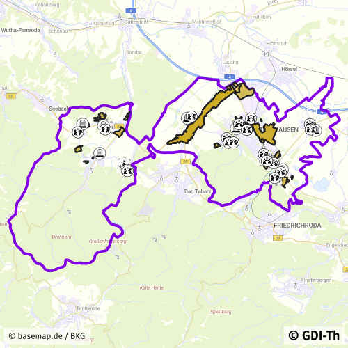
Vorschaubild
Provided by

Views
67072a99-7dd1-452e-a8dc-8e1037ddfc81
Access to the portal
Read here the full details and access to the data.
Associated resources
Not available