 www.geodatenkatalog.de (S3F)
WMTS Digitales Geländemodell Gitterweite 1m Brandenburg mit Berlin
Dieser Web Map Tile Service stellt das Digitale Geländemodell (Laserscan) mit der Bodenauflösung von 1m als farbige Höhenschichten mit Schummerung vom Gebiet Brandenburg mit Berlin zur Verfügung.
|
|
Citation proposal
. WMTS Digitales Geländemodell Gitterweite 1m Brandenburg mit Berlin. https://gdk.gdi-de.org/geonetwork/srv/api/records/67aa799e-d5ae-4005-b758-53b57ac7f16b |
INSPIRE
Identification
- File identifier
- 67aa799e-d5ae-4005-b758-53b57ac7f16b XML
- Hierarchy level
- service Service
Online resource
Resource identifier
Encoding
Projection
Classification of data and services
Classification of data and services
- Service Type
- view
- Coupling Type
- tight Tight
Coupled resource
Coupled resource
Classification of data and services
- Service Type
- view
- Coupling Type
- tight Tight
Coupled resource
Coupled resource
Keywords
- BE/BB Schlagwortliste, Version 1.0 ( Theme )
-
- Luftbild
Other keywords
- Keywords
-
- opendata
- Keywords ( Theme )
-
- GDI
- AdV-OWS-Basisprofil
- Vermessung
- WMTS_BB-BE_DGM_1m
- AdV
- Geobasisdaten
- Navigation
- AdVMIS
- BB-BE
- Digitales Geländemodell
- WMTS
- DGM
- Keywords ( Place )
-
- Brandenburg
- Berlin
Geographic coverage
N
S
E
W
))
Temporal reference
Temporal extent
Temporal extent
- Date ( Creation )
- 2012-01-23T00:00:00
Quality and validity
Conformity
Conformity
Conformity
Conformity
Conformity
Conformity
Restrictions on access and use
Restrictions on access and use
- Access constraints
- Die Daten können gemäß der „Datenlizenz Deutschland - Namensnennung - Version 2.0“ (https://www.govdata.de/dl-de/by-2-0) genutzt werden. Namensnennung: "GeoBasis-DE/LGB“, Beispiel: „© GeoBasis-DE/LGB, dl-de/by-2-0, (Daten geändert)“, (Klammer = optional) Hinweis: werden auch Daten des Bundeslandes Berlin genutzt, ist der Copyright-Vermerk um den Hinweis “© Geoportal Berlin, dl-de/by-2-0“ zu ergänzen. Beispiel: „© GeoBasis-DE/LGB, dl-de/by-2-0; © Geoportal Berlin, dl-de/by-2-0 (Daten geändert)“, (Klammer = optional)
- Access constraints
- {"id":"dl-by-de/2.0","name":"Datenlizenz Deutschland - Namensnennung - Version 2.0","url":"https://www.govdata.de/dl-de/by-2-0","quelle":"Quelle: © GeoBasis-DE/LGB, dl-de/by-2-0; © Geoportal Berlin, dl-de/by-2-0"}
Responsible organization (s)
Contact for the resource
- Organisation name
- Landesvermessung und Geobasisinformation Brandenburg (LGB)
Responsible organization (s)
Contact for the resource
- Organisation name
- Landesvermessung und Geobasisinformation Brandenburg (LGB)
Metadata information
Contact for the metadata
- Organisation name
- Landesvermessung und Geobasisinformation Brandenburg (LGB)
- Date stamp
- 2025-04-04T09:22:49
- Metadata language
- ger German
SDS
Conformance class 1: invocable
Access Point URL
Endpoint URL
Technical specification
Conformance class 2: interoperable
Coordinate reference system
Quality of Service
Access constraints
- Access constraints
- Other restrictions
Limitation
Use constraints
Limitation
- string
- Die Daten können gemäß der „Datenlizenz Deutschland - Namensnennung - Version 2.0“ (https://www.govdata.de/dl-de/by-2-0) genutzt werden. Namensnennung: "GeoBasis-DE/LGB“, Beispiel: „© GeoBasis-DE/LGB, dl-de/by-2-0, (Daten geändert)“, (Klammer = optional) Hinweis: werden auch Daten des Bundeslandes Berlin genutzt, ist der Copyright-Vermerk um den Hinweis “© Geoportal Berlin, dl-de/by-2-0“ zu ergänzen. Beispiel: „© GeoBasis-DE/LGB, dl-de/by-2-0; © Geoportal Berlin, dl-de/by-2-0 (Daten geändert)“, (Klammer = optional)
- string
- {"id":"dl-by-de/2.0","name":"Datenlizenz Deutschland - Namensnennung - Version 2.0","url":"https://www.govdata.de/dl-de/by-2-0","quelle":"Quelle: © GeoBasis-DE/LGB, dl-de/by-2-0; © Geoportal Berlin, dl-de/by-2-0"}
Responsible custodian
Contact for the resource
Conformance class 3: harmonized
Contains Operations
- Operation Name
- GetCapabilities
- Distributed Computing Platforms
- Web services
- Connect Point
- https://isk.geobasis-bb.de/mapproxy/dgm_wmts/service?
Contains Operations
- Operation Name
- GetTile
- Distributed Computing Platforms
- Web services
- Connect Point
- https://isk.geobasis-bb.de/mapproxy/dgm_wmts/service?
Overviews
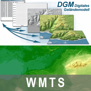
Vorschaubild: Digitales Geländemodell
Provided by

Views
67aa799e-d5ae-4005-b758-53b57ac7f16b
Access to the portal
Read here the full details and access to the data.
Associated resources
Not available