 www.geodatenkatalog.de (S3F)
Bodenrichtwerte 01.01.2019
Sachdaten zu den durch den Gutachterausschuss für Grundstückswerte in Berlin zum 01.01.2019 ermittelten Bodenrichtwerten. Die Sachdaten beinhalten die Ergebnisse der Beratungen zu den Bodenrichtwerten und dienen der tabellarischen Information.
|
|
Citation proposal
(2019) . Bodenrichtwerte 01.01.2019. https://gdk.gdi-de.org/geonetwork/srv/api/records/69ac5522-b775-3e77-bad1-a24d86c8e156 |
- Identification
- Distribution
- Quality
- Spatial rep.
- Ref. system
- Content
- Portrayal
- Metadata
- Md. constraints
- Md. maintenance
- Schema info
Identification
Identification info
Service Identification (19119)
Citation
- Date ( Creation )
- 2019-01-01
- Date ( Publication )
- 2019-02-26
- Presentation form
- Digital table
Point of contact
Point of contact
- Keywords ( Theme )
-
- open data
- opendata
- Berlin
- Preise
- Wertermittlung
- Gutachterausschuss
- BORIS
- Grundstück
- Geodaten
- Werte
- Bodenrichtwertatlas
- GAA
- Bodenrichtwerte
Legal constraints
- Access constraints
- Other restrictions
Legal constraints
- Use constraints
- Other restrictions
- Other constraints
- Für die Nutzung der Daten ist die Datenlizenz Deutschland - Zero - Version 2.0 anzuwenden. Die Lizenz ist über https://www.govdata.de/dl-de/zero-2-0 abrufbar.
- Other constraints
- { "id": "dl-zero-de/2.0" , "name": "Datenlizenz Deutschland - Zero - Version 2.0", "url": "https://www.govdata.de/dl-de/zero-2-0" }
- Service Type
- download
- Service Version
- OGC:WFS 1.0.0
- Service Version
- OGC:WFS 1.1.0
- Service Version
- OGC:WFS 2.0.0
Extent
N
S
E
W
))
Geographic description
- Extent type code
- true
- Geographic identifier
- 110000000000
- Coupling Type
- Tight
Contains Operations
- Operation Name
- GetCapabilities
- Distributed Computing Platforms
- Web services
Distribution
Distribution
- Distribution format
-
- Text/HTML (4.01 )
Digital transfer options
- OnLine resource
-
GetCapabilities Aufruf des WFS mit maschinenlesbarer Antwort
GetCapabilities Aufruf des WFS mit maschinenlesbarer Antwort
- OnLine resource
-
Aufruf des Geoportals Berlin mit Darstellung der downloadbaren Daten als Karte(nlayer)
Aufruf des Geoportals Berlin mit Darstellung der downloadbaren Daten als Karte(nlayer)
- OnLine resource
-
Inhaltliche Beschreibung
Inhaltliche Beschreibung
Quality
Scope
- Hierarchy level
- Service
- Other
- Dienst
Ref. system
- Reference system identifier
- http://www.opengis.net/def/crs/EPSG/0/25833
Metadata
Metadata
- File identifier
- 69ac5522-b775-3e77-bad1-a24d86c8e156 XML
- Metadata language
- German
- Character set
- UTF8
- Hierarchy level
- Service
- Hierarchy level name
- Bodenrichtwerte 01.01.2019 Dienst
- Date stamp
- 2025-03-06T12:30:19
- Metadata standard name
- ISO 19115/19119 – BE
- Metadata standard version
- 1.0.0
Overviews
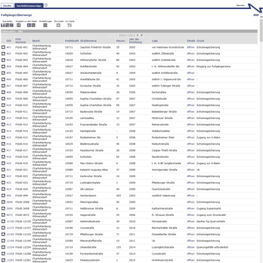
Vorschaugrafik
Provided by

Views
69ac5522-b775-3e77-bad1-a24d86c8e156
Access to the portal
Read here the full details and access to the data.
Associated resources
Not available