 www.geodatenkatalog.de (S1L)
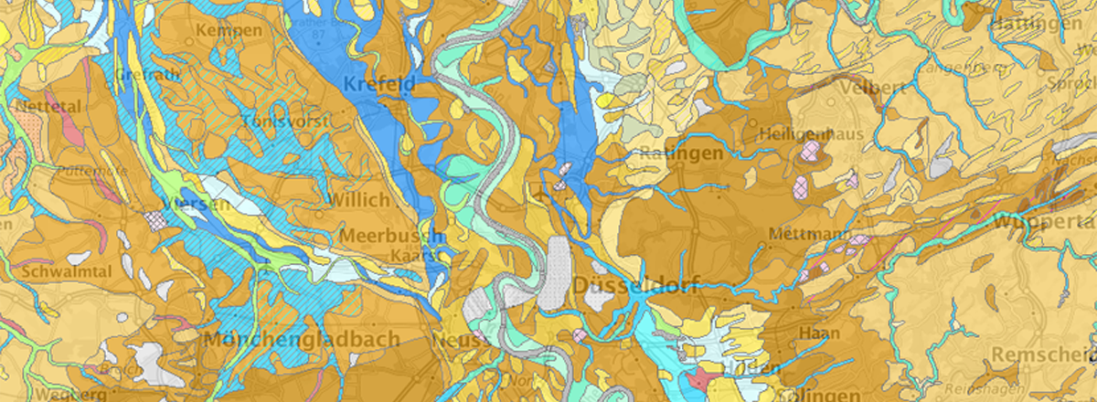
IS LBG 200 Bodenlandschaften und Leitbodengesellschaften von NRW 1 : 200.000 - WMS
Der WMS zeigt die Bodenlandschaften und Leitbodengesellschaften von NRW und erläutert diese in Texten. Die Karte basiert auf der überarbeiteten Bodenübersichtskarte 1 : 200 000 (BÜK200), herausgegeben von der Bundesanstalt für Geowissenschaften und Rohstoffe. Für den Niederrhein sowie das Sauer- und Siegerland sind Texte und fachliche Inhalte auszugsweise aus folgenden Veröffentlichungen des Geologischen Dienstes NRW hinterlegt: PAAS, W.; SCHALICH, J. (2005): Böden am Niederrhein - CD-ROM; Geologischer Dienst NRW ROTH, R. (2014): Böden im Sauer- und Siegerland – pdf-Datei; Geologischer Dienst NRW.
|
|
Citation proposal
- (Geologischer Dienst NRW). IS LBG 200 Bodenlandschaften und Leitbodengesellschaften von NRW 1 : 200.000 - WMS. https://gdk.gdi-de.org/geonetwork/srv/api/records/6dbb5fb3-1d29-4c96-8d51-2c9c1bea7337 |
INSPIRE
Identification
- File identifier
- 6dbb5fb3-1d29-4c96-8d51-2c9c1bea7337 XML
- Hierarchy level
- Service
Online resource
Resource identifier
Encoding
- Format
- Shape
- Version
- n.a.
Projection
Classification of data and services
Classification of data and services
- Service Type
- view
- Coupling Type
- Tight
Coupled resource
Coupled resource
Classification of data and services
- Service Type
- view
- Coupling Type
- Tight
Coupled resource
Coupled resource
Keywords
- OGDD-Kategorien
-
- geo
Other keywords
- Keywords
-
- Bodenlandschaften
- Leitbodengesellschaften
- Bodenkunde
- Bodenkarte
- 1 : 200000
- BÜK200
- Soil
- Boden
Geographic coverage
N
S
E
W
))
Temporal reference
Temporal extent
Temporal extent
- Date ( Creation )
- 2018-02-16
- Date ( Revision )
- 2021-06-14
Quality and validity
Conformity
Conformity
Conformity
Conformity
Conformity
Conformity
- Explanation
- -
Restrictions on access and use
Restrictions on access and use
Responsible organization (s)
Contact for the resource
- Organisation name
- Geologischer Dienst NRW
- geodaten@gd.nrw.de
Responsible organization (s)
Contact for the resource
- Organisation name
- Geologischer Dienst NRW
- geodaten@gd.nrw.de
Metadata information
Contact for the metadata
- Organisation name
- Geologischer Dienst NRW
- metadaten@gd.nrw.de
- Date stamp
- 2025-10-24
- Metadata language
- German
SDS
Conformance class 1: invocable
- Pass
- false
Access Point URL
Endpoint URL
Technical specification
- Date
- Explanation
- -
Conformance class 2: interoperable
Coordinate reference system
Quality of Service
Access constraints
Limitation
Use constraints
Limitation
Responsible custodian
Contact for the resource
Conformance class 3: harmonized
Contains Operations
- Operation Name
- GetCapabilities
- Distributed Computing Platforms
- Web services
- Connect Point
- https://www.wms.nrw.de/gd/lbg200?
Contains Operations
- Operation Name
- GetMap
- Distributed Computing Platforms
- Web services
- Connect Point
- https://www.wms.nrw.de/gd/lbg200?
Contains Operations
- Operation Name
- GetFeatureInfo
- Distributed Computing Platforms
- Web services
- Connect Point
- https://www.wms.nrw.de/gd/lbg200?
Overviews
Provided by

Views
6dbb5fb3-1d29-4c96-8d51-2c9c1bea7337
Access to the portal
Read here the full details and access to the data.
Associated resources
Not available