 www.geodatenkatalog.de (S3L)
Map of Near-Surface Deposits of the Federal Republic of Germany 1:250,000 (KOR250)
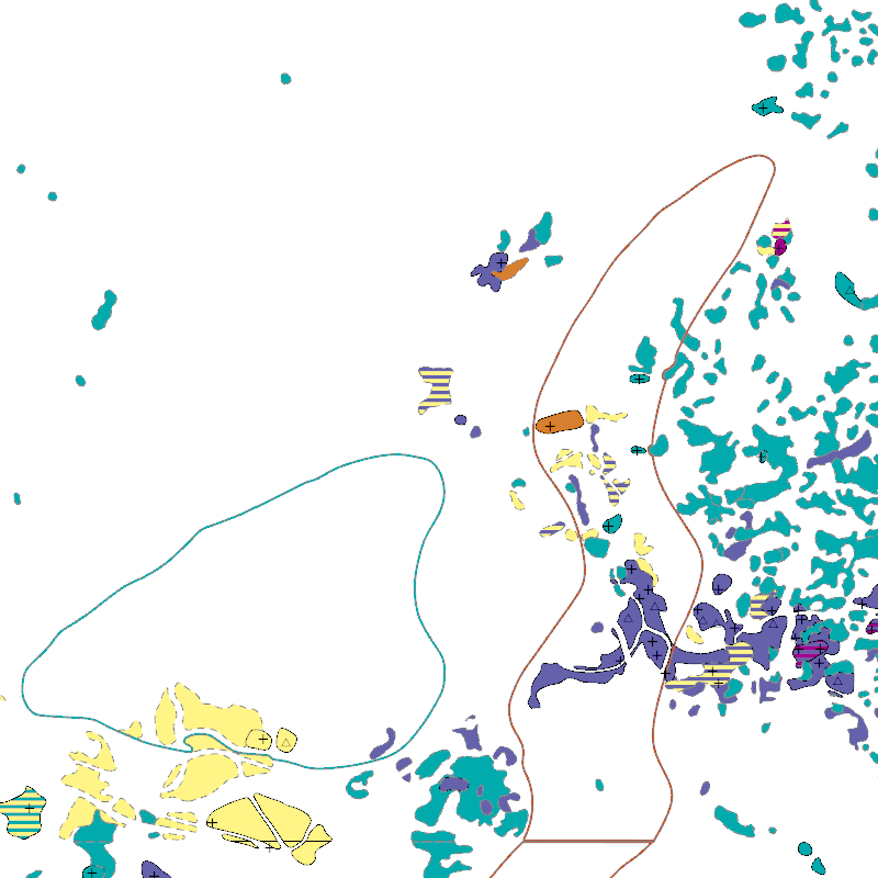
The KOR250 in the scale of 1:250,000 shows occurrences and deposits of mineral resources in Germany, which lie close to the Earth’s surface, i.e. can be mined in open-pits, quarries or near-surface mines. These mineral resources include industrial minerals, aggregates, peat, lignite, oil shales, and natural brines. The map is the digital successor of the map series KOR200 „Map of Near-Surface Deposits of the Federal Republic of Germany 1:200,000”, which has been published since 1984. The KOR200 and KOR250 have been published by the Federal Institute for Geosciences and Natural Resources together with the State Geological Surveys of the federal states on behalf of the Federal Ministry for Economic Affairs and Energy. Primary purpose of the KOR250 is to display Germany’s potential of domestic raw materials in a comparable way. The explanations given in the printed booklets accompanying the KOR200 are not available in the digital KOR250. In the KOR250 besides the defined deposits and differently coloured areas of raw materials, "active mines" (= operations) at time of publication or "focal points of several active mines" are marked with one symbol each. These symbols often display the headquarters of the mining company and not the mining site itself. As the map sheets of the KOR200 have been generated over more than three decades the timeliness of data is extremely different. For more detail, the current large-scale raw material maps of the Federal State Geological Surveys should always be consulted.
|
|
Citation proposal
(2021) . Map of Near-Surface Deposits of the Federal Republic of Germany 1:250,000 (KOR250). https://gdk.gdi-de.org/geonetwork/srv/api/records/6fe9c185-f0e2-4c47-bd88-c5148e24f93c |
- Identification
- Distribution
- Quality
- Spatial rep.
- Ref. system
- Content
- Portrayal
- Metadata
- Md. constraints
- Md. maintenance
- Schema info
Identification
Data identification
Citation
- Alternate title
- KOR250
- Date ( Creation )
- 2010-12-31
- Date ( Publication )
- 2021-02-08
- Edition
- Aktualität des Datensatzes regional sehr unterschiedlich, Datengrundlage wurde zwischen 1989 und 2010 erstellt
- Identifier
- bee799ce-3392-8898-63c7-138b95d7ac9f
- Status
- completed Completed
Point of contact
- GEMET - INSPIRE themes, version 1.0 ( Theme )
-
- Mineralische Bodenschätze
- Mineral Resources
- Keywords ( Theme )
-
- Rohstoff
- Karte
- Mineralien
- ökonomisch
- Mineralvorkommen
- Ressource
- Rohstoffindustrie
- Sand
- Ton
- Torf
- Wirtschaft
- opendata
- Keywords ( Place )
-
- Deutschland
- High-value dataset categories
-
- Erdbeobachtung und Umwelt
Legal constraints
- Access constraints
- Other restrictions
Legal constraints
- Use constraints
- Other restrictions
- Other constraints
- Allgemeine Geschäftsbedingungen, siehe https://www.bgr.bund.de/AGB - General terms and conditions, see https://www.bgr.bund.de/AGB_en. Die bereitgestellten Informationen sind bei Weiterverwendung wie folgt zu zitieren: Datenquelle: KOR250, (c) BGR, Hannover
- Other constraints
- Dieser Datensatz kann gemäß der "Nutzungsbestimmungen für die Bereitstellung von Geodaten des Bundes" (https://sg.geodatenzentrum.de/web_public/gdz/lizenz/geonutzv.pdf) genutzt werden.
- Other constraints
- {"id": "geoNutz/20130319", "name": "Nutzungsbestimmungen für die Bereitstellung von Geodaten des Bundes", "url": "https://sg.geodatenzentrum.de/web_public/gdz/lizenz/geonutzv.pdf", "quelle": "KOR250, (c) BGR, Hannover"}
- Denominator
- 250000
- Metadata language
- ger German
- Character set
- utf8 UTF8
- Topic category
-
- Geoscientific information
N
S
E
W
))
- Geographic identifier
- Regionalschlüssel / 000000000000
Distribution
Distribution
- Distribution format
-
- Shapefile (n/a )
Digital transfer options
- Transfer size
- 15
- OnLine resource
-
KOR250 (Shapefile)
KOR250 im Format ESRI Shape
- OnLine resource
-
Internetseite zur KOR200
Internetseite zur KOR200
- OnLine resource
-
Karte im BGR-Geoviewer
Karte im BGR-Geoviewer
Quality
Data quality
Scope
- Hierarchy level
- Dataset
Conformance result
Citation
- Date ( Publication )
- 2010-12-08
- Explanation
- siehe dazu die angegebene Durchführungsbestimmung
- Statement
- Die digitale KOR250 ist die Nachfolgerin des Kartenwerks KOR200 „Karte der oberflächennahen Rohstoffe der Bundesrepublik Deutschland 1:200.000“.
Metadata
Metadata
- File identifier
- 6fe9c185-f0e2-4c47-bd88-c5148e24f93c XML
- Metadata language
- German
- Character set
- utf8 UTF8
- Hierarchy level
- dataset Dataset
- Hierarchy level name
- Rohstoffe
- Date stamp
- 2024-04-24
- Metadata standard name
- INSPIRE Metadata Implementing Rules: Technical Guidelines based on EN ISO 19115 and EN ISO 19119
- Metadata standard version
- n/a
Point of contact
Overviews
Provided by

Views
6fe9c185-f0e2-4c47-bd88-c5148e24f93c
Access to the portal
Read here the full details and access to the data.
Associated resources
Not available