 www.geodatenkatalog.de (S3F)
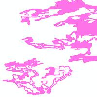
Lebensräume und Biotope in Hessen - GESCH_KOMPLEXE
Hessische Biotopkartierung, Biotope, Biotopkomplexe, geschützte Biotope und geschützte Biotopkomplexe:Hinweise auf gem. § 30 (2) BNatSchG bzw. § 13 (1) HAGBNatSchG geschützte Biotopkomplexflächen. Diese wurden aus Komplexgeometrien der Hessischen Biotopkartierung abgeleitet, daher ist das Lesen der "Kurzinformation" empfehlenswert. Die Daten der Hessischen Biotopkartierung wurden zwischen 1992 und 2006 erfasst. Bei der Kartierung handelt es sich um eine selektive Kartierung aus naturschutzfachlicher Sicht wertvoller, naturnaher bzw. extensiv genutzter Biotope und Biotopkomplexe im Maßstab 1:25.000.
|
|
Citation proposal
. Lebensräume und Biotope in Hessen - GESCH_KOMPLEXE. Hessisches Landesamt für Naturschutz, Umwelt und Geologie (HLNUG) https://gdk.gdi-de.org/geonetwork/srv/api/records/76c3b734-d868-02e9-f9ab-2351c7b3e0ab |
INSPIRE
Identification
- File identifier
- 76c3b734-d868-02e9-f9ab-2351c7b3e0ab XML
- Hierarchy level
- service Service
Online resource
- Protocol
- OGC:WMS-1.1.1-http-get-map
Resource identifier
Encoding
Projection
Classification of data and services
Classification of data and services
- Service Type
- view
- Coupling Type
- Tight
Coupled resource
Coupled resource
Classification of data and services
- Service Type
- view
- Coupling Type
- Tight
Coupled resource
Coupled resource
Keywords
- mapbender.2.registryId
-
- 1c349fea-924b-488f-b6a2-e896f40ac897
Other keywords
- Keywords
-
- Biotope
- Biotopkartierung
- Hessen
- HLNUG
- infoMapAccessService
- inspireidentifiziert
- inspireidentifiziert
Geographic coverage
N
S
E
W
))
Temporal reference
Temporal extent
Temporal extent
- Date ( Revision )
- 2025-05-16
Quality and validity
Conformity
Conformity
Conformity
Conformity
Conformity
Conformity
- Explanation
- No explanation available
- Explanation
- No explanation available
- Explanation
- No explanation available
- Explanation
- No explanation available
- Explanation
- No explanation available
- Explanation
- No explanation available
- Explanation
- No explanation available
- Explanation
- No explanation available
Restrictions on access and use
Restrictions on access and use
- Access constraints
- Dienst und Daten stellen keine rechtsverbindliche Auskunft dar. Die kostenfreie Nutzung der Geo- und Metadaten sowie der Geodatendienste ist für private und kommerzielle Zwecke erlaubt. Lizenz: Creative Commons BY 4.0 (https://creativecommons.org/licenses/by/4.0/deed.de). Quellenvermerk für Dienst: „Hessisches Landesamt für Naturschutz, Umwelt und Geologie (HLNUG)“. Quellenvermerk für Daten: „Darstellung auf der Grundlage von Daten des Hessischen Landesamtes für Naturschutz, Umwelt und Geologie (HLNUG)“
Responsible organization (s)
Contact for the resource
- Organisation name
- Hessisches Landesamt für Naturschutz, Umwelt und Geologie (HLNUG)
Responsible organization (s)
Contact for the resource
- Organisation name
- Hessisches Landesamt für Naturschutz, Umwelt und Geologie (HLNUG)
Metadata information
Contact for the metadata
- Organisation name
- HLNUG
- arcgis@hlnug.hessen.de
- Date stamp
- 2025-07-15
- Metadata language
- Deutsch German
SDS
Conformance class 1: invocable
- Pass
- true
- Pass
- true
- Pass
- true
- Pass
- true
- Pass
- true
- Pass
- true
- Pass
- true
- Pass
- true
Access Point URL
Endpoint URL
Technical specification
- Date
- Explanation
- No explanation available
- Date
- Explanation
- No explanation available
- Date
- Explanation
- No explanation available
- Date
- Explanation
- No explanation available
- Date
- Explanation
- No explanation available
- Date
- Explanation
- No explanation available
- Date
- Explanation
- No explanation available
- Date
- Explanation
- No explanation available
Conformance class 2: interoperable
Coordinate reference system
Quality of Service
Access constraints
- Access constraints
- Other restrictions
Limitation
Use constraints
Limitation
- string
- Dienst und Daten stellen keine rechtsverbindliche Auskunft dar. Die kostenfreie Nutzung der Geo- und Metadaten sowie der Geodatendienste ist für private und kommerzielle Zwecke erlaubt. Lizenz: Creative Commons BY 4.0 (https://creativecommons.org/licenses/by/4.0/deed.de). Quellenvermerk für Dienst: „Hessisches Landesamt für Naturschutz, Umwelt und Geologie (HLNUG)“. Quellenvermerk für Daten: „Darstellung auf der Grundlage von Daten des Hessischen Landesamtes für Naturschutz, Umwelt und Geologie (HLNUG)“
Responsible custodian
Contact for the resource
Conformance class 3: harmonized
Contains Operations
- Operation Name
- GetCapabilities
- Distributed Computing Platforms
- Web services
Overviews
Thumbnail
Provided by

Views
76c3b734-d868-02e9-f9ab-2351c7b3e0ab
Access to the portal
Read here the full details and access to the data.
Associated resources
Not available