 www.geodatenkatalog.de (S1F)
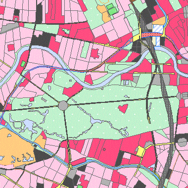
ATKIS Basis-DLM (Präsentationsdienst)
|
|
Citation proposal
. ATKIS Basis-DLM (Präsentationsdienst). https://gdk.gdi-de.org/geonetwork/srv/api/records/7f44a07d-36f3-3d4c-940d-5748c15932e5 |
- Identification
- Distribution
- Quality
- Spatial rep.
- Ref. system
- Content
- Portrayal
- Metadata
- Md. constraints
- Md. maintenance
- Schema info
Identification
Data identification
Citation
- Date ( Revision )
- 2024-04-19
- Presentation form
- Digital map
Point of contact
- Keywords ( Theme )
-
- open data
- opendata
- Geodaten
- ATKIS
- atkis
- Basis-DLM
- Präsentationsmodell
- DLM
- dlm
- Digitales Landschaftsmodell
- Bauwerke
- Tatsächliche Nutzung
- Gewässer
- Vegetation
- Verkehr
- Siedlung
- Bahn
- Bahnstrecke
- Bahnverkehr
- Industrie
- Gewerbe
- Sport
- Freizeit
- Erholung
- Denkmalschutz
- Denkmal
- Schiffsverkehr
- Fahrbahn
- Fahrbahnachse
- Flugverkehr
- Flugverkehrsanlagen
- Friedhof
- Grenze
- Gebiet
- Grenzlinie
- Baum
- Gewässerachse
- Gewässerstationierungsachse
- Gewässerstationierung
- Hafen
- Hafenbecken
- historisch
- Höhen
- Höhenlinien
- Insel
- Kommunales Gebiet
- Landwirtschaft
- Leitung
- Moor
- Naturschutzrecht
- Bodenschutzrecht
- Umweltschutzrecht
- Ortslage
- Platz
- Fährverkehr
- Schifffahrtslinie
- Schleuse
- Schutzzone
- Seilbahn
- Schwebebahn
- Straßenachsen
- Straßenverkehr
- Sumpf
- Tagebau
- Grube
- Steinbruch
- Transportanlage
- Turm
- Unland
- vegetationslos
- Vegetationsmerkmal
- Vorratsbehälter
- Speicherbauwerk
- Wald
- Weg
- Pfad
- Steig
- Wohnbaufläche
- Spatial scope
Legal constraints
- Access constraints
- Other restrictions
Legal constraints
- Use constraints
- Other restrictions
- Other constraints
- Für die Nutzung der Daten ist die Datenlizenz Deutschland - Namensnennung - Version 2.0 anzuwenden. Die Lizenz ist über https://www.govdata.de/dl-de/by-2-0 abrufbar. Der Quellenvermerk gemäß (2) der Lizenz lautet "Geoportal Berlin / [Titel des Datensatzes]".
- Other constraints
- { "id": "dl-by-de/2.0" , "name": "Datenlizenz Deutschland - Namensnennung - Version 2.0", "url": "https://www.govdata.de/dl-de/by-2-0", "quelle": "Geoportal Berlin / [Titel des Datensatzes]" }
- Spatial representation type
- Vector
- Denominator
- 10000
- Metadata language
- German
- Character set
- UTF8
- Topic category
-
- Imagery base maps earth cover
- Planning cadastre
Extent
))
Geographic description
- Extent type code
- true
- Geographic identifier
- 110000000000
Distribution
Distribution
- Distribution format
-
- Text/HTML (4.01 )
Digital transfer options
- OnLine resource
-
Darstellungsdienst - ATKIS Basis-DLM (Präsentationsdienst) (WMS)
Darstellungsdienst - ATKIS Basis-DLM (Präsentationsdienst) (WMS)
- OnLine resource
-
Downloaddienst - ATKIS Bahnstrecke (Linien) (WFS)
Downloaddienst - ATKIS Bahnstrecke (Linien) (WFS)
- OnLine resource
-
Downloaddienst - ATKIS Bahnverkehr (Fläche) (WFS)
Downloaddienst - ATKIS Bahnverkehr (Fläche) (WFS)
- OnLine resource
-
Downloaddienst - ATKIS Bahnverkehrsanlage (Fläche) (WFS)
Downloaddienst - ATKIS Bahnverkehrsanlage (Fläche) (WFS)
- OnLine resource
-
Downloaddienst - ATKIS Bahnverkehrsanlage (Punkte) (WFS)
Downloaddienst - ATKIS Bahnverkehrsanlage (Punkte) (WFS)
- OnLine resource
-
Downloaddienst - ATKIS Bauwerk im Gewässerbereich (Fläche) (WFS)
Downloaddienst - ATKIS Bauwerk im Gewässerbereich (Fläche) (WFS)
- OnLine resource
-
Downloaddienst - ATKIS Bauwerk im Gewässerbereich (Linien) (WFS)
Downloaddienst - ATKIS Bauwerk im Gewässerbereich (Linien) (WFS)
- OnLine resource
-
Downloaddienst - ATKIS Bauwerk im Gewässerbereich (Punkte) (WFS)
Downloaddienst - ATKIS Bauwerk im Gewässerbereich (Punkte) (WFS)
- OnLine resource
-
Downloaddienst - ATKIS Bauwerk im Verkehrsbereich (Fläche) (WFS)
Downloaddienst - ATKIS Bauwerk im Verkehrsbereich (Fläche) (WFS)
- OnLine resource
-
Downloaddienst - ATKIS Bauwerk im Verkehrsbereich (Linien) (WFS)
Downloaddienst - ATKIS Bauwerk im Verkehrsbereich (Linien) (WFS)
- OnLine resource
-
Downloaddienst - ATKIS Bauwerk im Verkehrsbereich (Punkte) (WFS)
Downloaddienst - ATKIS Bauwerk im Verkehrsbereich (Punkte) (WFS)
- OnLine resource
-
Downloaddienst - ATKIS Bauwerk oder Anlage für Industrie und Gewerbe (Fläche) (WFS)
Downloaddienst - ATKIS Bauwerk oder Anlage für Industrie und Gewerbe (Fläche) (WFS)
- OnLine resource
-
Downloaddienst - ATKIS Bauwerk oder Anlage für Industrie und Gewerbe (Linien) (WFS)
Downloaddienst - ATKIS Bauwerk oder Anlage für Industrie und Gewerbe (Linien) (WFS)
- OnLine resource
-
Downloaddienst - ATKIS Bauwerk oder Anlage für Industrie und Gewerbe (Punkte) (WFS)
Downloaddienst - ATKIS Bauwerk oder Anlage für Industrie und Gewerbe (Punkte) (WFS)
- OnLine resource
-
Downloaddienst - ATKIS Bauwerk oder Anlage für Sport, Freizeit und Erholung (Fläche) (WFS)
Downloaddienst - ATKIS Bauwerk oder Anlage für Sport, Freizeit und Erholung (Fläche) (WFS)
- OnLine resource
-
Downloaddienst - ATKIS Bauwerk oder Anlage für Sport, Freizeit und Erholung (Linien) (WFS)
Downloaddienst - ATKIS Bauwerk oder Anlage für Sport, Freizeit und Erholung (Linien) (WFS)
- OnLine resource
-
Downloaddienst - ATKIS Denkmalschutzrecht (Fläche) (WFS)
Downloaddienst - ATKIS Denkmalschutzrecht (Fläche) (WFS)
- OnLine resource
-
Downloaddienst - ATKIS Denkmalschutzrecht (Linien) (WFS)
Downloaddienst - ATKIS Denkmalschutzrecht (Linien) (WFS)
- OnLine resource
-
Downloaddienst - ATKIS Denkmalschutzrecht (Punkte) (WFS)
Downloaddienst - ATKIS Denkmalschutzrecht (Punkte) (WFS)
- OnLine resource
-
Downloaddienst - ATKIS Einrichtungen für den Schiffsverkehr (Punkte) (WFS)
Downloaddienst - ATKIS Einrichtungen für den Schiffsverkehr (Punkte) (WFS)
- OnLine resource
-
Downloaddienst - ATKIS Fahrbahnachse (Linien) (WFS)
Downloaddienst - ATKIS Fahrbahnachse (Linien) (WFS)
- OnLine resource
-
Downloaddienst - ATKIS Fahrwegachse (Linien) (WFS)
Downloaddienst - ATKIS Fahrwegachse (Linien) (WFS)
- OnLine resource
-
Downloaddienst - ATKIS Fließgewässer (Fläche) (WFS)
Downloaddienst - ATKIS Fließgewässer (Fläche) (WFS)
- OnLine resource
-
Downloaddienst - ATKIS Flugverkehr (Fläche) (WFS)
Downloaddienst - ATKIS Flugverkehr (Fläche) (WFS)
- OnLine resource
-
Downloaddienst - ATKIS Flugverkehrsanlage (Fläche) (WFS)
Downloaddienst - ATKIS Flugverkehrsanlage (Fläche) (WFS)
- OnLine resource
-
Downloaddienst - ATKIS Flugverkehrsanlage (Punkte) (WFS)
Downloaddienst - ATKIS Flugverkehrsanlage (Punkte) (WFS)
- OnLine resource
-
Downloaddienst - ATKIS Fläche besonderer funktionaler Prägung geschlossen (Fläche) (WFS)
Downloaddienst - ATKIS Fläche besonderer funktionaler Prägung geschlossen (Fläche) (WFS)
- OnLine resource
-
Downloaddienst - ATKIS Fläche besonderer funktionaler Prägung offen (Fläche) (WFS)
Downloaddienst - ATKIS Fläche besonderer funktionaler Prägung offen (Fläche) (WFS)
- OnLine resource
-
Downloaddienst - ATKIS Fläche gemischter Nutzung geschlossen (Fläche) (WFS)
Downloaddienst - ATKIS Fläche gemischter Nutzung geschlossen (Fläche) (WFS)
- OnLine resource
-
Downloaddienst - ATKIS Fläche gemischter Nutzung offen (Fläche) (WFS)
Downloaddienst - ATKIS Fläche gemischter Nutzung offen (Fläche) (WFS)
- OnLine resource
-
Downloaddienst - ATKIS Friedhof (Fläche) (WFS)
Downloaddienst - ATKIS Friedhof (Fläche) (WFS)
- OnLine resource
-
Downloaddienst - ATKIS Gebietsgrenze (Linien) (WFS)
Downloaddienst - ATKIS Gebietsgrenze (Linien) (WFS)
- OnLine resource
-
Downloaddienst - ATKIS Gehölz (Fläche) (WFS)
Downloaddienst - ATKIS Gehölz (Fläche) (WFS)
- OnLine resource
-
Downloaddienst - ATKIS Gewässerachse (Linien) (WFS)
Downloaddienst - ATKIS Gewässerachse (Linien) (WFS)
- OnLine resource
-
Downloaddienst - ATKIS Gewässerstationierungsachse (Linien) (WFS)
Downloaddienst - ATKIS Gewässerstationierungsachse (Linien) (WFS)
- OnLine resource
-
Downloaddienst - ATKIS Hafen (Fläche) (WFS)
Downloaddienst - ATKIS Hafen (Fläche) (WFS)
- OnLine resource
-
Downloaddienst - ATKIS Hafenbecken (Fläche) (WFS)
Downloaddienst - ATKIS Hafenbecken (Fläche) (WFS)
- OnLine resource
-
Downloaddienst - ATKIS Historisches Bauwerk oder historische Einrichtung (Punkte) (WFS)
Downloaddienst - ATKIS Historisches Bauwerk oder historische Einrichtung (Punkte) (WFS)
- OnLine resource
-
Downloaddienst - ATKIS Höhenlinie (Linien) (WFS)
Downloaddienst - ATKIS Höhenlinie (Linien) (WFS)
- OnLine resource
-
Downloaddienst - ATKIS Industrie und Gewerbefläche (Fläche) (WFS)
Downloaddienst - ATKIS Industrie und Gewerbefläche (Fläche) (WFS)
- OnLine resource
-
Downloaddienst - ATKIS Insel (Fläche) (WFS)
Downloaddienst - ATKIS Insel (Fläche) (WFS)
- OnLine resource
-
Downloaddienst - ATKIS Kommunales Gebiet (Fläche) (WFS)
Downloaddienst - ATKIS Kommunales Gebiet (Fläche) (WFS)
- OnLine resource
-
Downloaddienst - ATKIS Landwirtschaft (Fläche) (WFS)
Downloaddienst - ATKIS Landwirtschaft (Fläche) (WFS)
- OnLine resource
-
Downloaddienst - ATKIS Leitung (Linien) (WFS)
Downloaddienst - ATKIS Leitung (Linien) (WFS)
- OnLine resource
-
Downloaddienst - ATKIS Moor (Fläche) (WFS)
Downloaddienst - ATKIS Moor (Fläche) (WFS)
- OnLine resource
-
Downloaddienst - ATKIS Natur, Umwelt oder Bodenschutzrecht (Fläche) (WFS)
Downloaddienst - ATKIS Natur, Umwelt oder Bodenschutzrecht (Fläche) (WFS)
- OnLine resource
-
Downloaddienst - ATKIS Natur, Umwelt oder Bodenschutzrecht (Punkte) (WFS)
Downloaddienst - ATKIS Natur, Umwelt oder Bodenschutzrecht (Punkte) (WFS)
- OnLine resource
-
Downloaddienst - ATKIS Ortslage (Fläche) (WFS)
Downloaddienst - ATKIS Ortslage (Fläche) (WFS)
- OnLine resource
-
Downloaddienst - ATKIS Platz (Fläche) (WFS)
Downloaddienst - ATKIS Platz (Fläche) (WFS)
- OnLine resource
-
Downloaddienst - ATKIS Schifffahrtslinie, Fährverkehr (Linien) (WFS)
Downloaddienst - ATKIS Schifffahrtslinie, Fährverkehr (Linien) (WFS)
- OnLine resource
-
Downloaddienst - ATKIS Schiffsverkehr (Fläche) (WFS)
Downloaddienst - ATKIS Schiffsverkehr (Fläche) (WFS)
- OnLine resource
-
Downloaddienst - ATKIS Schleuse (Fläche) (WFS)
Downloaddienst - ATKIS Schleuse (Fläche) (WFS)
- OnLine resource
-
Downloaddienst - ATKIS Schutzzone (Fläche) (WFS)
Downloaddienst - ATKIS Schutzzone (Fläche) (WFS)
- OnLine resource
-
Downloaddienst - ATKIS Seilbahn und Schwebebahn (Linien) (WFS)
Downloaddienst - ATKIS Seilbahn und Schwebebahn (Linien) (WFS)
- OnLine resource
-
Downloaddienst - ATKIS Sonstiges Bauwerk oder sonstige Einrichtung (Linien) (WFS)
Downloaddienst - ATKIS Sonstiges Bauwerk oder sonstige Einrichtung (Linien) (WFS)
- OnLine resource
-
Downloaddienst - ATKIS Sonstiges Bauwerk oder sonstige Einrichtung (Punkte) (WFS)
Downloaddienst - ATKIS Sonstiges Bauwerk oder sonstige Einrichtung (Punkte) (WFS)
- OnLine resource
-
Downloaddienst - ATKIS Sport, Freizeit und Erholungsfläche (Fläche) (WFS)
Downloaddienst - ATKIS Sport, Freizeit und Erholungsfläche (Fläche) (WFS)
- OnLine resource
-
Downloaddienst - ATKIS Stehendes Gewässer (Fläche) (WFS)
Downloaddienst - ATKIS Stehendes Gewässer (Fläche) (WFS)
- OnLine resource
-
Downloaddienst - ATKIS Straßenachse (Linien) (WFS)
Downloaddienst - ATKIS Straßenachse (Linien) (WFS)
- OnLine resource
-
Downloaddienst - ATKIS Straßenverkehr (Fläche) (WFS)
Downloaddienst - ATKIS Straßenverkehr (Fläche) (WFS)
- OnLine resource
-
Downloaddienst - ATKIS Straßenverkehrsanlage (Punkte) (WFS)
Downloaddienst - ATKIS Straßenverkehrsanlage (Punkte) (WFS)
- OnLine resource
-
Downloaddienst - ATKIS Sumpf (Fläche) (WFS)
Downloaddienst - ATKIS Sumpf (Fläche) (WFS)
- OnLine resource
-
Downloaddienst - ATKIS Tagebau, Grube, Steinbruch (Fläche) (WFS)
Downloaddienst - ATKIS Tagebau, Grube, Steinbruch (Fläche) (WFS)
- OnLine resource
-
Downloaddienst - ATKIS Transportanlage (Fläche) (WFS)
Downloaddienst - ATKIS Transportanlage (Fläche) (WFS)
- OnLine resource
-
Downloaddienst - ATKIS Transportanlage (Linien) (WFS)
Downloaddienst - ATKIS Transportanlage (Linien) (WFS)
- OnLine resource
-
Downloaddienst - ATKIS Transportanlage (Punkte) (WFS)
Downloaddienst - ATKIS Transportanlage (Punkte) (WFS)
- OnLine resource
-
Downloaddienst - ATKIS Turm (Fläche) (WFS)
Downloaddienst - ATKIS Turm (Fläche) (WFS)
- OnLine resource
-
Downloaddienst - ATKIS Turm (Punkte) (WFS)
Downloaddienst - ATKIS Turm (Punkte) (WFS)
- OnLine resource
-
Downloaddienst - ATKIS Unland, vegetationslose Fläche (Fläche) (WFS)
Downloaddienst - ATKIS Unland, vegetationslose Fläche (Fläche) (WFS)
- OnLine resource
-
Downloaddienst - ATKIS Vegetationsmerkmal (Fläche) (WFS)
Downloaddienst - ATKIS Vegetationsmerkmal (Fläche) (WFS)
- OnLine resource
-
Downloaddienst - ATKIS Vegetationsmerkmal (Linien) (WFS)
Downloaddienst - ATKIS Vegetationsmerkmal (Linien) (WFS)
- OnLine resource
-
Downloaddienst - ATKIS Vegetationsmerkmal (Punkte) (WFS)
Downloaddienst - ATKIS Vegetationsmerkmal (Punkte) (WFS)
- OnLine resource
-
Downloaddienst - ATKIS Vorratsbehälter, Speicherbauwerk (Fläche) (WFS)
Downloaddienst - ATKIS Vorratsbehälter, Speicherbauwerk (Fläche) (WFS)
- OnLine resource
-
Downloaddienst - ATKIS Vorratsbehälter, Speicherbauwerk (Punkte) (WFS)
Downloaddienst - ATKIS Vorratsbehälter, Speicherbauwerk (Punkte) (WFS)
- OnLine resource
-
Downloaddienst - ATKIS Wald (Fläche) (WFS)
Downloaddienst - ATKIS Wald (Fläche) (WFS)
- OnLine resource
-
Downloaddienst - ATKIS Weg, Pfad, Steig (Linien) (WFS)
Downloaddienst - ATKIS Weg, Pfad, Steig (Linien) (WFS)
- OnLine resource
-
Downloaddienst - ATKIS Wohnbaufläche geschlossen (Fläche) (WFS)
Downloaddienst - ATKIS Wohnbaufläche geschlossen (Fläche) (WFS)
- OnLine resource
-
Downloaddienst - ATKIS Wohnbaufläche offen (Fläche) (WFS)
Downloaddienst - ATKIS Wohnbaufläche offen (Fläche) (WFS)
Quality
Data quality
- Hierarchy level
- Dataset
- Statement
- Daten aus der Berliner Verwaltung
Ref. system
- Reference system identifier
- http://www.opengis.net/def/crs/EPSG/0/25833
Metadata
Metadata
- File identifier
- 7f44a07d-36f3-3d4c-940d-5748c15932e5 XML
- Metadata language
- German
- Character set
- UTF8
- Hierarchy level
- Dataset
- Date stamp
- 2024-11-07T11:36:35
- Metadata standard name
- ISO 19115/19119 ? BE
- Metadata standard version
- 1.0.0
Overviews
Provided by
