 www.geodatenkatalog.de (S1L)
Hochwasserschutzanlagen - WMS
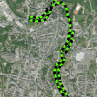
Der Dienst zeigt die Lage von Hochwasserschutzeinrichtungen an. Diese umfassen Anlagen verschiedener Bauweisen, wie z. B. ortsfeste Deiche und Hochwasserschutzmauern oder mobile Dammbalkensysteme, die nur im Hochwasserfall aufgestellt werden. Ebenfalls eingeschlossen sind Kombinationen aus Hochwasserschutzmauern und mobilen Dammbalken, die im Hochwasserfall geschlossen werden. Maximale Bildgröße: 4096 x 4096 Pixel.
|
|
Citation proposal
(2014) . Hochwasserschutzanlagen - WMS. https://gdk.gdi-de.org/geonetwork/srv/api/records/7f5ac6b1-a0dc-4456-94d2-a899aaadacd1 |
- Identification
- Distribution
- Quality
- Spatial rep.
- Ref. system
- Content
- Portrayal
- Metadata
- Md. constraints
- Md. maintenance
- Schema info
Identification
Identification info
Service Identification (19119)
Citation
- Alternate title
- Wasser
- Date ( Publication )
- 2014-04-22T00:00:00.000+02:00
- Status
- On going
Point of contact
- Website
- https://www.lfu.bayern.de
Maintenance information
- Maintenance and update frequency
- Weekly
- Update scope
- Service
- Service Classification, version 1.0 ( Theme )
-
- infoMapAccessService
- Keywords
-
- gdiby
- Hochwasserschutzanlage
- HWSA
- Deich
- Hochwasserschutzwand
- Hochwasserschutzsystem
- Hochwasser
- Deichlinien
- Use limitation
- keine Einschränkungen
Legal constraints
- Use constraints
- Other restrictions
- Other constraints
- Creative Commons Namensnennung - Weitergabe unter gleichen Bedingungen 4.0 International (CC BY-SA 4.0); Datenquelle: Bayerisches Landesamt für Umwelt, www.lfu.bayern.de
- Other constraints
- {"id":"cc-by-sa/4.0","name":"Creative Commons Namensnennung - Weitergabe unter gleichen Bedingungen 4.0 International (CC BY-SA 4.0)","url":"https://creativecommons.org/licenses/by-sa/4.0/deed.de","quelle":"Bayerisches Landesamt für Umwelt, www.lfu.bayern.de"}
Legal constraints
- Access constraints
- otherRestrictions Other restrictions
- Service Type
- view
- Service Version
- OGC:WMS 1.3.0
Extent
- Description
- Der Dienst umfasst die Landesfläche Bayerns.
N
S
E
W
))
Coupled Resource
- Operation Name
- GetCapabilities
Coupled Resource
- Operation Name
- GetMap
Coupled Resource
- Operation Name
- GetFeatureInfo
Coupled Resource
- Operation Name
- esri_wms:GetStyles
- Coupling Type
- Tight
Contains Operations
- Operation Name
- GetCapabilities
- Distributed Computing Platforms
- Web services
- Operation Description
- application/vnd.ogc.wms_xml; text/xml;
- Connect Point
- https://www.lfu.bayern.de/gdi/wms/wasser/hwsa?
Contains Operations
- Operation Name
- GetMap
- Distributed Computing Platforms
- Web services
- Operation Description
- image/bmp; image/jpeg; image/tiff; image/png; image/png8; image/png24; image/png32; image/gif; image/svg+xml;
- Connect Point
- https://www.lfu.bayern.de/gdi/wms/wasser/hwsa?
Contains Operations
- Operation Name
- GetFeatureInfo
- Distributed Computing Platforms
- Web services
- Operation Description
- application/vnd.esri.wms_raw_xml; application/vnd.esri.wms_featureinfo_xml; application/vnd.ogc.wms_xml; text/xml; text/html; text/plain;
- Connect Point
- https://www.lfu.bayern.de/gdi/wms/wasser/hwsa?
Contains Operations
- Operation Name
- esri_wms:GetStyles
- Distributed Computing Platforms
- Web services
- Operation Description
- application/vnd.ogc.sld+xml;
- Connect Point
- https://www.lfu.bayern.de/gdi/wms/wasser/hwsa?
Distribution
Distribution
- Distribution format
-
- Sonstiges ()
Distributor
Distributor
- Website
- https://www.lfu.bayern.de
- Fees
- geldleistungsfrei
- OnLine resource
-
URL des Dienstes
URL des Dienstes
- OnLine resource
-
Dienst "Hochwasserschutzanlagen - WMS" (GetCapabilities)
application/vnd.ogc.wms_xml; text/xml;
Metadata
Metadata
- File identifier
- 7f5ac6b1-a0dc-4456-94d2-a899aaadacd1 XML
- Metadata language
- German
- Character set
- UTF8
- Hierarchy level
- service Service
- Hierarchy level name
- service
- Date stamp
- 2025-08-13
- Metadata standard name
- ISO19119
- Metadata standard version
- 2005/PDAM 1
Point of contact
- Website
- https://www.lfu.bayern.de
Overviews
Provided by

Views
7f5ac6b1-a0dc-4456-94d2-a899aaadacd1
Access to the portal
Read here the full details and access to the data.
Associated resources
Not available