 My GeoNetwork catalogue
World-wide Hydrogeological Map Information System (WHYMIS)
The World-wide Hydrogeological Map Information System (WHYMIS) offers information on the availability of hydrogeological and other groundwater related maps at national (country) and international (continent) level.
INSPIRE
Identification
- File identifier
- 8050dc23-b535-4d08-b0a8-4da11d4c39e6 XML
- Hierarchy level
- Dataset
Online resource
Resource identifier
- code
-
e031c1dc-c0c4-4154-86b1-0980f06e4467
- Metadata language
- English
- Spatial representation type
- Vector
Encoding
- Format
-
WMS
- Version
-
OGC:WMS 1.3.0
Projection
- code
- EPSG:4326
Classification of data and services
- Topic category
-
- Geoscientific information
Classification of data and services
Coupled resource
Coupled resource
Classification of data and services
Coupled resource
Coupled resource
Keywords
-
GEMET - INSPIRE themes, version 1.0
-
-
Geologie
-
Geology
-
-
GEMET - Concepts, version 2.4
-
-
Grundwasser
-
Hydrogeologie
-
Groundwater
-
Hydrogeology
-
Other keywords
- Theme
-
-
Aquifer
-
Grundwasserneubildung
-
Groundwater recharge
-
Grundwasservorkommen
-
Groundwater resources
-
Grundwasserentnahme
-
Groundwater abstraction
-
- Place
-
-
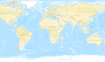
Weltweit
-
World-wide
-
Geographic coverage
))
Temporal reference
Temporal extent
Temporal extent
- Date (Revision)
- 2010-01-19
Quality and validity
- Lineage
-
World-wide Hydrogeological Mapping and Assessment Programme (WHYMAP)
- Denominator
- 25000000
Conformity
Conformity
Conformity
Conformity
Conformity
Conformity
Restrictions on access and use
- Access constraints
- Es gelten keine Zugriffsbeschränkungen
- Access constraints
-
Allgemeine Geschäftsbedingungen, s.: https://www.bgr.bund.de/AGB - General terms and conditions, s. https://www.bgr.bund.de/AGB_en ; Die bereitgestellten Informationen sind bei Weiterverwendung wie folgt zu zitieren: Datenquelle: WHYMAP, (C) BGR Hannover & UNESCO Paris
Responsible organization (s)
Contact for the resource
- Organisation name
-
Bundesanstalt für Geowissenschaften und Rohstoffe
Responsible organization (s)
Contact for the resource
- Organisation name
-
Bundesanstalt für Geowissenschaften und Rohstoffe
Metadata information
Contact for the metadata
- Organisation name
-
Bundesanstalt für Geowissenschaften und Rohstoffe (BGR)
- Date stamp
- 2025-03-12
- Metadata language
- English
- Character set
- UTF8
SDS
Conformance class 1: invocable
Access Point URL
Endpoint URL
Technical specification
Conformance class 2: interoperable
Access constraints
Limitation
Use constraints
Limitation
Responsible custodian
Contact for the resource
Overviews
Spatial extent
Provided by
