 www.geodatenkatalog.de (S3L)
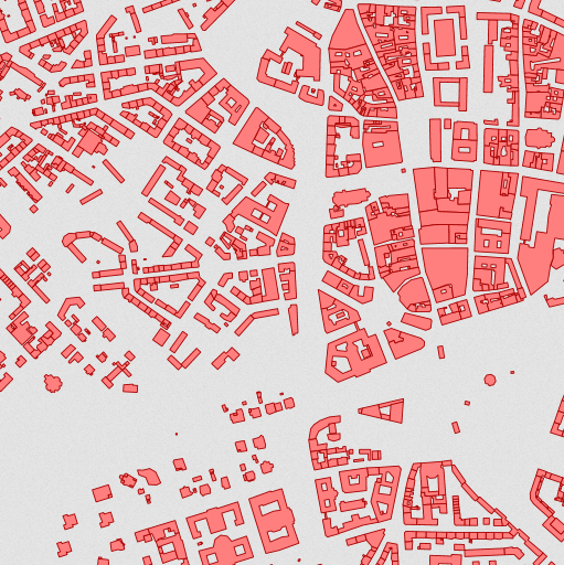
WMS für Hausumringe Deutschland
Der Darstellungsdienst amtliche Hausumringe (HU-DE) enthält georeferenzierte Umringspolygone von Gebäudegrundrissen der Automatisierten Liegenschaftskarte (ALK) bzw. der Digitalen Flurkarte (DFK) in Bayern, ohne Ausgestaltungsgeometrien, Dächer und unterirdische Gebäude. Neben der Geometrie besitzt jedes Objekt den Amtlichen Gemeindeschlüssel und Regionalschlüssel. Die Daten basieren auf einer individuellen Vermessung vor Ort, verfügen daher über eine hohe geometrische Genauigkeit. Sie lassen sich ideal mit dem Datensatz der amtliche Hauskoordinaten HK-DE kombinieren.
|
|
Citation proposal
. WMS für Hausumringe Deutschland. https://gdk.gdi-de.org/geonetwork/srv/api/records/80F7F20D-B080-400F-9642-9C3212F605C0 |
Simple
Identification info
- Alternate title
- Hausumringe
- Alternate title
- wms_hu
- Date ( Creation )
- 2012-05-02T00:00:00.000+02:00
- Status
- On going
Distributor
Bundesamt für Kartographie und Geodäsie (BKG)
Karl-Rothe-Str. 10-14
Leipzig
Bundesrepublik Deutschland
04105
DEU
Resource provider
Point of contact
Bundesamt für Kartographie und Geodäsie (BKG)
Karl-Rothe-Str. 10-14
Leipzig
Bundesrepublik Deutschland
04105
DEU
- Maintenance and update frequency
- Annually
- Update scope
- Service
- Keywords
-
- ViewService
- WMS
- HU-DE
- Hausumringe
- infoMapAccessService
- BKG
- Bundesamt für Kartographie und Geodäsie
- Deutschland
- Service Classification, version 1.0 ( Theme )
-
- infoMapAccessService
- Keywords
-
- AdVMIS
- Access constraints
- otherRestrictions Other restrictions
- Other constraints
- Es gelten Zugriffsbeschränkungen. Für den Erwerb von Nutzungsrechten wenden Sie sich deshalb bitte an die Zentrale Stelle Geotopographie der AdV (ZSGT) / Dienstleistungszentrum (DLZ) des Bundesamtes für Kartographie und Geodäsie: https://www.bkg.bund.de/DE/Service/Kontakt/kontakt.html.
- Use constraints
- otherRestrictions Other restrictions
- Other constraints
- Die Daten sind urheberrechtlich geschützt. Die Daten werden Nutzungsberechtigten nach V GeoBund und V GeoLänder geldleistungsfrei zur Verfügung gestellt. Bitte informieren Sie sich unter nachfolgendem Link über die Details zu Nutzungsbedingungen und Quellenvermerk: https://gdz.bkg.bund.de/index.php/default/hinweise-zu-nutzungsbedingungen-und-quellenvermerken. Der Quellenvermerk ist zu beachten.
- Service Type
- view
- Service Version
- OGC:WMS 1.3.0
- Service Version
- OGC:WMS 1.1.1
- Extent type code
- true
- Geographic identifier
- Raumbezug des Datensatzes
N
S
E
W
))
Coupled Resource
- Operation Name
- GetCapabilities
Coupled Resource
- Operation Name
- GetMap
Coupled Resource
- Operation Name
- GetFeatureInfo
- Coupling Type
- Tight
Contains Operations
- Operation Name
- GetCapabilities
- Distributed Computing Platforms
- HTTPGet
- Invocation Name
- GetCapabilities
Parameter
- Name
- Description
- Request name
- Optionality
- 0
- Repeatability
- false
- Name
Parameter
- Name
- Description
- Request version
- Optionality
- 1
- Repeatability
- false
- Name
Parameter
- Name
- Description
- Sequence number for cache control
- Optionality
- 1
- Repeatability
- false
- Name
Parameter
- Name
- Description
- Service type
- Optionality
- 0
- Repeatability
- false
- Name
- Connect Point
- https://sg.geodatenzentrum.de/wms_hu?
Contains Operations
- Operation Name
- GetMap
- Distributed Computing Platforms
- HTTPGet
- Invocation Name
- GetMap
Parameter
- Name
- Description
- Request version
- Optionality
- 0
- Repeatability
- false
- Name
Parameter
- Name
- Description
- Height in pixels of map picture
- Optionality
- 0
- Repeatability
- false
- Name
Parameter
- Name
- Description
- Hexadecimal red-green-blue color value for the background color (default=0xFFFFFF)
- Optionality
- 1
- Repeatability
- false
- Name
Parameter
- Name
- Description
- URL of Web Feature Service providing features to be symbolized using SLD
- Optionality
- 1
- Repeatability
- false
- Name
Parameter
- Name
- Description
- Elevation of layer desired
- Optionality
- 1
- Repeatability
- false
- Name
Parameter
- Name
- Description
- Request name
- Optionality
- 0
- Repeatability
- false
- Name
Parameter
- Name
- Description
- Width in pixels of map picture
- Optionality
- 0
- Repeatability
- false
- Name
Parameter
- Name
- Description
- Optional experimental parameters
- Optionality
- 1
- Repeatability
- false
- Name
Parameter
- Name
- Description
- Output format of map
- Optionality
- 0
- Repeatability
- false
- Name
Parameter
- Name
- Description
- URL of Styled Layer Descriptor (as defined in SLD Specification)
- Optionality
- 1
- Repeatability
- false
- Name
Parameter
- Name
- Description
- Comma-separated list of one or more map layers. Optional if SLD parameter is present
- Optionality
- 0
- Repeatability
- false
- Name
Parameter
- Name
- Description
- Bounding box corners (lower left, upper right) in SRS units
- Optionality
- 0
- Repeatability
- false
- Name
Parameter
- Name
- Description
- Background transparency of map (default=FALSE)
- Optionality
- 1
- Repeatability
- false
- Name
Parameter
- Name
- Description
- Spatial Reference System
- Optionality
- 0
- Repeatability
- false
- Name
Parameter
- Name
- Description
- The format in which exceptions are to be reported by the WMS (default=SE_XML)
- Optionality
- 1
- Repeatability
- false
- Name
Parameter
- Name
- Description
- Time value of layer desired
- Optionality
- 1
- Repeatability
- false
- Name
Parameter
- Name
- Description
- Value of other dimensions as appropriate
- Optionality
- 1
- Repeatability
- false
- Name
Parameter
- Name
- Description
- Comma-separated list of one rendering style per requested layer. Optional if SLD parameter is present
- Optionality
- 0
- Repeatability
- false
- Name
- Connect Point
- https://sg.geodatenzentrum.de/wms_hu?
Contains Operations
- Operation Name
- GetFeatureInfo
- Distributed Computing Platforms
- HTTPGet
- Invocation Name
- GetFeatureInfo
Parameter
- Name
- Description
- Partial copy of the Map request parameters that generated the map for which information is desired
- Optionality
- 0
- Repeatability
- false
- Name
Parameter
- Name
- Description
- Request version
- Optionality
- 0
- Repeatability
- false
- Name
Parameter
- Name
- Description
- X coordinate in pixels of feature (measured from upper left corner=0)
- Optionality
- 0
- Repeatability
- false
- Name
Parameter
- Name
- Description
- Y coordinate in pixels of feature (measured from upper left corner=0)
- Optionality
- 0
- Repeatability
- false
- Name
Parameter
- Name
- Description
- Return format of feature information (MIME type)
- Optionality
- 1
- Repeatability
- false
- Name
Parameter
- Name
- Description
- Optional experimental parameters
- Optionality
- 1
- Repeatability
- false
- Name
Parameter
- Name
- Description
- The format in which exceptions are to be reported by the WMS (default=application/vnd.ogc.se_xml)
- Optionality
- 1
- Repeatability
- false
- Name
Parameter
- Name
- Description
- Comma-separated list of one or more layers to be queried
- Optionality
- 0
- Repeatability
- false
- Name
Parameter
- Name
- Description
- Number of features about which to return information (default=1)
- Optionality
- 1
- Repeatability
- false
- Name
Parameter
- Name
- Description
- Request name
- Optionality
- 0
- Repeatability
- false
- Name
- Connect Point
- https://sg.geodatenzentrum.de/wms_hu?
- Operates On
- Reference system identifier
- CRS 84: CRS 84 / mathematisch
- Distribution format
-
- TIFF ()
- PNG ()
- JPEG ()
- OnLine resource
- Geodatenzentrum
- OnLine resource
- Nutzungsbedingungen
- OnLine resource
- Dienst "WMS für Hausumringe Deutschland" (GetCapabilities)
- Hierarchy level
- Service
- Other
- 3
Conformance result
- Date ( Publication )
- 2006-03-15
- Explanation
- see the referenced specification
- Pass
- true
gmd:MD_Metadata
- File identifier
- 80F7F20D-B080-400F-9642-9C3212F605C0 XML
- Metadata language
- German
- Character set
- UTF8
- Hierarchy level
- service Service
- Hierarchy level name
- service
- Date stamp
- 2025-08-13
- Metadata standard name
- ISO19119
- Metadata standard version
- 2005/PDAM 1
Point of contact
Overviews
Provided by

Views
80F7F20D-B080-400F-9642-9C3212F605C0
Access to the portal
Read here the full details and access to the data.
Associated resources
Not available