 www.geodatenkatalog.de (S3L)
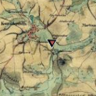
Historische Hochwasserereignisse/Wasserstandsmarken
Bei Wasserstandsmarken (auch Hochwassermarken genannt) handelt es sich um Stellen am Gewässer, an denen der Wasserstand eines vergangenen Hochwassers bekannt ist. Dabei handelt es sich oftmals um Markierungen an Gebäuden, welche den höchsten Wasserstand während eines vergangenen Hochwassers angeben. Mit Hilfe der Wasserstandsmarken können Rückschlüsse auf das Ausmaß des Hochwassers gezogen werden.
|
|
Citation proposal
. Historische Hochwasserereignisse/Wasserstandsmarken. https://gdk.gdi-de.org/geonetwork/srv/api/records/828b65b0-5330-4830-a22b-d166fadcc478 |
INSPIRE
Identification
- File identifier
- 828b65b0-5330-4830-a22b-d166fadcc478 XML
- Hierarchy level
- dataset Dataset
Online resource
Resource identifier
- Metadata language
- German
- Spatial representation type
- Vector
Encoding
- Format
- GDB
Projection
Classification of data and services
- Topic category
-
- Inland waters
- Imagery base maps earth cover
- Environment
Classification of data and services
Coupled resource
Coupled resource
Classification of data and services
Coupled resource
Coupled resource
Keywords
Other keywords
- Keywords
-
- Bayern
- Hochwasser
- Historisches Hochwasserereignis
- Wasserstandsmarke
- Hochwassermarke
- gdiby
- UmweltAtlas
- überschwemmungsgefährdet
- Hochwasserrisiko
- Hochwassergefahr
Geographic coverage
N
S
E
W
))
Temporal reference
Temporal extent
Temporal extent
- Date ( Creation )
- 2013-09-10T00:00:00.000+02:00
Quality and validity
- Lineage
- Die Wasserstandsmarken werden von den Wasserwirtschaftämtern im Hochwasserfall erfasst.
Conformity
Conformity
Conformity
Conformity
Conformity
Conformity
- Explanation
- see the referenced specification
- Explanation
- see the referenced specification
Restrictions on access and use
- Access constraints
- Creative Commons Namensnennung - Weitergabe unter gleichen Bedingungen 4.0 International (CC BY-SA 4.0); Datenquelle: Bayerisches Landesamt für Umwelt, www.lfu.bayern.de; Die Nutzung von Daten über Dienste ist geldleistungsfrei. Bei Bezug von Daten über die Datenstelle des LfU (nur Daten, die nicht über Dienste verfügbar sind) wird eine Bereitstellungsgebühr erhoben, die sich an der Umweltgebührenordnung orientiert.
- Access constraints
- {"id":"cc-by-sa/4.0","name":"Creative Commons Namensnennung - Weitergabe unter gleichen Bedingungen 4.0 International (CC BY-SA 4.0)","url":"https://creativecommons.org/licenses/by-sa/4.0/deed.de","quelle":"Bayerisches Landesamt für Umwelt, www.lfu.bayern.de"}
Restrictions on access and use
Responsible organization (s)
Contact for the resource
- Organisation name
- Bayerisches Landesamt für Umwelt
Responsible organization (s)
Contact for the resource
- Organisation name
- Bayerisches Landesamt für Umwelt
Metadata information
Contact for the metadata
- Organisation name
- Bayerisches Landesamt für Umwelt
- Date stamp
- 2024-11-27
- Metadata language
- German
- Character set
- UTF8
SDS
Conformance class 1: invocable
Access Point URL
Endpoint URL
Technical specification
Conformance class 2: interoperable
Coordinate reference system
Quality of Service
Access constraints
Limitation
Use constraints
Limitation
Responsible custodian
Contact for the resource
Conformance class 3: harmonized
Overviews
Provided by

Views
828b65b0-5330-4830-a22b-d166fadcc478
Access to the portal
Read here the full details and access to the data.
Associated resources
Not available