 www.geodatenkatalog.de (S1L)
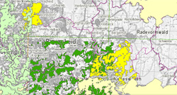
IS BK 5 Übersicht zur Bodenkarte von NRW 1 : 5.000 - WMS
Der WMS zeigt, wo in NRW großmaßstäbige Bodenkarten, meist im Maßstab 1 : 5.000, digital (vektorisiert) oder analog (gescannt und georeferenziert) vorliegen und, ob sie aus der forstlichen oder landwirtschaftlichen Standorterkundung stammen. Jedes Kartierprojekt ("Verfahren") wird mit Namen, Projektcode, Maßstab der Erhebung, Jahr der Kartierung, Liste und Bearbeitungsdatum der verfügbaren digitalen Auswertungen beschrieben und mit einer Verfahrensdokumentation verlinkt.
|
|
Citation proposal
geodaten (Geologischer Dienst NRW) (2013) . IS BK 5 Übersicht zur Bodenkarte von NRW 1 : 5.000 - WMS. https://gdk.gdi-de.org/geonetwork/srv/api/records/845DC6D2-39C1-497E-B9D8-07D5D188E826 |
INSPIRE
Identification
- File identifier
- 845DC6D2-39C1-497E-B9D8-07D5D188E826 XML
- Hierarchy level
- service Service
Online resource
Resource identifier
Encoding
- Format
- -
- Version
- -
Projection
Classification of data and services
Classification of data and services
- Service Type
- WMS
- Coupling Type
- Tight
Coupled resource
Coupled resource
Classification of data and services
- Service Type
- WMS
- Coupling Type
- Tight
Coupled resource
Coupled resource
Keywords
- GEMET - INSPIRE themes, version 1.0
-
- infoMapAccessService
- German Environmental Classification - Topic, version 1.0 ( Theme )
-
- Soil
Other keywords
- Keywords ( Discipline )
-
- Boden
- Bodenkarte
- Bodenkartierung
- großmaßstäbig
- 1 : 5.000
- Bodeninformationssystem
- Bodenschutz
- Bodenfunktion
- Bodenbeschaffenheit
- Bodentyp
- Bodenart
- Bodenartenschichtung
- Wasserhaushalt
- Nährstoffhaushalt
- Waldbauplanung
- Grundwasser
- Staunässe
- Sickerwasser
- Wasserschutz
- Flurbereinigung
- Naturschutz
- Landschaftsplanung
- BK 5 Übersicht
- Keywords
-
- opendata
Geographic coverage
N
S
E
W
))
Temporal reference
Temporal extent
Temporal extent
- Date ( Publication )
- 2013-02-05
- Date ( Revision )
- 2025-09-15
Quality and validity
Conformity
Conformity
Conformity
Conformity
Conformity
Conformity
Restrictions on access and use
Restrictions on access and use
- Access constraints
- Nutzungsbedingungen: {"id":"dl-by-de/2.0", "name": "Datenlizenz Deutschland Namensnennung 2.0", "url": "https://www.govdata.de/dl-de/by-2-0", "IS BK 5 Übersicht zur Bodenkarte von NRW 1 : 5.000 - WMS, Geologischer Dienst NRW, Abrufdatum"}
Responsible organization (s)
Contact for the resource
- Organisation name
- Geologischer Dienst NRW
- geodaten@gd.nrw.de
Responsible organization (s)
Contact for the resource
- Organisation name
- Geologischer Dienst NRW
- geodaten@gd.nrw.de
Metadata information
Contact for the metadata
- Organisation name
- Geologischer Dienst NRW
- metadaten@gd.nrw.de
- Date stamp
- 2025-11-04
- Metadata language
- ger German
SDS
Conformance class 1: invocable
Access Point URL
Endpoint URL
Technical specification
Conformance class 2: interoperable
Coordinate reference system
Quality of Service
Access constraints
- Access constraints
- Other restrictions
Limitation
Use constraints
Limitation
- string
- Nutzungsbedingungen: {"id":"dl-by-de/2.0", "name": "Datenlizenz Deutschland Namensnennung 2.0", "url": "https://www.govdata.de/dl-de/by-2-0", "IS BK 5 Übersicht zur Bodenkarte von NRW 1 : 5.000 - WMS, Geologischer Dienst NRW, Abrufdatum"}
Responsible custodian
Contact for the resource
Conformance class 3: harmonized
Contains Operations
- Operation Name
- GetCapabilities
- Distributed Computing Platforms
- Web services
- Invocation Name
- GetCapabilities
Parameter
- Name
- UPDATESEQUENCE=number
- Name
- Optionality
- 1
- Repeatability
- false
- Name
Parameter
- Name
- REQUEST=GetCapabilities
- Name
- Optionality
- 0
- Repeatability
- false
- Name
Parameter
- Name
- SERVICE=WMS
- Name
- Optionality
- 0
- Repeatability
- false
- Name
Parameter
- Name
- VERSION=version
- Name
- Optionality
- 0
- Repeatability
- false
- Name
- Connect Point
- https://www.wms.nrw.de/gd/bk05_uebersichtskarte?
Contains Operations
- Operation Name
- GetMap
- Distributed Computing Platforms
- Web services
- Invocation Name
- GetMap
Parameter
- Name
- BGCOLOR=color_value
- Name
- Optionality
- 1
- Repeatability
- false
- Name
Parameter
- Name
- TRANSPARENT=TRUE|FALSE
- Name
- Optionality
- 1
- Repeatability
- false
- Name
Parameter
- Name
- Other sample dimension(s)
- Name
- Optionality
- 1
- Repeatability
- false
- Name
Parameter
- Name
- REQUEST=GetMap
- Name
- Optionality
- 0
- Repeatability
- false
- Name
Parameter
- Name
- HEIGHT=output_height
- Name
- Optionality
- 0
- Repeatability
- false
- Name
Parameter
- Name
- WFS=web_feature_service_URL
- Name
- Optionality
- 1
- Repeatability
- false
- Name
Parameter
- Name
- ELEVATION=elevation
- Name
- Optionality
- 1
- Repeatability
- false
- Name
Parameter
- Name
- VERSION=version
- Name
- Optionality
- 0
- Repeatability
- false
- Name
Parameter
- Name
- FORMAT=output_format
- Name
- Optionality
- 0
- Repeatability
- false
- Name
Parameter
- Name
- EXCEPTIONS=exception_format
- Name
- Optionality
- 1
- Repeatability
- false
- Name
Parameter
- Name
- SRS=namespace:identifier
- Name
- Optionality
- 0
- Repeatability
- false
- Name
Parameter
- Name
- SLD=styled_layer_descriptor_URL
- Name
- Optionality
- 1
- Repeatability
- false
- Name
Parameter
- Name
- Vendor-specific parameters
- Name
- Optionality
- 1
- Repeatability
- false
- Name
Parameter
- Name
- STYLES=style_list
- Name
- Optionality
- 0
- Repeatability
- false
- Name
Parameter
- Name
- WIDTH=output_width
- Name
- Optionality
- 0
- Repeatability
- false
- Name
Parameter
- Name
- LAYERS=layer_list
- Name
- Optionality
- 0
- Repeatability
- false
- Name
Parameter
- Name
- BBOX=minx,miny,maxx,maxy
- Name
- Optionality
- 0
- Repeatability
- false
- Name
Parameter
- Name
- TIME=time
- Name
- Optionality
- 1
- Repeatability
- false
- Name
- Connect Point
- https://www.wms.nrw.de/gd/bk05_uebersichtskarte?
Contains Operations
- Operation Name
- GetFeatureInfo
- Distributed Computing Platforms
- Web services
- Invocation Name
- GetFeatureInfo
Parameter
- Name
- EXCEPTIONS=exception_format
- Name
- Optionality
- 1
- Repeatability
- false
- Name
Parameter
- Name
- REQUEST=GetFeatureInfo
- Name
- Optionality
- 0
- Repeatability
- false
- Name
Parameter
- Name
- <map_request_copy>
- Name
- Optionality
- 0
- Repeatability
- false
- Name
Parameter
- Name
- FEATURE_COUNT=number
- Name
- Optionality
- 1
- Repeatability
- false
- Name
Parameter
- Name
- INFO_FORMAT=output_format
- Name
- Optionality
- 1
- Repeatability
- false
- Name
Parameter
- Name
- VERSION=version
- Name
- Optionality
- 0
- Repeatability
- false
- Name
Parameter
- Name
- Y=pixel_row
- Name
- Optionality
- 0
- Repeatability
- false
- Name
Parameter
- Name
- QUERY_LAYERS=layer_list
- Name
- Optionality
- 0
- Repeatability
- false
- Name
Parameter
- Name
- Vendor-specific parameters
- Name
- Optionality
- 1
- Repeatability
- false
- Name
Parameter
- Name
- X=pixel_column
- Name
- Optionality
- 0
- Repeatability
- false
- Name
- Connect Point
- https://www.wms.nrw.de/gd/bk05_uebersichtskarte?
Overviews
Provided by

Views
845DC6D2-39C1-497E-B9D8-07D5D188E826
Access to the portal
Read here the full details and access to the data.
Associated resources
Not available