 www.geodatenkatalog.de (S3L)
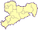
Verwaltungsgrenzen
Die Vektordaten der Verwaltungsgrenzen beinhalten immer den aktuellen Stand der Gemeindegrenzen, Kreisgrenzen, Landesgrenzen und Staatsgrenzen.
|
|
Citation proposal
. Verwaltungsgrenzen. https://gdk.gdi-de.org/geonetwork/srv/api/records/85983692-f68c-45b2-b6a3-bb11959c5cf2 |
INSPIRE
Identification
- File identifier
- 85983692-f68c-45b2-b6a3-bb11959c5cf2 XML
- Hierarchy level
- Dataset
Online resource
Resource identifier
- Metadata language
- ger German
- Spatial representation type
- Vector
Encoding
- Format
- Shape
- Version
- 10.1
Projection
Classification of data and services
- Topic category
-
- Society
- Boundaries
- Location
Classification of data and services
Coupled resource
Coupled resource
Classification of data and services
Coupled resource
Coupled resource
Keywords
- GeoSN ( Theme )
-
- Verwaltungsgrenzen
- ATKIS
Other keywords
- Keywords
-
- AdVMIS
- Keywords
-
- opendata
Geographic coverage
N
S
E
W
))
Temporal reference
Temporal extent
Temporal extent
- Date ( Creation )
- 2013-01-31
Quality and validity
- Lineage
- Grundlage der Erfassung bei: Gemeindegrenzen und in der Hierarchie höhere Grenzen - Basis: DLM Eingemeindungen - Basis: VÜK200 Die Fortführung erfolgt anhand von Veränderungsmeldungen im Liegenschaftskataster sowie Angaben des Statistischen Landesamtes des Freistaates Sachsen.
- Denominator
- 10000
Conformity
Conformity
Conformity
Conformity
Conformity
Conformity
Restrictions on access and use
- Access constraints
- Es gelten keine Zugriffsbeschränkungen
- Access constraints
- Es gelten keine Zugriffseinschränkungen
- Access constraints
- Dieser Datensatz kann gemäß den Nutzungsbestimmungen von Datenlizenz Deutschland - Namensnennung - Version 2.0 (https://www.govdata.de/dl-de/by-2-0) unter Angabe der Quelle: "GeoSN" genutzt werden.
- Access constraints
- { "id": "dl-by-de/2.0", "name": "Datenlizenz Deutschland Namensnennung 2.0", "url": "https://www.govdata.de/dl-de/by-2-0", "quelle": "Quelle: GeoSN" }
Restrictions on access and use
Responsible organization (s)
Contact for the resource
- Organisation name
- Landesamt für Geobasisinformation Sachsen (GeoSN)
Responsible organization (s)
Contact for the resource
- Organisation name
- Landesamt für Geobasisinformation Sachsen (GeoSN)
Metadata information
Contact for the metadata
- Organisation name
- Landesamt für Geobasisinformation Sachsen (GeoSN)
- Date stamp
- 2024-02-02
- Metadata language
- ger German
- Character set
- UTF8
SDS
Conformance class 1: invocable
Access Point URL
Endpoint URL
Technical specification
Conformance class 2: interoperable
Coordinate reference system
Quality of Service
Access constraints
Limitation
Use constraints
Limitation
Responsible custodian
Contact for the resource
Conformance class 3: harmonized
Overviews
Provided by

Views
85983692-f68c-45b2-b6a3-bb11959c5cf2
Access to the portal
Read here the full details and access to the data.
Associated resources
Not available