 www.geodatenkatalog.de (S3L)
Airborne Laserscanning (ALS) Primäre 3D Laserscan-Daten
Bei diesen ALS-Daten handelt es sich um eine klassifizierte 3D-Punktwolke im las1.4-Format. Die Punktdichte ist ca. 9,8 Punkte/m². Folgende Klassen sind im Datensatz enthalten: Boden (class 2), Tiefe- (class 3), Mittlere- (class 4) und Hohe-Vegetation (class 5), Ausreißer (Klasse low-Points class 7) und Default (class 0). Alle Objekte über dem Boden befinden sich grundsätzlich in den drei zuvor genannten Vegetationsklassen. Der Blattschnitt ist 1km x 1km. In das Land Brandenburg reicht ein Buffer von ca. 250m.
|
|
Citation proposal
. Airborne Laserscanning (ALS) Primäre 3D Laserscan-Daten. https://gdk.gdi-de.org/geonetwork/srv/api/records/85a97801-36bb-4627-8790-f5e53b1e38b3 |
- Identification
- Distribution
- Quality
- Spatial rep.
- Ref. system
- Content
- Portrayal
- Metadata
- Md. constraints
- Md. maintenance
- Schema info
Identification
Data identification
Citation
- Date ( Creation )
- 2021-07-13
Point of contact
- Maintenance and update frequency
- As needed
- Keywords ( Theme )
-
- open data
- opendata
- Sachdaten
- Geodaten
- Berlin
- AdVMIS
- 3D-Punktwolke
- Airborne Laserscanning
- ATKIS
- Topographie
- Topografie
- topographisch
- topografisch
- Lidar
- Geländemodell
- Höhenmodell
- Oberflächenmodell
- Räumlicher Anwendungsbereich ( Theme )
Legal constraints
- Access constraints
- Other restrictions
Legal constraints
- Use constraints
- Other restrictions
- Other constraints
- Für die Nutzung der Daten ist die Datenlizenz Deutschland - Zero - Version 2.0 anzuwenden. Die Lizenz ist über https://www.govdata.de/dl-de/zero-2-0 abrufbar.
- Other constraints
- {"id":"dl-zero-de/2.0","name":"Datenlizenz Deutschland - Zero - Version 2.0","url":"https://www.govdata.de/dl-de/zero-2-0"}
- Spatial representation type
- Vector
- Denominator
- 1000
- Metadata language
- German
- Character set
- UTF8
- Topic category
-
- Imagery base maps earth cover
Extent
N
S
E
W
))
Geographic description
- Extent type code
- true
- Geographic identifier
- 110000000000
Distribution
Distribution
- Distribution format
-
-
Text/HTML
(4.01 )
- Specification
- Keine Angabe
-
Text/HTML
(4.01 )
- OnLine resource
-
Downloaddienst - Airborne Laserscanning (ALS) Primäre 3D Laserscan-Daten (ATOM)
Downloaddienst - Airborne Laserscanning (ALS) Primäre 3D Laserscan-Daten (ATOM)
Quality
Data quality
- Hierarchy level
- Dataset
Lineage
- Statement
- Airborne Laserscanning Flug 24.02.2021, 25.02.2021 und 02.03.2021
- Description
- Airborne Laserscanning Flug 24.02.2021, 25.02.2021 und 02.03.2021
Ref. system
- Reference system identifier
- http://www.opengis.net/def/crs/EPSG/0/25833
Metadata
Metadata
- File identifier
- 85a97801-36bb-4627-8790-f5e53b1e38b3 XML
- Metadata language
- German
- Character set
- UTF8
- Hierarchy level
- Dataset
- Date stamp
- 2025-11-19T00:00:00Z
- Metadata standard name
- ISO 19115/19119 - BE
- Metadata standard version
- 1.0.0
Point of contact
Overviews
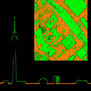
Vorschaubild
Provided by

Views
85a97801-36bb-4627-8790-f5e53b1e38b3
Access to the portal
Read here the full details and access to the data.
Associated resources
Not available