 www.geodatenkatalog.de (S3L)
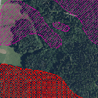
GEORISK - Ablagerungsbereiche
Dargestellt werden die Ablagerungsbereiche von Sturz- oder Rutschprozessen sowie die Ausdehnung größerer Dolinen.
|
|
Citation proposal
(2004) . GEORISK - Ablagerungsbereiche. https://gdk.gdi-de.org/geonetwork/srv/api/records/85fc5218-30fb-472d-bfdc-e2c29717fafe |
Simple
- Date ( Publication )
- 2004-10-11T00:00:00.000+02:00
- Status
- On going
Point of contact
- Website
- https://www.lfu.bayern.de
- Maintenance and update frequency
- Monthly
- Update scope
- Dataset
- GEMET - INSPIRE themes, version 1.0 ( Theme )
-
- Gebiete mit naturbedingten Risiken
- Keywords
-
- UmweltAtlas
- gdiby
- Hangbewegungen
- Georisiken
- Rutschungen
- Hangrutschung
- Steinschlag
- Blockschlag
- Felssturz
- Bergsturz
- Erdfall
- Doline
- opendata
- Spatial scope
- Keywords ( Theme )
-
- ENVI
- Keywords
-
- inspireidentifiziert
- Use limitation
- keine Einschränkungen
- Use constraints
- Other restrictions
- Other constraints
- Creative Commons Namensnennung 4.0 International (CC BY 4.0); Datenquelle: Bayerisches Landesamt für Umwelt, www.lfu.bayern.de; Die Nutzung von Daten über Dienste ist geldleistungsfrei. Bei Bezug von Daten über die Datenstelle des LfU (nur Daten, die nicht über Dienste verfügbar sind) wird eine Bereitstellungsgebühr erhoben, die sich an der Umweltgebührenordnung orientiert.
- Other constraints
- {"id":"cc-by/4.0","name":"Creative Commons Namensnennung 4.0 International (CC BY 4.0)","url":"https://creativecommons.org/licenses/by/4.0/deed.de","quelle":"Bayerisches Landesamt für Umwelt, www.lfu.bayern.de"}
- Access constraints
- otherRestrictions Other restrictions
- Spatial representation type
- Vector
- Denominator
- 10000
- Metadata language
- German
- Character set
- UTF8
- Topic category
-
- Environment
- Geoscientific information
- Description
- Daten aus ganz Bayern
N
S
E
W
))
- Geometric object type
- Surface
- Geometric object count
- 1731
- Distribution format
-
- Shapefile ()
- Datenbank ()
Distributor
Distributor
- Website
- https://www.lfu.bayern.de
- Fees
- geldleistungsfrei
- OnLine resource
-
Informationsseite
Informationsseite zu GEORISK
- OnLine resource
-
Daten in Darstellungs- und Downloaddiensten
Die Daten können über einen Darstellungsdienst (WMS) und/oder Downloaddienst (WFS oder Predefined Atom) aufgerufen werden.
- OnLine resource
-
Daten im UmweltAtlas Bayern
Die Daten können im UmweltAtlas Bayern aufgerufen werden.
- OnLine resource
-
Kontaktformular
Kontaktformular der Datenstelle
- OnLine resource
- Datendownload
- OnLine resource
- Dienst "Georisiken in Bayern - WMS" (GetCapabilities)
- OnLine resource
- Dienst "Georisiken in Bayern - Downloaddienst" (GetCapabilities)
- Hierarchy level
- Dataset
Conformance result
- Date ( Publication )
- 2013-12-10
- Explanation
- see the referenced specification
- Pass
- false
Conformance result
- Date ( Publication )
- 2010-12-08
- Explanation
- see the referenced specification
- Pass
- false
- Statement
- Datenquelle: BAYERISCHES LANDESAMT FÜR UMWELT
gmd:MD_Metadata
- File identifier
- 85fc5218-30fb-472d-bfdc-e2c29717fafe XML
- Metadata language
- German
- Character set
- UTF8
- Hierarchy level
- dataset Dataset
- Date stamp
- 2024-06-28
- Metadata standard name
- ISO19115
- Metadata standard version
- 2003/Cor.1:2006
Point of contact
- Website
- https://www.lfu.bayern.de
Overviews
Provided by

Views
85fc5218-30fb-472d-bfdc-e2c29717fafe
Access to the portal
Read here the full details and access to the data.
Associated resources
Not available