 www.geodatenkatalog.de (S3L)
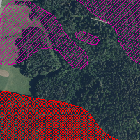
GEORISK - Ablagerungsbereiche
Dargestellt werden die Ablagerungsbereiche von Sturz- oder Rutschprozessen sowie die Ausdehnung größerer Dolinen.
|
|
Citation proposal
(2004) . GEORISK - Ablagerungsbereiche. https://gdk.gdi-de.org/geonetwork/srv/api/records/85fc5218-30fb-472d-bfdc-e2c29717fafe |
INSPIRE
Identification
- File identifier
- 85fc5218-30fb-472d-bfdc-e2c29717fafe XML
- Hierarchy level
- dataset Dataset
Online resource
Resource identifier
- Metadata language
- German
- Spatial representation type
- Vector
Encoding
- Format
- Shapefile
- Format
- Datenbank
Projection
Classification of data and services
- Topic category
-
- Environment
- Geoscientific information
Classification of data and services
Coupled resource
Coupled resource
Classification of data and services
Coupled resource
Coupled resource
Keywords
- GEMET - INSPIRE themes, version 1.0 ( Theme )
-
- Gebiete mit naturbedingten Risiken
- Spatial scope
Other keywords
- Keywords
-
- UmweltAtlas
- gdiby
- Hangbewegungen
- Georisiken
- Rutschungen
- Hangrutschung
- Steinschlag
- Blockschlag
- Felssturz
- Bergsturz
- Erdfall
- Doline
- opendata
- Keywords ( Theme )
-
- ENVI
- Keywords
-
- inspireidentifiziert
Geographic coverage
N
S
E
W
))
Temporal reference
Temporal extent
Temporal extent
- Date ( Publication )
- 2004-10-11T00:00:00.000+02:00
Quality and validity
- Lineage
- Datenquelle: BAYERISCHES LANDESAMT FÜR UMWELT
- Denominator
- 10000
Conformity
Conformity
Conformity
Conformity
Conformity
Conformity
- Explanation
- see the referenced specification
- Explanation
- see the referenced specification
Restrictions on access and use
- Access constraints
- Creative Commons Namensnennung 4.0 International (CC BY 4.0); Datenquelle: Bayerisches Landesamt für Umwelt, www.lfu.bayern.de; Die Nutzung von Daten über Dienste ist geldleistungsfrei. Bei Bezug von Daten über die Datenstelle des LfU (nur Daten, die nicht über Dienste verfügbar sind) wird eine Bereitstellungsgebühr erhoben, die sich an der Umweltgebührenordnung orientiert.
- Access constraints
- {"id":"cc-by/4.0","name":"Creative Commons Namensnennung 4.0 International (CC BY 4.0)","url":"https://creativecommons.org/licenses/by/4.0/deed.de","quelle":"Bayerisches Landesamt für Umwelt, www.lfu.bayern.de"}
Restrictions on access and use
Responsible organization (s)
Contact for the resource
- Organisation name
- Bayerisches Landesamt für Umwelt
Responsible organization (s)
Contact for the resource
- Organisation name
- Bayerisches Landesamt für Umwelt
Metadata information
Contact for the metadata
- Organisation name
- Bayerisches Landesamt für Umwelt
- Date stamp
- 2024-06-28
- Metadata language
- German
- Character set
- UTF8
SDS
Conformance class 1: invocable
Access Point URL
Endpoint URL
Technical specification
Conformance class 2: interoperable
Coordinate reference system
Quality of Service
Access constraints
Limitation
Use constraints
Limitation
Responsible custodian
Contact for the resource
Conformance class 3: harmonized
Overviews
Provided by

Views
85fc5218-30fb-472d-bfdc-e2c29717fafe
Access to the portal
Read here the full details and access to the data.
Associated resources
Not available