 My GeoNetwork catalogue
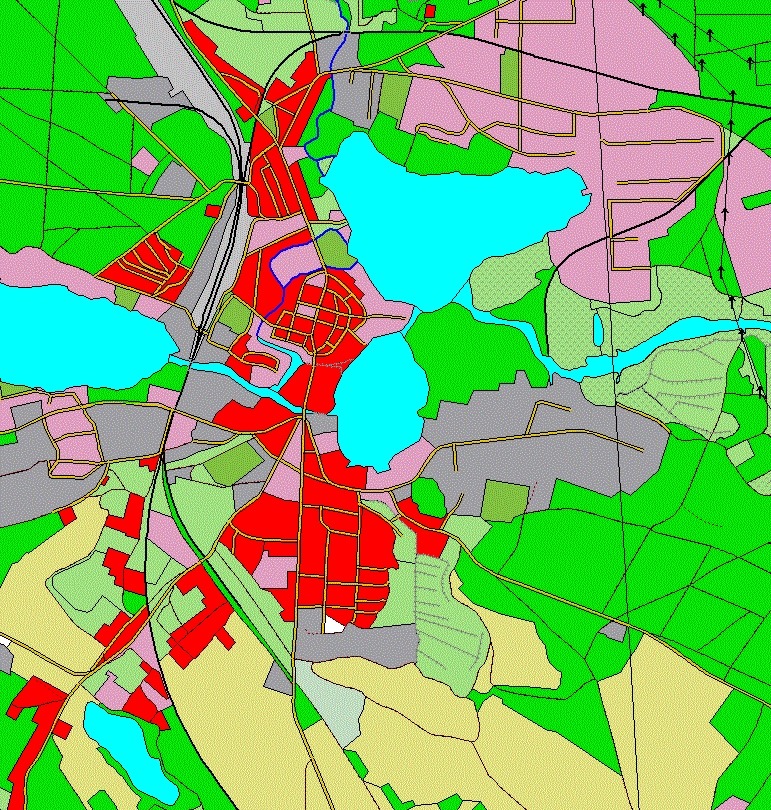
Digitales Basis-Landschaftsmodell (Overlay)
Das Basis-DLM (AAA) ist Bestandteil des Amtlichen Topographisch-Kartographischen Informationssystems (ATKIS®) und basiert auf dem gemeinsamen Datenmodell für AFIS®, ALKIS® und ATKIS®.
Es handelt sich um den Overlay-Datensatz für den entsprechenden Dienst. Weitere Informationen zum Basis-DLM (AAA) finden sich unter entsprechendem Metadateneintrag.
INSPIRE
Identification
- File identifier
- 8D862D77-B07C-4BDE-A4D4-E299A28753C2 XML
- Hierarchy level
- Dataset
Online resource
- Protocol
- OGC Web Map Service
Resource identifier
- Metadata language
- Deutsch
Encoding
Classification of data and services
- Topic category
-
- Transportation
- Inland waters
- Boundaries
- Farming
- Location
Classification of data and services
Coupled resource
Coupled resource
Classification of data and services
Coupled resource
Coupled resource
Keywords
-
GEMET - Concepts, version 3.1
Geographic coverage
))
Temporal reference
Temporal extent
Temporal extent
- Date (Revision)
- 2026-04-01T00:00:00.000+02:00
Quality and validity
- Lineage
-
Der Basis-DLM Overlay-Datensatz wird aus den Daten des Basis-DLM (AAA) abgeleitet. Er umfasst die Daten zu Gewässer, Verkehr und Siedlung.
- Denominator
- 25000
- Denominator
- 5000
Conformity
Conformity
Conformity
Conformity
Conformity
Conformity
- Explanation
-
see the referenced specification
- Explanation
-
see the referenced specification
Restrictions on access and use
- Access constraints
-
Es gelten Zugriffsbeschränkungen. Für den Erwerb von Nutzungsrechten wenden Sie sich deshalb bitte an die Zentrale Stelle Geotopographie der AdV (ZSGT) / Dienstleistungszentrum (DLZ) des Bundesamtes für Kartographie und Geodäsie: https://www.bkg.bund.de/DE/Service/Kontakt/kontakt.html .
Responsible organization (s)
Contact for the resource
- Organisation name
-
Bundesamt für Kartographie und Geodäsie (BKG)
- Organisation name
-
Bundesamt für Kartographie und Geodäsie (BKG)
Responsible organization (s)
Contact for the resource
- Organisation name
-
Bundesamt für Kartographie und Geodäsie (BKG)
- Organisation name
-
Bundesamt für Kartographie und Geodäsie (BKG)
Metadata information
Contact for the metadata
- Organisation name
-
Bundesamt für Kartographie und Geodäsie (BKG)
- Date stamp
- 2026-05-07
- Metadata language
- Deutsch
SDS
Conformance class 1: invocable
Access Point URL
Endpoint URL
Technical specification
Conformance class 2: interoperable
Access constraints
Limitation
Use constraints
Limitation
Responsible custodian
Contact for the resource
Overviews
Spatial extent
Provided by
