 www.geodatenkatalog.de (S1L)
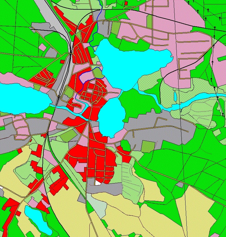
Digitales Basis-Landschaftsmodell (Overlay)
Das Basis-DLM (AAA) ist Bestandteil des Amtlichen Topographisch-Kartographischen Informationssystems (ATKIS®) und basiert auf dem gemeinsamen Datenmodell für AFIS®, ALKIS® und ATKIS®.
Es handelt sich um den Overlay-Datensatz für den entsprechenden Dienst. Weitere Informationen zum Basis-DLM (AAA) finden sich unter entsprechendem Metadateneintrag.
|
|
Citation proposal
. Digitales Basis-Landschaftsmodell (Overlay). Bundesamt für Kartographie und Geodäsie (BKG) https://gdk.gdi-de.org/geonetwork/srv/api/records/8D862D77-B07C-4BDE-A4D4-E299A28753C2 |
INSPIRE
Identification
- File identifier
- 8D862D77-B07C-4BDE-A4D4-E299A28753C2 XML
- Hierarchy level
- dataset Dataset
Online resource
Resource identifier
- Metadata language
- German
Encoding
Projection
Classification of data and services
- Topic category
-
- Transportation
- Inland waters
- Boundaries
- Farming
- Location
Classification of data and services
Coupled resource
Coupled resource
Classification of data and services
Coupled resource
Coupled resource
Keywords
- GEMET - Concepts, version 3.1 ( Theme )
Other keywords
Geographic coverage
N
S
E
W
))
Temporal reference
Temporal extent
Temporal extent
- Date ( Revision )
- 2020-09-23T00:00:00.000+02:00
Quality and validity
- Lineage
- Der Basis-DLM Overlay-Datensatz wird aus den Daten des Basis-DLM (AAA) abgeleitet. Er umfasst die Daten zu Gewässer, Verkehr und Siedlung.
- Denominator
- 25000
- Denominator
- 5000
Conformity
Conformity
Conformity
Conformity
Conformity
Conformity
- Explanation
- see the referenced specification
- Explanation
- see the referenced specification
Restrictions on access and use
- Access constraints
- Es gelten Zugriffsbeschränkungen. Für den Erwerb von Nutzungsrechten wenden Sie sich deshalb bitte an die Zentrale Stelle Geotopographie der AdV (ZSGT) / Dienstleistungszentrum (DLZ) des Bundesamtes für Kartographie und Geodäsie: https://www.bkg.bund.de/DE/Service/Kontakt/kontakt.html.
- Access constraints
- Die Daten sind urheberrechtlich geschützt. Bundesbehörden und Nutzungsberechtigte im Sinne des § 4 V GeoBund werden die Daten auf Grundlage des Vertrages über die kontinuierliche Übermittlung von amtlichen digitalen Geobasisdaten der Länder zur Nutzung im Bundesbereich vom 01.07.2019 (V GeoBund) geldleistungsfrei zur Verfügung gestellt. Der Quellenvermerk ist zu beachten.
Restrictions on access and use
Responsible organization (s)
Contact for the resource
- Organisation name
- Bundesamt für Kartographie und Geodäsie (BKG)
- dlz@bkg.bund.de
- Organisation name
- Bundesamt für Kartographie und Geodäsie (BKG)
- dlz@bkg.bund.de
- Organisation name
- Bundesamt für Kartographie und Geodäsie (BKG)
- mailbox@bkg.bund.de
Metadata information
Contact for the metadata
- Organisation name
- Bundesamt für Kartographie und Geodäsie (BKG)
- dlz@bkg.bund.de
- Date stamp
- 2025-03-10
- Metadata language
- German
SDS
Conformance class 1: invocable
Access Point URL
Endpoint URL
Technical specification
Conformance class 2: interoperable
Coordinate reference system
Quality of Service
Access constraints
Limitation
Use constraints
Limitation
Responsible custodian
Contact for the resource
Conformance class 3: harmonized
Overviews
Provided by

Views
8D862D77-B07C-4BDE-A4D4-E299A28753C2
Access to the portal
Read here the full details and access to the data.
Associated resources
Not available