 www.geodatenkatalog.de (S2F)
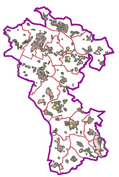
Geoportal - Planungsportal Kreis Kleve
Im Planungsportal Kreis Kleve werden die Festsetzungen der Bebauungspläne, Flächennutzungspläne und der Landschaftspläne aus den xplankonformen Datenbeständen bereitgestellt. Die nachrichtlichen Themen dieser Pläne werden aus den Original-Datenbeständen bereitgestellt. Außerdem werden alle im Umfeld der Planung relevanten Themen dargestellt, damit sich ein umfassendes Bild der Planungssituation ergibt.
|
|
Citation proposal
. Geoportal - Planungsportal Kreis Kleve. Kreis Kleve - Der Landrat https://gdk.gdi-de.org/geonetwork/srv/api/records/9bee59db-248b-4330-b0bc-f105fe7464ac |
INSPIRE
Identification
- File identifier
- 9bee59db-248b-4330-b0bc-f105fe7464ac XML
- Hierarchy level
- application application
Online resource
Resource identifier
- Metadata language
- German
Encoding
Projection
Classification of data and services
Classification of data and services
Coupled resource
Coupled resource
Classification of data and services
Coupled resource
Coupled resource
Keywords
- UMTHES Thesaurus ( Theme )
- GEMET - Concepts, version 3.1 ( Theme )
Other keywords
- Keywords
-
- Geoportal
- Kreis Kleve
- Kleve
- Emmerich
- Bedburg-Hau
- Goch
- Geldern
- Issum
- Kevelaer
- Kalkar
- Kranenburg
- Rees
- Rheurdt
- Straelen
- Uedem
- Wachtendonk
- Weeze
- Kerken
- Windenergie
- Bauen und Planen
- XPlanung
- BPL
- BPlan
- Bebauungsplan
- WMS
- KRZN
- Bebauungspläne
- Ortplanungsrecht
- Bauen
- Satzung
- Wasserschutzzonen
- Naturschutzgebiet
- Überschwemmungsgebiet
- HQ 100
- HQ extrem
- Abgrabungen
- FFH Gebiet
- Biotop
- geschützte Landschaftsbestandteile
- Kompensationsflächen
- Naturdenkmal
- Waldbedeckung
- Naturdenkmäler
- Bodendenkmal
- Bodendenkmäler
- Risikogebiet
Geographic coverage
N
S
E
W
))
Temporal reference
Temporal extent
Temporal extent
- Date ( Creation )
- 2025-06-17T00:00:00.000+02:00
Quality and validity
Conformity
Conformity
Conformity
Conformity
Conformity
Conformity
Restrictions on access and use
Restrictions on access and use
Responsible organization (s)
Contact for the resource
- Organisation name
- Kreis Kleve - Der Landrat
- info@kreis-kleve.de
- Organisation name
- Kreis Kleve - Abt. Kataster- und Vermessung - Produktbereich GeoInformation (GIS)
Responsible organization (s)
Contact for the resource
- Organisation name
- Kreis Kleve - Der Landrat
- info@kreis-kleve.de
- Organisation name
- Kreis Kleve - Abt. Kataster- und Vermessung - Produktbereich GeoInformation (GIS)
Metadata information
Contact for the metadata
- Organisation name
- Kreis Kleve - Abt. Kataster- und Vermessung - Produktbereich GeoInformation (GIS)
- Date stamp
- 2025-06-20
- Metadata language
- German
SDS
Conformance class 1: invocable
Access Point URL
Endpoint URL
Technical specification
Conformance class 2: interoperable
Coordinate reference system
Quality of Service
Access constraints
Limitation
Use constraints
Limitation
Responsible custodian
Contact for the resource
Conformance class 3: harmonized
Overviews
Provided by

Views
9bee59db-248b-4330-b0bc-f105fe7464ac
Access to the portal
Read here the full details and access to the data.
Associated resources
Not available