 www.geodatenkatalog.de (S2F)
RK 10 KO A - Geologische Karte des Rheinisch-Westfälischen Steinkohlengebietes 1:10.000 (analog)
Die Karte zeigt die Verbreitung der karbonzeitlichen Steinkohlen-Flöze und Sandsteine. Sie informiert außerdem über die Tektonik und die Tiefenlage der Karbonoberfläche. Das Kartenwerk wurde in den Jahren 1949 bis 1954 vom damaligen Amt für Bodenforschung – Landesstelle Nordrhein-Westfalen, Krefeld – erarbeitet und gibt den geowissenschaftlichen Kenntnisstand des Erstellungszeitraums wieder. Heute gewinnen die insgesamt 58 hochauflösenden Kartenblätter zur Bearbeitung von Fragen zum Thema Altbergbau zunehmend an Bedeutung. Das analoge Gesamtkartenwerk liegt in Form gescannter und georeferenzierter Kartenblätter, einschließlich nicht georeferenzierter Schnitte, mit dazugehörigen Erläuterungen [vgl. RK 10 KO E] vor.
|
|
Citation proposal
(1954) . RK 10 KO A - Geologische Karte des Rheinisch-Westfälischen Steinkohlengebietes 1:10.000 (analog). https://gdk.gdi-de.org/geonetwork/srv/api/records/9d9b5079-695e-40aa-8f79-a5f4fa24e3fd |
INSPIRE
Identification
- File identifier
- 9d9b5079-695e-40aa-8f79-a5f4fa24e3fd XML
- Hierarchy level
- Dataset
Online resource
Resource identifier
- Metadata language
- German
- Spatial representation type
- Grid
Encoding
- Format
- TIFF
- Version
- -
Projection
Classification of data and services
- Topic category
-
- Geoscientific information
- Economy
Classification of data and services
Coupled resource
Coupled resource
Classification of data and services
Coupled resource
Coupled resource
Keywords
- OGDD-Kategorien
-
- geo
Other keywords
- Keywords
-
- opendata
- Keywords ( Discipline )
-
- Geology
- Geologie
- Lagerstätte
- Rohstoff
- Kohle
- Steinkohle
- Geologische Karte
- Tektonik
- Altbergbau
Geographic coverage
N
S
E
W
))
Temporal reference
Temporal extent
Temporal extent
- Date ( Publication )
- 1954-12-31
Quality and validity
- Denominator
- 10000
Conformity
Conformity
Conformity
Conformity
Conformity
Conformity
Restrictions on access and use
- Access constraints
- {"id": "dl-by-de/2.0","name": "Datenlizenz Deutschland Namensnennung 2.0","url": "https://www.govdata.de/dl-de/by-2-0","quelle": "RK 10 KO A (1954) @Geologischer Dienst NRW, Jahr des Abrufs"}
Restrictions on access and use
Responsible organization (s)
Contact for the resource
- Organisation name
- Geologischer Dienst NRW
- geodaten@gd.nrw.de
Responsible organization (s)
Contact for the resource
- Organisation name
- Geologischer Dienst NRW
- geodaten@gd.nrw.de
Metadata information
Contact for the metadata
- Organisation name
- Geologischer Dienst NRW
- metadaten@gd.nrw.de
- Date stamp
- 2025-02-27
- Metadata language
- German
- Character set
- UTF8
SDS
Conformance class 1: invocable
Access Point URL
Endpoint URL
Technical specification
Conformance class 2: interoperable
Coordinate reference system
Quality of Service
Access constraints
Limitation
Use constraints
Limitation
Responsible custodian
Contact for the resource
Conformance class 3: harmonized
Overviews
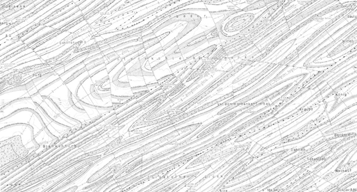
Ausschnitt RK 10 KO
Provided by

Views
9d9b5079-695e-40aa-8f79-a5f4fa24e3fd
Access to the portal
Read here the full details and access to the data.
Associated resources
Not available