 www.geodatenkatalog.de (S3L)
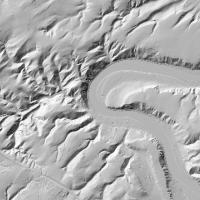
Schummerung RP 1m - Schummerung RP 1m
Schummerung (SHADE) - Dienst für Schummerung der Vermessungs- und Katasterverwaltung Rheinland-Pfalz mit einer Bodenauflösung von 1 m.:Schummerung-Ebene (1m)
|
|
Citation proposal
. Schummerung RP 1m - Schummerung RP 1m. Landesamt für Vermessung und Geobasisinformation (LVermGeo) Rheinland-Pfalz https://gdk.gdi-de.org/geonetwork/srv/api/records/9edd6fb8-e7be-bae4-82da-3aaeb6097100 |
Simple
Identification info
- Alternate title
- Sonstige Produkte Geotopographie
- Date ( Revision )
- 2025-02-26
Publisher
- mapbender.2.registryId
-
- 2f23ed6e-0186-4c2b-8380-748389036509
- Keywords
-
- Shade
- AdVMIS
- Schummerung
- Relief
- Metadaten
- infoMapAccessService
- Access constraints
- Other restrictions
- Use constraints
- Other restrictions
- Other constraints
- geldleistungsfrei, Datenlizenz Deutschland – Namensnennung – Version 2.0; URL: https://www.govdata.de/dl-de/by-2-0 Die Namensnennung der Vermessungs- und Katasterverwaltung Rheinland-Pfalz als Rechteinhaberin hat in folgender Weise zu erfolgen: ©GeoBasis-DE / LVermGeoRP (Jahr des Datenbezugs), dl-de/by-2-0, http://www.lvermgeo.rlp.de [Daten bearbeitet]; Es gelten folgende Regelungen zu Gewährleistung und Haftung; URL:https://lvermgeo.rlp.de/geodaten-geoshop/open-data/gewaehrleistung-haftung/ - Lizenz: dl-de-by-2.0 - Datenlizenz Deutschland Namensnennung 2.0 - https://www.govdata.de/dl-de/by-2-0 - Quellenvermerk: ©GeoBasis-DE / LVermGeoRP (Jahr des Datenbezugs), dl-de/by-2-0, http://www.lvermgeo.rlp.de [Daten bearbeitet]
- Other constraints
- {"id":"dl-de-by-2.0","name":"Datenlizenz Deutschland Namensnennung 2.0","url":"https:\/\/www.govdata.de\/dl-de\/by-2-0","quelle":"\u00a9GeoBasis-DE \/ LVermGeoRP (Jahr des Datenbezugs), dl-de\/by-2-0, http:\/\/www.lvermgeo.rlp.de [Daten bearbeitet]"}
- Service Type
- view
- Service Version
- OGC:WMS 1.1.1
N
S
E
W
))
- Coupling Type
- Tight
Contains Operations
- Operation Name
- GetCapabilities
- Distributed Computing Platforms
- Web services
- Distribution format
-
- ()
- OnLine resource
-
rp_shade1m
Schummerung-Ebene (1m)
- Hierarchy level
- service Service
- Other
- Dienst
Conformance result
- Date ( Publication )
- 2010-12-08
- Explanation
- No explanation available
- Pass
- true
Conformance result
- Date ( Publication )
- 2009-10-20
- Explanation
- No explanation available
- Pass
- true
Conformance result
- Date ( Publication )
- 2014-12-11
- Explanation
- No explanation available
- Pass
- true
Conformance result
- Date ( Publication )
- 2008-12-04
- Explanation
- No explanation available
- Pass
- true
Conformance result
- Date ( Publication )
- 2014-12-11
- Explanation
- No explanation available
- Pass
- true
Conformance result
- Date ( Publication )
- 2013-12-10
- Explanation
- No explanation available
- Pass
- true
Conformance result
- Date ( Publication )
- 2011-02-05
- Explanation
- No explanation available
- Pass
- true
Conformance result
- Date ( Publication )
- 2010-12-08
- Explanation
- No explanation available
- Pass
- true
gmd:MD_Metadata
- File identifier
- 9edd6fb8-e7be-bae4-82da-3aaeb6097100 XML
- Metadata language
- Deutsch German
- Character set
- UTF8
- Hierarchy level
- service Service
- Hierarchy level name
- Darstellungsdienst
- Date stamp
- 2025-11-23
- Metadata standard name
- ISO19119
- Metadata standard version
- 2005/PDAM 1
Point of contact
Overviews
Thumbnail
Provided by

Views
9edd6fb8-e7be-bae4-82da-3aaeb6097100
Access to the portal
Read here the full details and access to the data.
Associated resources
Not available