 www.geodatenkatalog.de (S1L)
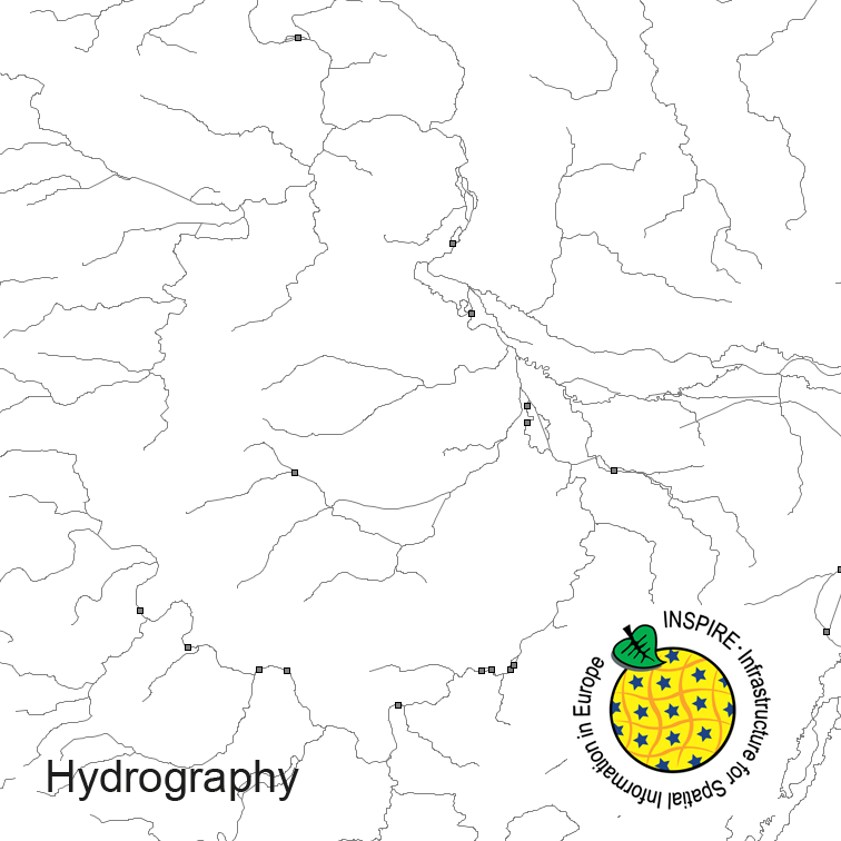
INSPIRE Hydrography ATKIS-DLM250
Hydrography of Germany, derived from the german digital landscape model at scale 1:250000. Mapped via EuroRegionalMap to satisfy INSPIRE and European Location Framework conformance. The dataset contains the hydrographic network and physical waters and is available as Open Data.
|
|
Citation proposal
. INSPIRE Hydrography ATKIS-DLM250. https://gdk.gdi-de.org/geonetwork/srv/api/records/A912C808-0B5A-4F39-A822-19C29047AE0B |
- Identification
- Distribution
- Quality
- Spatial rep.
- Ref. system
- Content
- Portrayal
- Metadata
- Md. constraints
- Md. maintenance
- Schema info
Identification
Data identification
Citation
- Alternate title
- INSPIRE Gewässernetz
- Date ( Creation )
- 2017-09-06T00:00:00.000+02:00
- Date ( Revision )
- 2023-07-10T00:00:00.000+02:00
- Status
- On going
Point of contact
Federal Agency for Cartography and Geodesy
Karl-Rothe-Str. 10-14
Leipzig
Bundesrepublik Deutschland
04105
DEU
Owner
Federal Agency for Cartography and Geodesy
Richard-Strauss-Allee 11
Frankfurt am Main
Bundesrepublik Deutschland
60598
DEU
Distributor
Federal Agency for Cartography and Geodesy
Karl-Rothe-Str. 10-14
Leipzig
Bundesrepublik Deutschland
04105
DEU
Maintenance information
- Maintenance and update frequency
- Biannually
- Update scope
- Dataset
- GEMET - INSPIRE themes, version 1.0 ( Theme )
-
- Hydrography
- GEMET - Concepts, version 3.1 ( Theme )
- Keywords
-
- physical waters
- standing water
- hydro network
- Keywords
-
- inspireidentifiziert
- Keywords
-
- opendata
- Keywords
-
- AdVMIS
- Spatial scope
- High-value dataset categories
Legal constraints
- Access constraints
- otherRestrictions Other restrictions
Legal constraints
- Use constraints
- otherRestrictions Other restrictions
- Other constraints
- The data are protected by copyright. In accordance with the "Geodatenzugangsgesetz" (Geodata Access Act), the data are made available free of charge for download and online use, see https://sgx.geodatenzentrum.de/web_public/gdz/lizenz/geozg.pdf. The use of the data is regulat-ed by the "Verordnung zur Festlegung der Nutzungsbestimmungen für die Bereitstellung von Geodaten des Bundes – GeoNutzV" (Regulation on the Determination of the Terms of Use for the Provision of Federal Geodata) of 19 March 2013 (Bundesgesetzblatt Jahrgang 2013 Teil I Nr. 14), see https://sgx.geodatenzentrum.de/web_public/gdz/lizenz/eng/geonutzv.pdf. The source note must be observed.
- Other constraints
- Quellenvermerk: © GeoBasis-DE / BKG (year of last data download)
- Other constraints
- {"id":"geoNutz/20130319","name":"Nutzungsbestimmungen für die Bereitstellung von Geodaten des Bundes","url":"https://sg.geodatenzentrum.de/web_public/gdz/lizenz/geonutzv.pdf","quelle":"© GeoBasis-DE / BKG (year of last data download)"}
- Spatial representation type
- Vector
- Denominator
- 250000
- Metadata language
- German
- Character set
- UTF8
- Topic category
-
- Inland waters
Extent
Geographic description
- Extent type code
- true
- Geographic identifier
- Bundesrepublik Deutschland (000000000000)
N
S
E
W
))
Distribution
Distribution
- Distribution format
-
- GML (3.2 )
Quality
Data quality
- Hierarchy level
- Dataset
Conformance result
Citation
- Date ( Publication )
- 2010-04-26
- Explanation
- see the referenced specification
- Pass
- true
Conformance result
Citation
- Date ( Publication )
- 2010-12-08
- Explanation
- see the referenced specification
- Pass
- true
- Statement
- derived from german topographic database 1:250 000
Metadata
Metadata
- File identifier
- A912C808-0B5A-4F39-A822-19C29047AE0B XML
- Metadata language
- English
- Character set
- UTF8
- Hierarchy level
- dataset Dataset
- Date stamp
- 2025-02-19
- Metadata standard name
- ISO19115
- Metadata standard version
- 2003/Cor.1:2006
Point of contact
Overviews
preview
Provided by

Views
A912C808-0B5A-4F39-A822-19C29047AE0B
Access to the portal
Read here the full details and access to the data.
Associated resources
Not available