 www.geodatenkatalog.de (S1L)
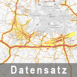
Strategische Lärmkarten für Ballungsräume (Potsdam) 2017 für das Land Brandenburg
Der Ballungsraum umfasst das Stadtgebiet von Potsdam.
Neben den Isophonenkarten des Straßenverkehrslärms werden zusätzlich Karten zum Gewerbe- und Schienenverkehrslärm bereitgestellt:
1. Pegel - Straße - Tag (L-DEN)
2. Pegel - Straße - Nacht (L-NIGHT)
3. Pegel - Industrie - Tag (L-DEN)
4. Pegel - Industrie - Nacht (L-NIGHT)
5. Pegel - Bahn - Tag (L-DEN, nur TRAM)
6. Pegel - Bahn - Nacht (L-NIGHT, nur TRAM)
|
|
Citation proposal
. Strategische Lärmkarten für Ballungsräume (Potsdam) 2017 für das Land Brandenburg. https://gdk.gdi-de.org/geonetwork/srv/api/records/E04D90A6-35F5-480D-ABD7-640C48A6694D |
INSPIRE
Identification
- File identifier
- E04D90A6-35F5-480D-ABD7-640C48A6694D XML
- Hierarchy level
- dataset Dataset
Online resource
Resource identifier
- Metadata language
- German
- Spatial representation type
- Vector
Encoding
Projection
Classification of data and services
- Topic category
-
- Health
- Geoscientific information
- Structure
Classification of data and services
Coupled resource
Coupled resource
Classification of data and services
Coupled resource
Coupled resource
Keywords
- Further legal basis
-
- Richtlinie 2002/49/EG (Umgebungslärmrichtlinie)
- 34. Verordnung zur Durchführung des Bundes-Immissionsschutzgesetzes (Verordnung über die Lärmkartierung - 34. BImSchV)
- Bundes-Immissionsschutzgesetz (BImSchG)
- UMTHES Thesaurus ( Theme )
- High-value dataset categories ( Theme )
Other keywords
- Keywords
-
- Grenzwerte
- Lärmaktionsplanung
- Umgebungslärm
- opendata
- Keywords ( Theme )
-
- ENVI
Geographic coverage
N
S
E
W
))
Temporal reference
Temporal extent
Temporal extent
- Date ( Creation )
- 2017-10-31T00:00:00.000+01:00
Quality and validity
- Lineage
- Der Datenbestand basiert auf Ergebnissen der 3. Stufe der Lärmkartierung im Jahr 2017.
- Denominator
- 50000
Conformity
Conformity
Conformity
Conformity
Conformity
Conformity
- Explanation
- see the referenced specification
Restrictions on access and use
- Access constraints
- Datenlizenz Deutschland Namensnennung 2.0
- Access constraints
- Quellenvermerk: Landesamt für Umwelt Brandenburg
- Access constraints
- {"id":"dl-by-de/2.0","name":"Datenlizenz Deutschland Namensnennung 2.0","url":"https://www.govdata.de/dl-de/by-2-0","quelle":"Landesamt für Umwelt Brandenburg"}
Restrictions on access and use
Responsible organization (s)
Contact for the resource
- Organisation name
- Landesamt für Umwelt Brandenburg (LfU)
Responsible organization (s)
Contact for the resource
- Organisation name
- Landesamt für Umwelt Brandenburg (LfU)
Metadata information
Contact for the metadata
- Organisation name
- Landesamt für Umwelt Brandenburg (LfU)
- Date stamp
- 2025-08-06
- Metadata language
- German
- Character set
- UTF8
SDS
Conformance class 1: invocable
Access Point URL
Endpoint URL
Technical specification
Conformance class 2: interoperable
Coordinate reference system
Quality of Service
Access constraints
Limitation
Use constraints
Limitation
Responsible custodian
Contact for the resource
Conformance class 3: harmonized
Overviews
ds-lfu-laerm
Provided by

Views
E04D90A6-35F5-480D-ABD7-640C48A6694D
Access to the portal
Read here the full details and access to the data.
Associated resources
Not available