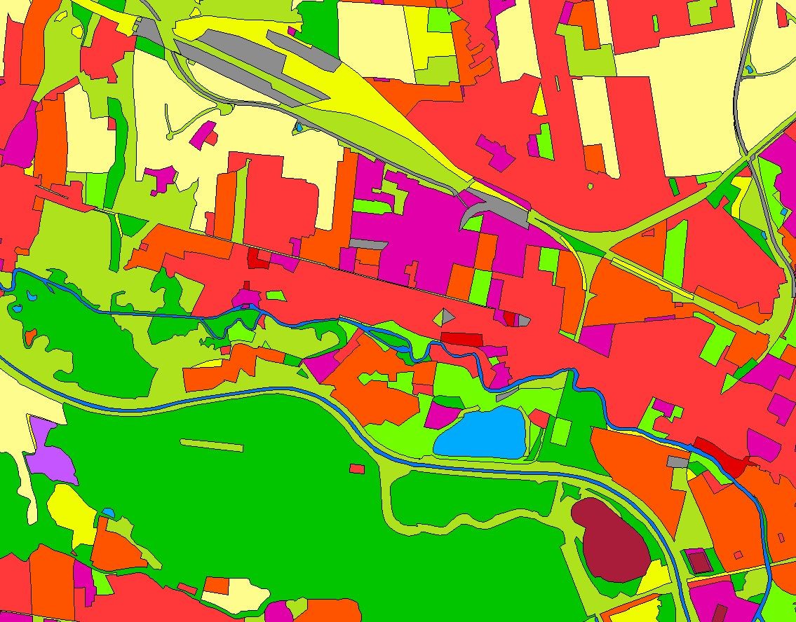
Landbedeckungsmodell für Deutschland (LBM-DE) 2018
Das Landbedeckungsmodell Deutschland (LBM-DE) besitzt eine detaillierten Gliederung in Landbedeckung (LB) und Landnutzung (LN) bei einer Mindestkartierfläche von 1ha. Aus den Kombinationen von LB und LN werden eindeutige CORINE LandCover-Klassen abgeleitet ("CLC").
|
|
Citation proposal
. Landbedeckungsmodell für Deutschland (LBM-DE) 2018. https://gdk.gdi-de.org/geonetwork/srv/api/records/ED7F6DE9-6433-41DA-928A-044837C6EDAA |
INSPIRE
Identification
- File identifier
- ED7F6DE9-6433-41DA-928A-044837C6EDAA XML
- Hierarchy level
- dataset Dataset
Online resource
Resource identifier
- Metadata language
- German
- Spatial representation type
- Grid
Encoding
- Format
- Shapefiles
Projection
- code
- 4258
- code
- 25833
- code
- 31469
- code
- 31468
- code
- 31467
Classification of data and services
- Topic category
-
- Imagery base maps earth cover
Classification of data and services
Coupled resource
Coupled resource
Classification of data and services
Coupled resource
Coupled resource
Keywords
- GEMET - INSPIRE themes, version 1.0 ( Theme )
-
- Bodenbedeckung
- Bodennutzung
- Gewässernetz
- Boden
- Höhe
- Mineralische Bodenschätze
- Adressen
- GEMET - Concepts, version 3.1 ( Theme )
Other keywords
- Keywords
-
- CLC
- Landnutzung
Geographic coverage
N
S
E
W
))
Temporal reference
Temporal extent
Temporal extent
- Date ( Creation )
- 2017-08-28T00:00:00.000+02:00
- Date ( Revision )
- 2020-10-01T00:00:00.000+02:00
Quality and validity
- Lineage
- Das BKG erstellt und aktualisiert das LBM-DE, welches auf Geobasisdaten aufsetzt und Satellitenbilder zur Aktualisierung nutzt.
- Denominator
- 25000
Conformity
Conformity
Conformity
Conformity
Conformity
Conformity
- Explanation
- see the referenced specification
Restrictions on access and use
- Access constraints
- Für die kostenfreie Nutzung des LBM-DE durch Dritte muss die Lizenzierung der entsprechenden Fläche des Digitalen Basis-Landschaftsmodells (Basis-DLM) erfolgen. Die Lizenzierung des Basis-DLM erfolgt gegen Entgelt über die Zentrale Stelle Geotopographie (ZSGT) im Auftrag sowie zu den Bedingungen und Produktspezifikationen der Arbeitsgemeinschaft der Vermessungsverwaltungen der Länder der Bundesrepublik Deutschland (AdV) gemäß der jeweils gültigen AdV-Gebührenrichtlinie.
- Access constraints
- Wenden Sie sich bitte an das Dienstleistungszentrum (DLZ) des Bundesamt für Kartographie und Geodäsie: https://www.bkg.bund.de/DE/Service/Kontakt/kontakt.html
- Access constraints
- Quellenvermerk: © GeoBasis-DE / BKG (Jahr des letzten Datenbezugs)
Restrictions on access and use
Responsible organization (s)
Contact for the resource
- Organisation name
- Bundesamt für Kartographie und Geodäsie (BKG)
- dlz@bkg.bund.de
- Organisation name
- Bundesamt für Kartographie und Geodäsie (BKG)
- dlz@bkg.bund.de
- Organisation name
- Bundesamt für Kartographie und Geodäsie (BKG)
- mailbox@bkg.bund.de
Metadata information
Contact for the metadata
- Organisation name
- Bundesamt für Kartographie und Geodäsie (BKG)
- dlz@bkg.bund.de
- Date stamp
- 2025-03-10
- Metadata language
- German
SDS
Conformance class 1: invocable
Access Point URL
Endpoint URL
Technical specification
Conformance class 2: interoperable
Coordinate reference system
Quality of Service
- Name of measure
- Number of invalid overlaps of surfaces
- Measure identification
- 11
Quantitative result
- Value
- 0
- Name of measure
- Compliance rate with the rules of the conceptual schema
Quantitative result
- Value
- 100
Access constraints
Limitation
Use constraints
Limitation
Responsible custodian
Contact for the resource
Conformance class 3: harmonized
Overviews

Provided by

Views
ED7F6DE9-6433-41DA-928A-044837C6EDAA
Access to the portal
Read here the full details and access to the data.
Associated resources
Not available
 www.geodatenkatalog.de (S1L)