 www.geodatenkatalog.de (S1F)
Lebensräume und Biotope in Hessen - BIOTOPE
|
|
Citation proposal
. Lebensräume und Biotope in Hessen - BIOTOPE. Hessisches Landesamt für Naturschutz, Umwelt und Geologie (HLNUG) https://gdk.gdi-de.org/geonetwork/srv/api/records/a09b903f-9abc-2cad-fe8d-5afd5b1642c4 |
- Identification
- Distribution
- Quality
- Spatial rep.
- Ref. system
- Content
- Portrayal
- Metadata
- Md. constraints
- Md. maintenance
- Schema info
Identification
Identification info
Service Identification (19119)
Citation
- Alternate title
- Date ( Revision )
- 2025-05-16
- mapbender.2.registryId
-
- 1c349fea-924b-488f-b6a2-e896f40ac897
- Keywords
-
- Biotope
- Biotopkartierung
- Hessen
- HLNUG
- infoMapAccessService
- inspireidentifiziert
- inspireidentifiziert
Legal constraints
- Access constraints
- Other restrictions
Legal constraints
- Use constraints
- Other restrictions
- Other constraints
- Dienst und Daten stellen keine rechtsverbindliche Auskunft dar. Die kostenfreie Nutzung der Geo- und Metadaten sowie der Geodatendienste ist für private und kommerzielle Zwecke erlaubt. Lizenz: Creative Commons BY 4.0 (https://creativecommons.org/licenses/by/4.0/deed.de). Quellenvermerk für Dienst: „Hessisches Landesamt für Naturschutz, Umwelt und Geologie (HLNUG)“. Quellenvermerk für Daten: „Darstellung auf der Grundlage von Daten des Hessischen Landesamtes für Naturschutz, Umwelt und Geologie (HLNUG)“
- Service Type
- view
- Service Version
- OGC:WMS 1.1.1
))
- Coupling Type
- Tight
Contains Operations
- Operation Name
- GetCapabilities
- Distributed Computing Platforms
- Web services
Distribution
Distribution
- Distribution format
-
- ()
- OnLine resource
-
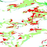
BIOTOPE
Hessische Biotopkartierung, Biotope und Biotopkomplexe - Die Daten wurden zwischen 1992 und 2006 erfasst. Bei der Kartierung handelt es sich um eine selektive Kartierung aus naturschutzfachlicher Sicht wertvoller, naturnaher bzw. extensiv genutzter Biotope und Biotopkomplexe im Maßstab 1.25.000. Der maximale Betrachtungsmaßstab sollte 1:10.000-15.000 sein, da die Datengrundlage eine höhere Genauigkeit nicht wiedergibt. Die Daten liegen im Koodinatensystem Gauß-Krüger Zone 3 vor. Im Zuge der aktuellen "Quellen"-Diskussion bitten wir Sie bei Veröffentlichungen folgenden Hinweis auf die Herkunft der Daten anzugeben:"Quelle: Hessen-Forst, Forsteinrichtung und Naturschutz (FENA), Gießen". Weiter bitten wir Sie, uns bei Verwendung der Daten in wissenschaftlichen Publikationen oder Postern ein Belegexemplar zuzusenden.
Quality
Data quality
Scope
- Hierarchy level
- service Service
- Other
- Dienst
Conformance result
Citation
- Date ( Publication )
- 2010-12-08
- Explanation
- No explanation available
- Pass
- true
Conformance result
Citation
- Date ( Publication )
- 2009-10-20
- Explanation
- No explanation available
- Pass
- true
Conformance result
Citation
- Date ( Publication )
- 2014-12-11
- Explanation
- No explanation available
- Pass
- true
Conformance result
Citation
- Date ( Publication )
- 2008-12-04
- Explanation
- No explanation available
- Pass
- true
Conformance result
Citation
- Date ( Publication )
- 2014-12-11
- Explanation
- No explanation available
- Pass
- true
Conformance result
Citation
- Date ( Publication )
- 2013-12-10
- Explanation
- No explanation available
- Pass
- true
Conformance result
Citation
- Date ( Publication )
- 2011-02-05
- Explanation
- No explanation available
- Pass
- true
Conformance result
Citation
- Date ( Publication )
- 2010-12-08
- Explanation
- No explanation available
- Pass
- true
Metadata
Metadata
- File identifier
- a09b903f-9abc-2cad-fe8d-5afd5b1642c4 XML
- Metadata language
- Deutsch German
- Character set
- UTF8
- Hierarchy level
- service Service
- Hierarchy level name
- Darstellungsdienst
- Date stamp
- 2025-07-15
- Metadata standard name
- ISO19119
- Metadata standard version
- 2005/PDAM 1
Point of contact
Overviews
Provided by
