 www.geodatenkatalog.de (S2F)
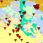
Oberflächennahe Geothermie - WMS
Erdwärme aus bis zu 400 Metern Tiefe wird als oberflächennahe Geothermie bezeichnet. Die Genehmigung und die Wirtschaftlichkeit der Nutzung sowie die Art der eingesetzten Technik hängen von den jeweiligen geologischen Gegebenheiten und von den Grundwasserverhältnissen ab. Der Dienst vermittelt eine erste Übersicht über die Standortbedingungen und Nutzungsmöglichkeiten für Erdwärmesonden, Erdwärmekollektoren sowie Grundwasserwärmepumpen. Weitere Informationen sowie Standortauskünfte erhalten Sie im Themenbereich Oberflächennahe Geothermie des UmweltAtlas Bayern (www.umweltatlas.bayern.de). Maximale Bildgröße: 4096x4096Pixel.
|
|
Citation proposal
(2017) . Oberflächennahe Geothermie - WMS. https://gdk.gdi-de.org/geonetwork/srv/api/records/a44f6991-6c64-42a4-aba3-50585a5c4552 |
INSPIRE
Identification
- File identifier
- a44f6991-6c64-42a4-aba3-50585a5c4552 XML
- Hierarchy level
- service Service
Online resource
Resource identifier
Encoding
- Format
- Sonstiges
Projection
Classification of data and services
Classification of data and services
- Service Type
- view
- Coupling Type
- Tight
Coupled resource
Coupled resource
Classification of data and services
- Service Type
- view
- Coupling Type
- Tight
Coupled resource
Coupled resource
Keywords
- Service Classification, version 1.0 ( Theme )
-
- infoMapAccessService
Other keywords
- Keywords
-
- gdiby
- Oberflächennahe Geothermie
- Geothermisches Potential
- Erdwärmesonden
- Erdwärmekollektoren
- Geologie
Geographic coverage
N
S
E
W
))
Temporal reference
Temporal extent
Temporal extent
- Date ( Publication )
- 2017-03-31T00:00:00.000+02:00
- Date ( Revision )
- 2018-09-19T00:00:00.000+02:00
Quality and validity
Conformity
Conformity
Conformity
Conformity
Conformity
Conformity
Restrictions on access and use
Restrictions on access and use
- Access constraints
- Creative Commons Namensnennung 4.0 International (CC BY 4.0); Datenquelle: Bayerisches Landesamt für Umwelt, www.lfu.bayern.de
- Access constraints
- {"id":"cc-by/4.0","name":"Creative Commons Namensnennung 4.0 International (CC BY 4.0)","url":"https://creativecommons.org/licenses/by/4.0/deed.de","quelle":"Bayerisches Landesamt für Umwelt, www.lfu.bayern.de"}
Responsible organization (s)
Contact for the resource
- Organisation name
- Bayerisches Landesamt für Umwelt
- Organisation name
- Bayerisches Landesamt für Umwelt
Responsible organization (s)
Contact for the resource
- Organisation name
- Bayerisches Landesamt für Umwelt
- Organisation name
- Bayerisches Landesamt für Umwelt
Metadata information
Contact for the metadata
- Organisation name
- Bayerisches Landesamt für Umwelt
- Date stamp
- 2024-11-19
- Metadata language
- German
SDS
Conformance class 1: invocable
Access Point URL
Endpoint URL
Technical specification
Conformance class 2: interoperable
Coordinate reference system
Quality of Service
Access constraints
- Access constraints
- otherRestrictions Other restrictions
Limitation
Use constraints
Limitation
- string
- Creative Commons Namensnennung 4.0 International (CC BY 4.0); Datenquelle: Bayerisches Landesamt für Umwelt, www.lfu.bayern.de
- string
- {"id":"cc-by/4.0","name":"Creative Commons Namensnennung 4.0 International (CC BY 4.0)","url":"https://creativecommons.org/licenses/by/4.0/deed.de","quelle":"Bayerisches Landesamt für Umwelt, www.lfu.bayern.de"}
Responsible custodian
Contact for the resource
Conformance class 3: harmonized
Contains Operations
- Operation Name
- GetCapabilities
- Distributed Computing Platforms
- Web services
- Operation Description
- application/vnd.ogc.wms_xml; text/xml;
Contains Operations
- Operation Name
- GetMap
- Distributed Computing Platforms
- Web services
- Operation Description
- image/bmp; image/jpeg; image/tiff; image/png; image/png8; image/png24; image/png32; image/gif; image/svg+xml;
Contains Operations
- Operation Name
- GetFeatureInfo
- Distributed Computing Platforms
- Web services
- Operation Description
- application/vnd.esri.wms_raw_xml; application/vnd.esri.wms_featureinfo_xml; application/vnd.ogc.wms_xml; application/geojson; text/xml; text/html; text/plain;
Contains Operations
- Operation Name
- esri_wms:GetStyles
- Distributed Computing Platforms
- Web services
- Operation Description
- application/vnd.ogc.sld+xml;
Overviews
Provided by

Views
a44f6991-6c64-42a4-aba3-50585a5c4552
Access to the portal
Read here the full details and access to the data.
Associated resources
Not available