 www.geodatenkatalog.de (S1L)
Helicopter-borne Radiometrics (HRD)
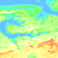
The BGR helicopter (Sikorsky S-76B) is used for airborne geophysical surveying of the Earth’s subsurface. The standard equipment comprises the methods electromagnetics, magnetics and radiometrics. The passive helicopter-borne radiometric (HRD) measuring system is a gamma-ray spectrometer, which is installed into the helicopter. The detector of the spectrometer consists of five Sodium-iodide crystals (volume: 4 l per NaI crystal). The spectral range of gamma radiation recorded ranges from 0 to 3 MeV. The results are displayed as total count rate and the (equivalent) concentrations of Thorium, Uranium and Sodium as well as the exposure rate at ground level.
|
|
Citation proposal
(2016) . Helicopter-borne Radiometrics (HRD). https://gdk.gdi-de.org/geonetwork/srv/api/records/ac818fce-f429-449c-85cf-6c838db1d0da |
Simple
- Alternate title
- HRD (Serie)
- Date ( Publication )
- 2016-09-06
- Identifier
- e32b2912-9961-4124-986e-37f6082e2785
- Status
- onGoing On going
Point of contact
- GEMET - INSPIRE themes, version 1.0 ( Theme )
-
- Geologie
- Geology
- GEMET - Concepts, version 2.4 ( Theme )
-
- Geophysik
- Keywords ( Theme )
-
- Aerogeophysik
- Hubschrauber-Radiometrie
- Äquivalentgehalte
- Thorium
- Uran
- Kalium
- Ionendosisleistung
- airborne geophysics
- helicopter-borne radiometrics
- equivalent concentrations
- thorium
- uranium
- potassium
- exposure rate
- Keywords ( Place )
-
- Deutschland
- Access constraints
- Other restrictions
- Use constraints
- Other restrictions
- Other constraints
- Allgemeine Geschäftsbedingungen, siehe https://www.bgr.bund.de/AGB - General terms and conditions, see https://www.bgr.bund.de/AGB_en. Die bereitgestellten Informationen sind bei Weiterverwendung wie folgt zu zitieren: Datenquelle: HRD, (c) BGR, Hannover, 2016
- Spatial representation type
- Grid
- Metadata language
- German
- Character set
- UTF8
- Topic category
-
- Geoscientific information
N
S
E
W
))
- Distribution format
-
- WMS (OGC:WMS 1.3.0 )
- PDF (n/a )
- georef. TIFF (n/a )
- OnLine resource
-
BGR-Website: Aeroradiometrie
BGR-Website: Aeroradiometrie
- Hierarchy level
- Series
Conformance result
- Date ( Publication )
- 2010-12-08
- Explanation
- siehe dazu die angegebene Durchführungsbestimmung
- Statement
- Erarbeitung im Rahmen diverser Projekte, in denen das aerogeophysikalische Messsystem der BGR in Deutschland eingesetzt wurde.
gmd:MD_Metadata
- File identifier
- ac818fce-f429-449c-85cf-6c838db1d0da XML
- Metadata language
- German
- Character set
- UTF8
- Hierarchy level
- Series
- Hierarchy level name
- Geophysik
- Date stamp
- 2025-04-07
- Metadata standard name
- INSPIRE Metadata Implementing Rules: Technical Guidelines based on EN ISO 19115 and EN ISO 19119
- Metadata standard version
- n/a
Point of contact
Overviews
Provided by

Views
ac818fce-f429-449c-85cf-6c838db1d0da
Access to the portal
Read here the full details and access to the data.
Associated resources
Not available