 www.geodatenkatalog.de (S3L)
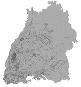
LGRB-BW ISONG: Störungen
Gezeigt werden geologische Störungen an der Erdoberfläche, unter dem Quartär oder in tiefer liegenden geologischen Einheiten. Der Datensatz zeigt, regional unterschiedlich den Kenntnisstand zwischen 2007 und 2015. Der aktuelle Stand der tektonischen Linien ist in den Geofachdaten BW - Geologie enthalten. Ausführliche Informationen sind den Isong-Erläuterungen zu entnehmen (https://www.lgrb-bw.de/download_pool/is_geothermie-erlaeuterungen.pdf.)
|
|
Citation proposal
. LGRB-BW ISONG: Störungen. https://gdk.gdi-de.org/geonetwork/srv/api/records/afc13533-5914-48ad-9a3f-662b8f35c91b |
- Identification
- Distribution
- Quality
- Spatial rep.
- Ref. system
- Content
- Portrayal
- Metadata
- Md. constraints
- Md. maintenance
- Schema info
Identification
Data identification
Citation
- Alternate title
- ISONG: Störungen
- Date ( Revision )
- 2015-12-31
- Status
- On going
Point of contact
- Maintenance and update frequency
- Biannually
- Keywords
-
- Erdwärme
- Keywords
-
- Geothermie
- Keywords
-
- Störung
- GDI-BW-Schlüsselwortliste nach dem mehrsprachigen Umwelt-Thesaurus GEMET
-
- Geologie
- Energie
- Grundwasser
Legal constraints
- Use constraints
- Other restrictions
- Metadata language
- German
- Character set
- UTF8
N
S
E
W
))
- Supplemental Information
Distribution
Distribution
- Distribution format
-
-
ESRI Shapefile
(n/a (default) )
-
ESRI Shapefile
(n/a (default) )
Distributor
Distributor
Standard order process
- Fees
- AGB
- Ordering instructions
- https://produkte.lgrb-bw.de/
Quality
Data quality
- Hierarchy level
- Dataset
- Statement
- Informationssystem Oberflächennahe Geothermie für Baden-Württemberg
Metadata
Metadata
- File identifier
- afc13533-5914-48ad-9a3f-662b8f35c91b XML
- Metadata language
- German
- Character set
- UTF8
- Hierarchy level
- Dataset
- Date stamp
- 2025-11-18T07:49:45
- Metadata standard name
- ISO 19115:2003 (GDI-BW)
- Metadata standard version
- 2.1
Overviews
thumbnail
Provided by

Views
afc13533-5914-48ad-9a3f-662b8f35c91b
Access to the portal
Read here the full details and access to the data.
Associated resources
Not available