 www.geodatenkatalog.de (S3L)
Naturschutz - Naturschutzgebiete
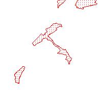
Der Kartendienst stellt die digitalen Geodaten aus dem Bereich Naturschutz des Saarlandes dar.:Naturschutzgebiete im Saarland: Bei dieser Schutzgebietskategorie handelt es sich um Gebiete, in denen ein besonderer Schutz von Natur und Landschaft in ihrer Ganzheit oder in einzelnen Teilen erforderlich ist. Schutzgebiete dieser Kategorie sind die am strengsten geschützten Gebiete. Insbesondere werden die wild lebenden Pflanzen oder Tiere, Biotope oder bestimmte Lebensgemeinschaften zu ihrem Erhalt, ihrer Entwicklung, aufgrund ihres seltenen Vorkommens oder auch aus wissenschaftlichen Gründen unter den gesetzlichen Schutz gestellt. Aktuell sind 121 Naturschutzgebiete unter Schutz gestellt. Für welche Gebiete welche Erfassungsschärfe vorliegt, kann aus dem Attribut-Feld „Erfassungsmaßstab“ abgelesen werden. Die Bestandskarte der Naturschutzgebiete im Saarland gibt Auskunft über die aktuell ausgewiesenen Naturschutzgebiete. Sachdaten/Attributinformationen: NAME:Name des Naturschutzgebietes AUSWEISUNG:Datum der Ausweisung AMT_J_S:im Amtsblatt veröffentlicht-Jahr_Seite GEB_ID_SL:Gebietsnummer Saarland für Bund/Länder-Datenaustausch INFO:Link zu den dazugehörigen Metadaten NR_BER_SAM:Nummer der bereinigten Sammlung des NSG VO_QUELLE:Verordnung über das Naturschutzgebiet ERFASSUNG: Erfassungsgrundlage RECHTSGR:Rechtsgrundlage SHAPE_AREA:vom System berechnete Flächen SHAPE_LEN:vom System berechneter Umring FLAECHE_HA:amtliche Flächengröße in HA gemäß Verordnung
|
|
Citation proposal
. Naturschutz - Naturschutzgebiete. Ministerium für Umwelt, Klima, Mobilität, Agrar und Verbraucherschutz https://gdk.gdi-de.org/geonetwork/srv/api/records/b4427bda-1add-91fe-a8d1-aa62bd46e2e6 |
INSPIRE
Identification
- File identifier
- b4427bda-1add-91fe-a8d1-aa62bd46e2e6 XML
- Hierarchy level
- service Service
Online resource
- Protocol
- OGC:WMS-1.1.1-http-get-map
Resource identifier
Encoding
Projection
Classification of data and services
Classification of data and services
- Service Type
- view
- Coupling Type
- Loose
Coupled resource
Coupled resource
Classification of data and services
- Service Type
- view
- Coupling Type
- Loose
Coupled resource
Coupled resource
Keywords
Other keywords
- Keywords
-
- Naturschutz
- Naturschutzgebiet
- NSG
- infoMapAccessService
- natur_landschaft
Geographic coverage
N
S
E
W
))
Temporal reference
Temporal extent
Temporal extent
- Date ( Revision )
- 2024-01-10
Quality and validity
Conformity
Conformity
Conformity
Conformity
Conformity
Conformity
- Explanation
- No explanation available
- Explanation
- No explanation available
- Explanation
- No explanation available
- Explanation
- No explanation available
- Explanation
- No explanation available
- Explanation
- No explanation available
- Explanation
- No explanation available
- Explanation
- No explanation available
Restrictions on access and use
Restrictions on access and use
Responsible organization (s)
Contact for the resource
- Organisation name
- Ministerium für Umwelt, Klima, Mobilität, Agrar und Verbraucherschutz
Responsible organization (s)
Contact for the resource
- Organisation name
- Ministerium für Umwelt, Klima, Mobilität, Agrar und Verbraucherschutz
Metadata information
Contact for the metadata
- Organisation name
- GDI-Saarland
- gdi-sl@lvgl.saarland.de
- Date stamp
- 2024-01-10
- Metadata language
- ger German
SDS
Conformance class 1: invocable
- Pass
- true
- Pass
- true
- Pass
- true
- Pass
- true
- Pass
- true
- Pass
- true
- Pass
- true
- Pass
- true
Access Point URL
Endpoint URL
Technical specification
- Date
- Explanation
- No explanation available
- Date
- Explanation
- No explanation available
- Date
- Explanation
- No explanation available
- Date
- Explanation
- No explanation available
- Date
- Explanation
- No explanation available
- Date
- Explanation
- No explanation available
- Date
- Explanation
- No explanation available
- Date
- Explanation
- No explanation available
Conformance class 2: interoperable
Coordinate reference system
Quality of Service
Access constraints
- Access constraints
- Other restrictions
Limitation
Use constraints
- Use constraints
- Other restrictions
Limitation
Responsible custodian
Contact for the resource
Conformance class 3: harmonized
Contains Operations
- Operation Name
- GetCapabilities
- Distributed Computing Platforms
- Web services
Overviews
Thumbnail
Provided by

Views
b4427bda-1add-91fe-a8d1-aa62bd46e2e6
Access to the portal
Read here the full details and access to the data.
Associated resources
Not available