 www.geodatenkatalog.de (S1L)
Stadtplanwerk 2.0
Stadtplanwerk 2.0 auf Basis von ALKIS-, ATKIS- und OSM-Daten
|
|
Citation proposal
. Stadtplanwerk 2.0. https://gdk.gdi-de.org/geonetwork/srv/api/records/b4bb3c7c-77a1-4d02-ad53-f8bfd5e1c7c2 |
INSPIRE
Identification
- File identifier
- b4bb3c7c-77a1-4d02-ad53-f8bfd5e1c7c2 XML
- Hierarchy level
- Service
Online resource
- Protocol
- application/vnd.ogc.wms_xml
Resource identifier
Encoding
Projection
Classification of data and services
Classification of data and services
- Service Type
- view
- Coupling Type
- Tight
Coupled resource
Coupled resource
Classification of data and services
- Service Type
- view
- Coupling Type
- Tight
Coupled resource
Coupled resource
Keywords
Other keywords
- Keywords ( Theme )
-
- infoMapAccessService
- Stadtplan
Geographic coverage
N
S
E
W
))
Temporal reference
Temporal extent
Temporal extent
- Date ( Creation )
- 2019-05-15
- Date ( Revision )
- 2019-05-21
Quality and validity
Conformity
Conformity
Conformity
Conformity
Conformity
Conformity
Restrictions on access and use
Restrictions on access and use
- Access constraints
- {"id":"dl-by-de/2.0", "name": "Datenlizenz Deutschland Namensnennung 2.0", "url": "http://www.govdata.de/dl-de/by-2-0", "quelle": "Quelle: © Regionalverband Ruhr und Kooperationspartner"}
- Access constraints
- Datengrundlagen: ALKIS, ATKIS - Land NRW/Katasterämter (Datenlizenz Deutschland - Zero - Version 2.0) und © OpenStreetMap - Mitwirkende (License: ODbL)
Responsible organization (s)
Contact for the resource
- Organisation name
- Regionalverband Ruhr
- gharghi@rvr.ruhr
Responsible organization (s)
Contact for the resource
- Organisation name
- Regionalverband Ruhr
- gharghi@rvr.ruhr
Metadata information
Contact for the metadata
- Organisation name
- Regionalverband Ruhr
- gharghi@rvr.ruhr
- Date stamp
- 2024-11-13
- Metadata language
- German
SDS
Conformance class 1: invocable
Access Point URL
Endpoint URL
Technical specification
Conformance class 2: interoperable
Coordinate reference system
Quality of Service
Access constraints
- Access constraints
- Other restrictions
Limitation
Use constraints
- Use limitation
- Datengrundlagen: ALKIS, ATKIS - Land NRW/Katasterämter (Datenlizenz Deutschland - Zero - Version 2.0) und © OpenStreetMap - Mitwirkende (License: ODbL)
- Use constraints
- Other restrictions
- Other constraints
- {"id":"dl-by-de/2.0", "name": "Datenlizenz Deutschland Namensnennung 2.0", "url": "http://www.govdata.de/dl-de/by-2-0", "quelle": "Quelle: © Regionalverband Ruhr und Kooperationspartner"}
- Other constraints
- Datengrundlagen: ALKIS, ATKIS - Land NRW/Katasterämter (Datenlizenz Deutschland - Zero - Version 2.0) und © OpenStreetMap - Mitwirkende (License: ODbL)
Limitation
- string
- {"id":"dl-by-de/2.0", "name": "Datenlizenz Deutschland Namensnennung 2.0", "url": "http://www.govdata.de/dl-de/by-2-0", "quelle": "Quelle: © Regionalverband Ruhr und Kooperationspartner"}
- string
- Datengrundlagen: ALKIS, ATKIS - Land NRW/Katasterämter (Datenlizenz Deutschland - Zero - Version 2.0) und © OpenStreetMap - Mitwirkende (License: ODbL)
Responsible custodian
Contact for the resource
Conformance class 3: harmonized
Contains Operations
- Operation Name
- GetCapabilities
- Distributed Computing Platforms
- Web services
- Connect Point
- https://geodaten.metropoleruhr.de/spw2?
Overviews
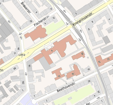
thumbnail
Provided by

Views
b4bb3c7c-77a1-4d02-ad53-f8bfd5e1c7c2
Access to the portal
Read here the full details and access to the data.
Associated resources
Not available